
California
Recent Articles
More Articles
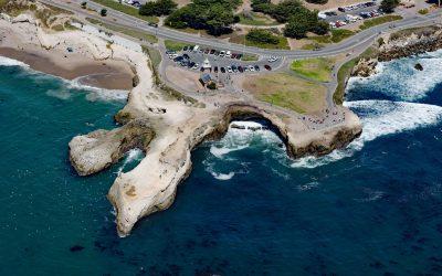
Lighthouse Point Park, Point Santa Cruz
Lighthouse Point Park is located on Point Santa Cruz, adjacent to Lighthouse Field State Beach at the northern boundary of Monterey Bay, about 25 miles (40 km) north-northwest of Monterey and in Santa Cruz, California.
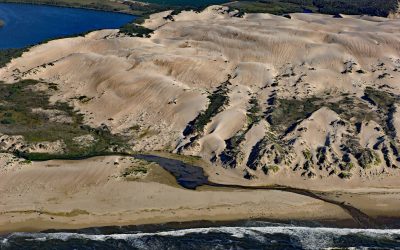
Oso Flaco Creek, Guadalupe-Nipomo Dunes
Oso Flaco Creek drains a watershed of approximately 7,400 acres (2,995 ha) consisting mostly of agricultural land before forming Oso Flaco Lake, now part of the Oso Flaco Lake Natural Area in the Guadalupe-Nipomo Dunes, and then flows into the Pacific Ocean, about 68 miles (109 km) northwest of Santa Barbara and 5 miles (8 km) south of Oceano, California.
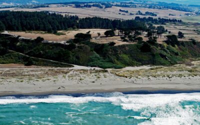
Table Bluff, Humboldt Bay
Table Bluff is a promontory and coastal plateau less than 1 mile (1.6 km) wide, with an elevation of 163 feet (50 m), at the base of South Spit, which encloses the southern portion of Humboldt Bay, about 9 miles (15 km) southwest of Eureka and 4.5 miles (7 km) northwest of Loleta, California.
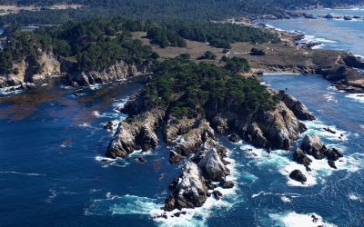
Point Lobos, Carmel Bay
Point Lobos is a rocky headland at the south end of Carmel Bay between Cypress Cove to the north and Headland Cove to the south on the central coast of California, about 19 miles (31 km) north-northwest of Big Sur and 2.5 miles (4 km) southwest of Carmel, California.
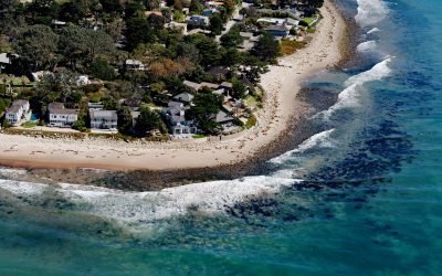
Rincon Creek, Santa Barbara Channel
Rincon Creek is a stream that begins in the Santa Ynez Mountains near Divide Peak, at an elevation of 4,800 feet (1,463 m), and drains a watershed of 9,352 acres (3,785-ha) while flowing generally south for 10 miles (16 km) to the Santa Barbara Channel at Rincon Point, about 12 miles (19 km) northwest of Ventura and 3 miles (5 km) southeast of Carpinteria, California.
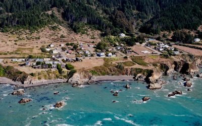
Westport, Mendocino Coast
Westport is a historic timber export community on the Mendocino coast, where lumber schooners were loaded using long chutes built across nearshore rocks, about 83 miles (134 km) south-southeast of Eureka and 13 miles (21 km) north of Fort Bragg, California.
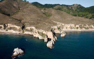
Point Resistance, Point Reyes National Seashore
Point Resistance is a headland on Drakes Bay, on the western shore of the Marin Peninsula, at the north end of Kelham Beach in the Phillip Burton Wilderness of Point Reyes National Seashore, about 27 miles (44 km) northwest of San Francisco and 3.5 miles (7 km) southwest of Olema, California.
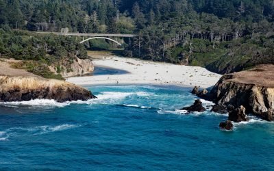
Jug Handle Cove, Ecological Staircase
Jug Handle Cove is a California State Natural Preserve made up of a series of ancient marine terraces, known as the Ecological Staircase, which exhibit different stages of ecological succession at the mouth of Jug Handle Creek, about 5 miles (8 km) south of Fort Bragg and 5 miles (8 km) north of Mendocino, California.
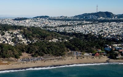
Lobos Creek, Baker Beach
Lobos Creek is a stream in the Presidio of San Francisco, draining urban runoff and underground springs and flowing intermittently west for 1 mile (1.6 km) from near Mountain Lake to the Pacific Ocean between Baker Beach and China Beach, about 5 miles (8 km) west of downtown San Francisco and at Sea Cliff, California.
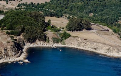
Fort Ross, Northwest Cape
Fort Ross, a historic Russian settlement and part of Fort Ross State Historic Park, lies on a small bight called Fort Ross Cove, south of Northwest Cape, about 24 miles (39 km) southeast of Gualala and 8 miles (13 km) northwest of Jenner, California.
About the background graphic
This ‘warming stripe’ graphic is a visual representation of the change in global temperature from 1850 (top) to 2019 (bottom). Each stripe represents the average global temperature for one year. The average temperature from 1971-2000 is set as the boundary between blue and red. The colour scale goes from -0.7°C to +0.7°C. The data are from the UK Met Office HadCRUT4.6 dataset.
Click here for more information about the #warmingstripes.