
Climate Change
Recent Articles
More Articles
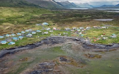
Akhiok, Kodiak Island
Akhiok is the southernmost Alutiiq Sugpiat village on Kodiak Island, situated on Akhiok Bay which is on the western shore of Alitak Bay, about 167 miles (269 km) east-northeast of Chignik and 87 miles (140 km) southwest of Kodiak, Alaska.
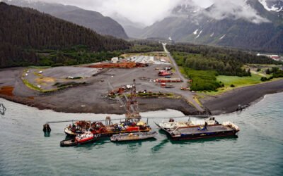
Fourth of July Creek, Resurrection Bay
Fourth of July Creek originates from a series of unnamed glaciers and snowfields on the Resurrection Peninsula in the Chugach Mountains on the Kenai Peninsula, and flows generally west for 3.2 miles (5 km) to an alluvial fan where it joins Godwin River and then flows southwest for 1.5 miles (2.4 km) to Resurrection Bay, about 53 miles (85 km) south-southwest of Whittier and 3.6 miles (6 km) southeast of Seward, Alaska.
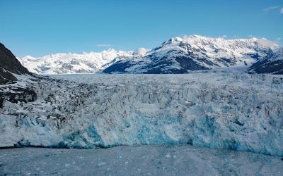
Columbia Glacier, Prince William Sound
Columbia Glacier starts from ice fields at elevations over 9,000 feet (2743 m) near Mount Witherspoon in the Chugach Mountains and flows east and then generally south for 23 miles (37 km) to Columbia Bay on the north coast of Prince William Sound, about 62 miles (100 km) northeast of Whittier and 23 miles (37 km) west of Valdez, Alaska.
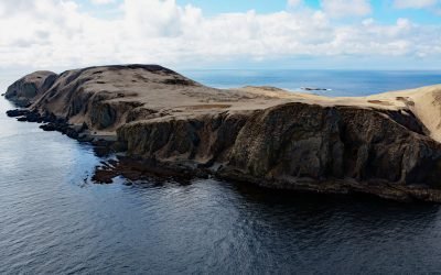
Anangula Island, Bering Sea
Anangula Island, also known as Ananiuliak Island, is situated in the Bering Sea and is one of the Fox Islands in the eastern Aleutian Islands, separated from Umnak Island by a channel about 0.93 miles (1.50 km) wide, about 116 miles (187 km) southwest of Dutch Harbor and 4.6 miles (7.4 km) north-northwest of Nikolski, Alaska.
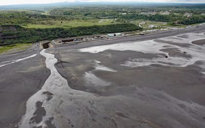
Ninilchik, Kenai Peninsula
Ninilchik is a community at Cape Ninilchik at the mouth of the Ninilchik River on the Kenai Peninsula, on the eastern shore of Cook Inlet, about 99 miles (160 km) southwest of Anchorage and 30 miles (48 km) north-northwest of Homer, Alaska.
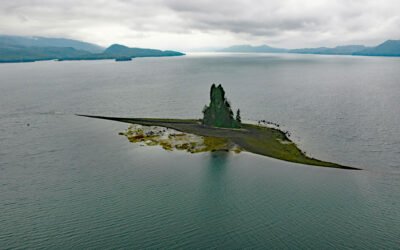
New Eddystone Rock, Behm Canal
The New Eddystone Rock is a pillar of basalt 237 feet (72 m) high, situated in Misty Fjords National Monument and in the eastern arm of Behm Canal, about 87 miles (140 km) north-northwest of Prince Rupert and 32 miles (52 km) northeast of Ketchikan, Alaska.

Beloit Glacier, Blackstone Bay
Beloit Glacier flows northeast for about 2 miles (3.2 km) from an unnamed ice field on the Kenai Peninsula to Blackstone Bay in Prince William Sound, about 86 miles (138 km) southwest of Valdez and 9 miles (15 km) south of Whittier, Alaska.
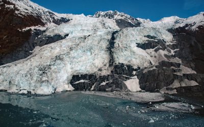
Bryn Mawr Glacier, College Fjord
Bryn Mawr Glacier flows southeast for about 4.5 miles (7 km) to Harvard Arm of College Fjord in northwestern Prince William Sound, about 52 miles (84 km) west of Valdez and 44 miles (71 km) northeast of Whittier, Alaska.
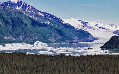
Excelsior Glacier, Johnstone Bay
Excelsior Glacier flows south for about 8 miles (13 km) from the Sargent Icefield on the Kenai Peninsula to its terminus at Big Johnstone Lake, formerly called Excelsior Lake, about 28 miles (45 km) west-southwest of Chenega Bay and 26 miles (42 km) southeast of Seward, Alaska.

Taz Basin, Granite Island
Taz Basin is a small cove on the west coast of Granite Island, one of the Chiswell Islands on the south coast of Kenai Fjords National Park, about 61 miles (98 km) east of Homer and 34 miles (55 km) south-southwest of Seward, Alaska.
About the background graphic
This ‘warming stripe’ graphic is a visual representation of the change in global temperature from 1850 (top) to 2019 (bottom). Each stripe represents the average global temperature for one year. The average temperature from 1971-2000 is set as the boundary between blue and red. The colour scale goes from -0.7°C to +0.7°C. The data are from the UK Met Office HadCRUT4.6 dataset.
Click here for more information about the #warmingstripes.