
Climate Change
Recent Articles
More Articles
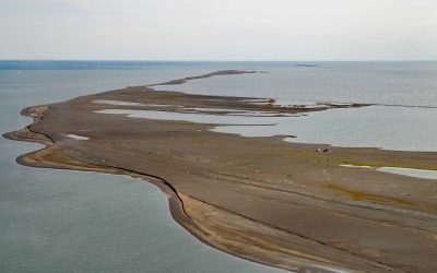
Cooper Island, Beaufort Sea
Cooper Island is an Arctic barrier island and one of the Plover Islands on Elson Lagoon on the Beaufort Sea coast, about 129 miles (208 km) northwest of Nuiqsut and 24 miles (39 km) east of Utqiaġvik, Alaska.
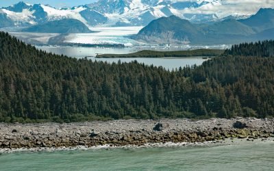
Grand Plateau Glacier, Fairweather Range
Grand Plateau Glacier starts on the north flank of Mount Fairweather in the Fairweather Range of the Saint Elias Mountains and flows generally northwest for 19 miles (31 km) where it splits into two terminal lobes, with the southern lobe flowing 6 miles (10 km) to Grand Plateau Lake, about 142 miles (229 km) northwest of Juneau and 70 miles (113 km) southeast of Yakutat, Alaska.
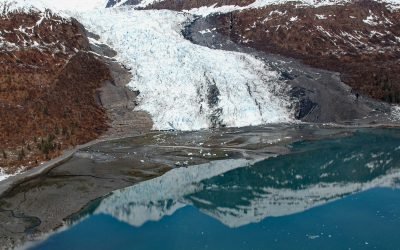
Wellesley Glacier, College Fjord
Wellesley Glacier flows for about 4.5 miles (7 km) from the Chugach Mountains and terminates at a lagoon on the west side of College Fjord, about 55 miles (89 km) west of Valdez and 40 miles (64 km) northeast of Whittier, Alaska.
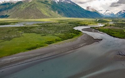
Portage, Turnagain Arm
Portage is a historical community and railroad siding at milepost 64.2 on the Alaska Railroad at the head of Turnagain Arm in the Chugach National Forest, about 41 miles (66 km) south of Anchorage and 11 miles (18 km) northwest of Whittier, Alaska.
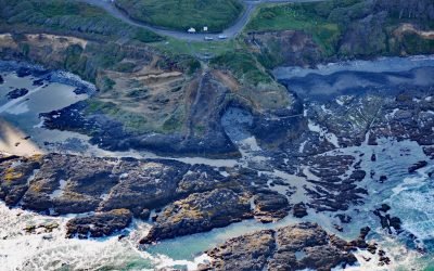
Strawberry Hill, Neptune State Park
Strawberry Hill is part of Neptune State Park, situated between Nancy Creek and Bob Creek, about 19 miles (31 km) north of Florence and 5 miles (8 km) south of Yachats, Oregon.
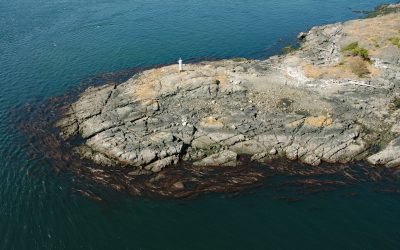
Fairfax Point, Moresby Island
Fairfax Point is a point of land at the southern tip of Moresby Island, one of the Southern Gulf Islands, about 41 miles (66 km) south-southwest of Vancouver and 6 miles (10 km) northeast of Sidney, British Columbia.
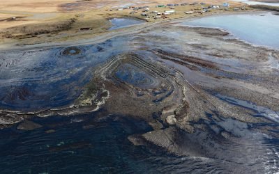
Mueller Cove, Umnak Island
Mueller Cove provides a protected landing for the village of Nikolski at the head of Nikolski Bay, on the northern shore and at the southwestern end of Umnak Island in the eastern Aleutian Islands, about 338 miles (544 km) east-northeast of Adak and 116 miles (187 km) southwest of Dutch Harbor, Alaska.
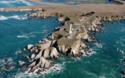
Point Arena, Mendocino Coast
Point Arena is a narrow headland about 0.5 miles (0.8 km) long with a historical lighthouse that marks a significant change in the orientation of the Mendocino Coast, about 34 miles (55 km) south of Fort Bragg and 4 miles (6.4 km) northwest of the community of Point Arena, California.
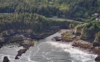
Boiler Bay Intertidal Research Reserve
Boiler Bay Intertidal Research Reserve is a rocky embayment 0.6 miles (1 km) wide between Government Point to the south and Rabbit Rock to the north, about 9 miles (14.5 km) south of Lincoln City and 1.6 miles (2.6 km) north of Depoe Bay, Oregon.
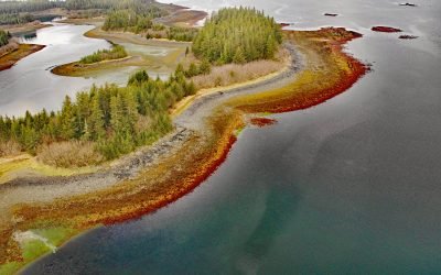
Stockdale Harbor, Montague Island
Stockdale Harbor is on the northwest coast of Montague Island in Prince William Sound, about 62 miles (100 km) southeast of Whittier and 54 miles (87 km) southwest of Cordova, Alaska.
About the background graphic
This ‘warming stripe’ graphic is a visual representation of the change in global temperature from 1850 (top) to 2019 (bottom). Each stripe represents the average global temperature for one year. The average temperature from 1971-2000 is set as the boundary between blue and red. The colour scale goes from -0.7°C to +0.7°C. The data are from the UK Met Office HadCRUT4.6 dataset.
Click here for more information about the #warmingstripes.