
Climate Change
Recent Articles
More Articles
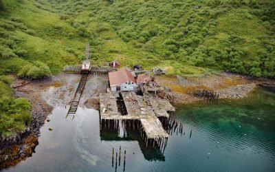
Uganik Fisheries Cannery, Northeast Arm
Uganik Fisheries is a historical salmon cannery on the north shore of Northeast Arm in Uganik Bay on the northwestern coast of Kodiak Island, about 147 miles (237 km) south-southwest of Homer and 35 miles (56 km) west of Kodiak, Alaska.
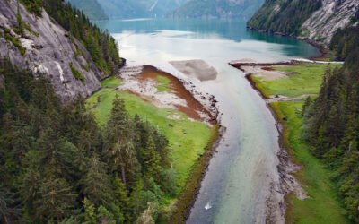
Brim River Hot Springs, Gardner Canal
Brim River Hot Springs and adjoining Owyacumish River Park protect 2,488 acres (1,007 ha) at the head of Owyacumish Bay on the north shore of Gardner Canal, about 96 miles (155 km) southwest of Prince Rupert and 40 miles (64 km) south-southwest of Kitimat, British Columbia.
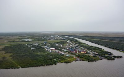
Napakiak, Kuskokwim River
Napakiak is a village located on an island situated between the Kuskokwim River to the south and Johnson Slough to the north, about 167 miles (269 km) southeast of Emmonak and 10 miles (16 km) southwest of Bethel, Alaska.
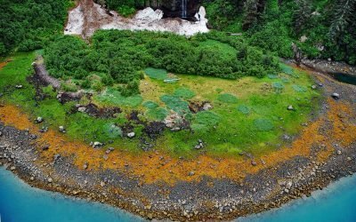
Whale Bay, Prince William Sound
Whale Bay lies on the northeastern coast of the Kenai Peninsula in Prince William Sound, extending 4 miles (6.5 km) northeast to the southern end of Knight Island Passage, about 88 miles (141 km) west-southwest of Cordova and 45 miles (73 km) east of Seward, Alaska.
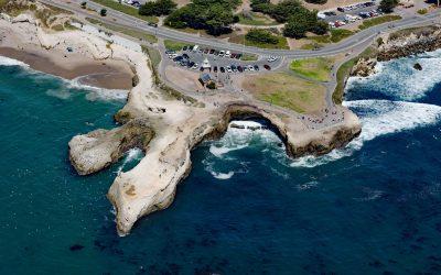
Lighthouse Point Park, Point Santa Cruz
Lighthouse Point Park is located on Point Santa Cruz, adjacent to Lighthouse Field State Beach at the northern boundary of Monterey Bay, about 25 miles (40 km) north-northwest of Monterey and in Santa Cruz, California.
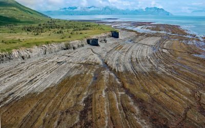
Rocky Cove, Cook Inlet
Rocky Cove is an embayment about 1 mile (1.6 km) wide at the base of Step Mountain, between Ursus Cove to the north and Bruin Bay to the south on the western shore of Cook Inlet, about 128 miles (206 km) northeast of Naknek and 76 miles (122 km) west-southwest of Homer, Alaska.
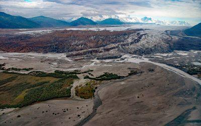
Brady Glacier, Taylor Bay
Brady Glacier lies in Glacier Bay National Park and Preserve, flowing from the Brady Icefield at 11,942 feet (3,640 m) in the Fairweather Range of the Saint Elias Mountains to Taylor Bay on Cross Sound’s north shore, about 139 miles (224 km) southeast of Yakutat and 32 miles (52 km) west of Gustavus, Alaska.
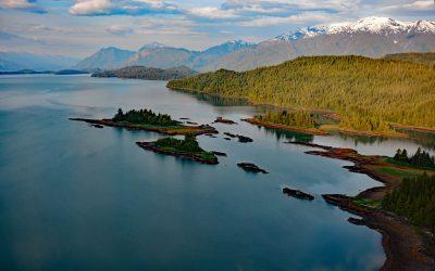
Hastings Arm, Observatory Inlet
Hastings Arm extends 14 miles (23 km) north from Observatory Inlet into the Coast Mountains and terminates at the mouth of the Kshwan River, about 23 miles (37 km) south‐southeast of Stewart and 17 miles (27 km) northwest of Kitsault, British Columbia.
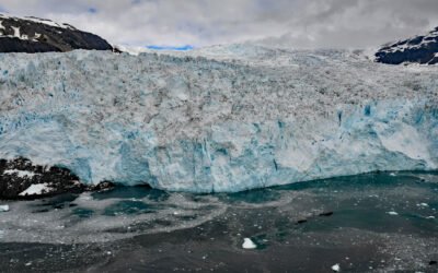
Aialik Glacier, Kenai Fjords National Park
Aialik Glacier flows southeast for 8 miles (13 km) from the Harding Icefield in the Kenai Mountains to tidewater at Aialik Bay in Kenai Fjords National Park, about 66 miles (106 km) east-northeast of Homer and 16 miles (26 km) southwest of Seward, Alaska.
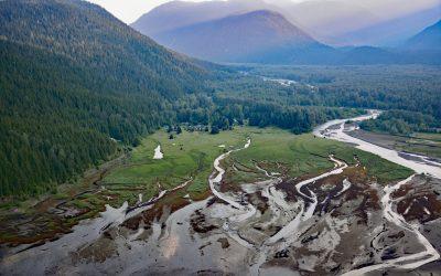
Kitsault River, Alice Arm
Kitsault River drains a watershed area of about 113,668 acres (46,000 ha), including the Kitsault Glacier that flows out of the Cambria Icefield and several smaller glaciers, and flows generally south for 23 miles (37 km) through the Coast Mountains to the head of Alice Arm, about 37 miles (60 km) south-southeast of Stewart and 1.7 miles (2.7 km) north-northwest of Kitsault, British Columbia.
About the background graphic
This ‘warming stripe’ graphic is a visual representation of the change in global temperature from 1850 (top) to 2019 (bottom). Each stripe represents the average global temperature for one year. The average temperature from 1971-2000 is set as the boundary between blue and red. The colour scale goes from -0.7°C to +0.7°C. The data are from the UK Met Office HadCRUT4.6 dataset.
Click here for more information about the #warmingstripes.