
Climate Change
Recent Articles
More Articles
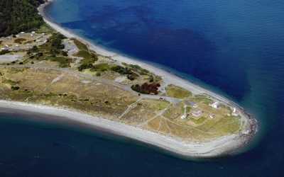
Point Wilson Light Station, Fort Worden
Point Wilson is the site of a historic light station on the grounds of former Fort Worden, situated on a low, broad sand spit that extends northeast for 1.5 miles (0.8 km) from the northern end of the Quimper Peninsula into Admiralty Inlet, about 31 miles (50 km) east of Port Angeles and 2 miles (3.2 km) north of Port Townsend, Washington.
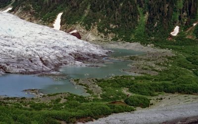
Bainbridge Glacier, Port Bainbridge
Bainbridge Glacier originates on Pinnacle Mountain at the edge of the Sargent Icefield on the Kenai Peninsula, and flows east for 10 miles (16 km) to Port Bainbridge, about 47 miles (76 km) south-southeast of Whittier and 36 miles (58 km) east of Seward, Alaska.
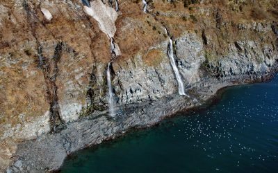
Rookery Falls, Passage Canal
Rookery Falls is on the northern shore of Passage Canal in Prince William Sound, about 50 miles (80 km) southeast of Anchorage and 1.7 miles (1.9 km) north-northeast of Whittier, Alaska.
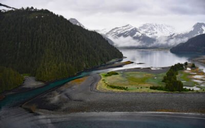
James Lagoon, McCarty Fjord
James Lagoon is a drowned cirque basin about 0.5 miles (0.8 km) wide, partially enclosed by the remains of a terminal moraine, on the western shore of McCarty Fjord in Kenai Fjords National Park, about 51 miles (82 km) southwest of Seward and 40 miles (64 km) east-southeast of Homer, Alaska.
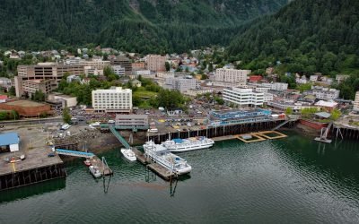
Juneau, Gastineau Channel
Juneau is the state capital, situated at the mouth of Gold Creek on Gastineau Channel, about 93 miles (150 km) northeast of Sitka and 87 miles (140 km) south-southeast of Skagway, Alaska.
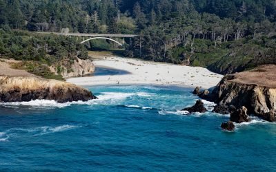
Jug Handle Cove, Ecological Staircase
Jug Handle Cove is a California State Natural Preserve made up of a series of ancient marine terraces, known as the Ecological Staircase, which exhibit different stages of ecological succession at the mouth of Jug Handle Creek, about 5 miles (8 km) south of Fort Bragg and 5 miles (8 km) north of Mendocino, California.
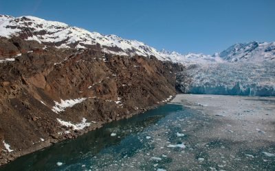
Yale Glacier, College Fjord
Yale Glacier is a massive tidewater glacier in College Fjord of Prince William Sound that starts at an elevation of 9,270 feet (2,826 m) between Mount Cardozo and Mount Einstein in the Chugach Mountains and flows generally southwest for 17 miles (27 km) to Yale Arm, about 48 miles (77 km) northeast of Whittier and 43 miles (69 km) west-northwest of Valdez, Alaska.
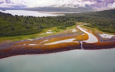
Scidmore Bay, Gilbert Peninsula
Scidmore Bay, enclosed by the Gilbert Peninsula to the east and the Fairweather Mountains to the west, lies in Glacier Bay National Park and Preserve, about 119 miles (192 km) southeast of Yakutat and 43 miles (69 km) northwest of Gustavus, Alaska.
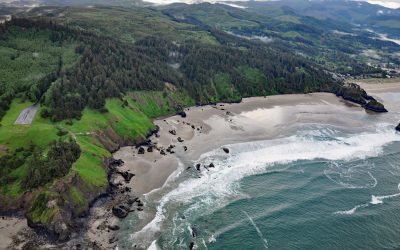
Crescent Beach, Ecola State Park
Crescent Beach lies between Ecola Point and Chapman Point in Ecola State Park, about 20 miles (32 km) south-southwest of Astoria and 2 miles (3.2 km) north-northwest of Cannon Beach, Oregon. It is accessible via a 1.5‑mile (2.4‑km) trail from Ecola Point.
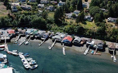
Cowichan Bay, Vancouver Island
Cowichan Bay is a community situated on the south shore of an estuary shared by the Cowichan and Koksilah Rivers that form an extensive tidal flat on the east coast of southern Vancouver Island, about 26 miles (42 km) north-northwest of Victoria and 4 miles (6 km) southeast of Duncan, British Columbia.
About the background graphic
This ‘warming stripe’ graphic is a visual representation of the change in global temperature from 1850 (top) to 2019 (bottom). Each stripe represents the average global temperature for one year. The average temperature from 1971-2000 is set as the boundary between blue and red. The colour scale goes from -0.7°C to +0.7°C. The data are from the UK Met Office HadCRUT4.6 dataset.
Click here for more information about the #warmingstripes.