
Climate Change
Recent Articles
More Articles
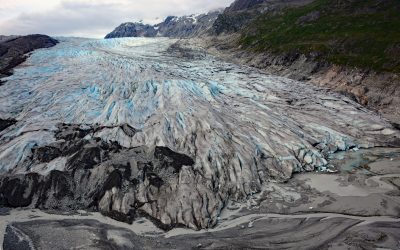
Reid Glacier, Glacier Bay National Park and Preserve
Reid Glacier flows north for 11 miles from the Brady Icefield to Reid Inlet in Glacier Bay National Park and Preserve, about 113 miles (182 km) southeast of Yakutat and 50 miles northwest of Gustavus, Alaska.
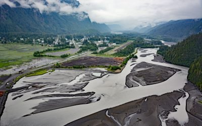
Stewart, Bear River
Stewart is a Canadian border community at the mouth of the Bear River and the head of Portland Canal, connected to Hyder, Alaska by 2 miles (3.2 km) of road, about 99 miles (159 km) east-southeast of Wrangell and 114 miles (183 km) north of Prince Rupert, British Columbia.
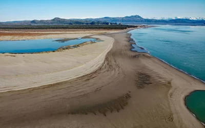
Strawberry Hill, Point Bentinck
Strawberry Hill is a series of uplifted beach ridges on Point Bentinck, at the eastern tip of Hinchinbrook Island and the southern entrance to Strawberry Channel, which separates the island from the mainland, about 53 miles (85 km) south of Valdez and 17 miles (27 km) southwest of Cordova, Alaska.
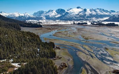
Coghill River, Dartmouth Glacier
The Coghill River in Chugach National Forest flows southwest for 5 miles (8 km) from the terminus of Dartmouth Glacier to Coghill Lake, which is 4.7 miles (7.5 km) long, and then runs west-southwest for 3 miles (4.8 km) to College Fjord near Coghill Point, about 54 miles (87 km) west of Valdez and 32 miles (51 km) northeast of Whittier, Alaska.
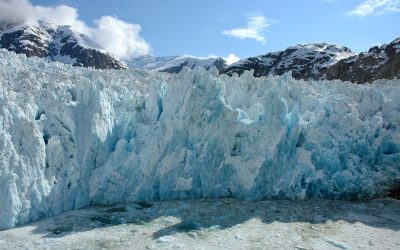
Le Conte Glacier, Frederick Sound
Le Conte Glacier starts from the Stikine Icefield in the Coast Mountains of British Columbia, at an elevation of about 8,500 feet (2,591 m) between Devils Thumb and Mount Gilroy, and flows generally south for 22 miles (35 km) to Southeast Alaska at the head of Le Conte Bay in Frederick Sound, about 25 miles (40 km) north of Wrangell and 22 miles (35 km) east of Petersburg, Alaska.
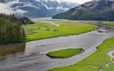
Gilttoyees Creek, Foch-Gilttoyees Provincial Park
Gilttoyees Creek originates in a series of cirque basins on the east and south flanks of Tentacle Peak in the Kitimat Ranges, and flows generally southeast for about 20 miles (32 km) through Foch-Gilttoyees Provincial Park and Protected Area before reaching Gilttoyees Inlet, which opens onto Douglas Channel, about 60 miles (97 km) southeast of Prince Rupert and 20 miles (32 km) southwest of Kitimat, British Columbia.
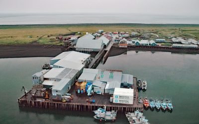
Port Moller, Moller Bay
Port Moller is a small community clustered around a historic salmon cannery on Moller Bay, an embayment on the Bering Sea coast of the Alaska Peninsula near the western margin of Bristol Bay, about 93 miles (150 km) northeast of King Cove and 87 miles (140 km) west-southwest of Chignik, Alaska.
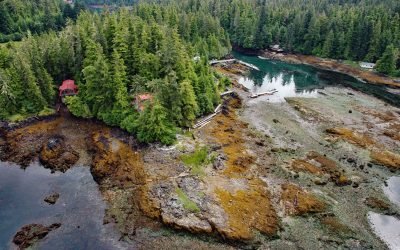
Point Baker, Sumner Strait
Point Baker is a cape on the south shore of Sumner Strait at the north end of Prince of Wales Island in Southeast Alaska, where a small community with the same name lines the shore of a narrow water passage, about 101 miles (163 km) northwest of Ketchikan and 49 miles (79 km) west of Wrangell, Alaska.
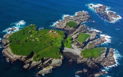
Tatoosh Island, Cape Flattery
Tatoosh Island is the largest of a small group of islands offshore from Cape Flattery and the site of a historic light station, situated on the Makah Reservation, about 34 miles (55 km) north of La Push and 6 miles (10 km) west-northwest of Neah Bay, Washington.
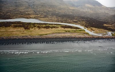
Kanatak, Portage Bay
Kanatak is an uninhabited Alutiiq community of the Native Tribe of Kanatak located at the head of Portage Bay, on the Pacific coast of the Alaska Peninsula, about 136 miles (219 km) west-southwest of Kodiak and 65 miles (105 km) southeast of Egegik, Alaska.
About the background graphic
This ‘warming stripe’ graphic is a visual representation of the change in global temperature from 1850 (top) to 2019 (bottom). Each stripe represents the average global temperature for one year. The average temperature from 1971-2000 is set as the boundary between blue and red. The colour scale goes from -0.7°C to +0.7°C. The data are from the UK Met Office HadCRUT4.6 dataset.
Click here for more information about the #warmingstripes.