
Communities
Recent Articles
More Articles
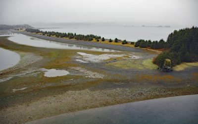
Nuchek, Constantine Harbor
Nuchek is the site of a historical village and Russian trading post on Constantine Harbor at Port Etches on Hinchinbrook Island in Prince William Sound, about 56 miles (90 km) south-southwest of Valdez and 35 miles (56 km) southwest of Cordova, Alaska.
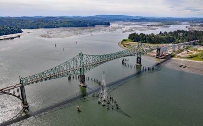
North Bend, Coos Bay
North Bend is one of several communities on Coos Bay, an estuary on the southern Oregon coast, about 22 miles (35 km) south of Reedsport and 3 miles (4.8 km) north of the city of Coos Bay, Oregon.
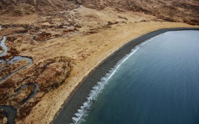
Ugadaga Bay, Unalaska Island
Ugadaga Bay is part of Beaver Inlet, one of the large embayments nearly bisecting Unalaska Island in the Eastern Aleutians, about 141 miles southwest of False Pass and 5.5 miles (9 km) southeast of Dutch Harbor, Alaska.
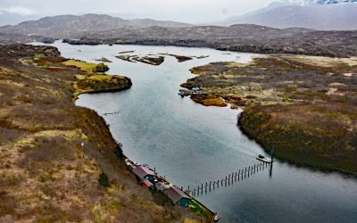
Chignik Fish Weir, Chignik River
Chignik River starts at Black Lake and flows south for about 8 miles to Chignik Lake, which is about 7 miles (11 km) long, and then the river continues flowing east for another 2 miles (3.2 km) to Chignik Lagoon, past the fish weir located about 12 miles (19 km) west-southwest of the community of Chignik and 2.3 miles (3.7 km) east-northeast of the community of Chignik Lake, Alaska.
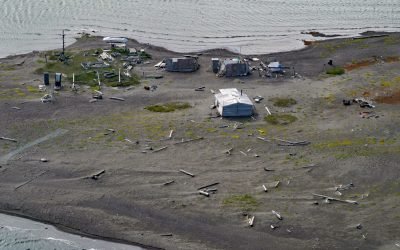
Griffin Point Fish Camp, Beaufort Sea
Griffin Point, also called Uqsruqtalik in the Iñupiat language, is the site of a traditional fish camp on the Beaufort Sea in the Arctic National Wildlife Refuge, about 240 miles (387 km) west-northwest of Tuktoyuktuk and 15 miles (24 km) southeast of Kaktovik, Alaska.
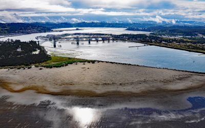
Newport, Yaquina Bay
Newport is a coastal community on Yaquina Bay on the central Oregon coast, about 39 miles (63 km) west of Corvallis and 23 miles (37 km) south of Lincoln City, Oregon.
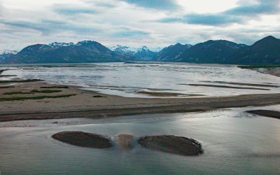
Katmai Bay, Katmai National Park and Preserve
Katmai Bay is about 9 miles (14.5 km) across, located at the mouth of the Katmai River on the Shelikof Strait coast of the Alaska Peninsula in Katmai National Park and Preserve, about 93 miles (150 km) west-northwest of Kodiak and 77 miles (124 km) southeast of King Salmon, Alaska.
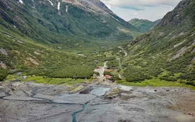
Williamsport, Iliamna Bay
Williamsport is a boat landing and seasonal community at the mouth of Williams Creek in the Chigmit Mountains on the west shore of Iliamna Bay on Cook Inlet, about 75 miles (121 km) west of Homer and 43 miles (70 km) east of Iliamna, Alaska.
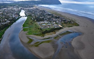
Necanicum River, Seaside
Necanicum River is approximately 21 miles (34 km) long draining a watershed of 84 square miles (21,756 ha), and forms the first estuary south of the Columbia River about 70 miles (113 km) northwest of Portland and 13 miles (21 km) southwest of Astoria at the coastal community of Seaside, Oregon.
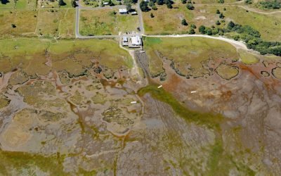
Oysterville, Willapa Bay
Oysterville is located in Willapa Bay on the Long Beach Peninsula, about 28 miles (45 km) north-northwest of Astoria and 17 miles (27 km) southwest of Raymond, Washington.
About the background graphic
This ‘warming stripe’ graphic is a visual representation of the change in global temperature from 1850 (top) to 2019 (bottom). Each stripe represents the average global temperature for one year. The average temperature from 1971-2000 is set as the boundary between blue and red. The colour scale goes from -0.7°C to +0.7°C. The data are from the UK Met Office HadCRUT4.6 dataset.
Click here for more information about the #warmingstripes.