
Glaciers
Recent Articles
More Articles
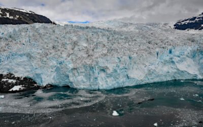
Aialik Glacier, Kenai Fjords National Park
Aialik Glacier flows southeast for 8 miles (13 km) from the Harding Icefield in the Kenai Mountains to tidewater at Aialik Bay in Kenai Fjords National Park, about 66 miles (106 km) east-northeast of Homer and 16 miles (26 km) southwest of Seward, Alaska.
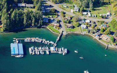
Grapeview, Case Inlet
Grapeview is a community that includes Allyn, Stretch Island, and Reach Island located on the western shore at the head of Case Inlet in South Puget Sound, about 19 miles (31 km) west-northwest of Tacoma and 16 miles (26 km) northeast of Shelton, Washington.
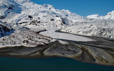
Dirty Glacier, Harriman Fjord
The Dirty Glacier flows generally north for about 1.7 miles (2.7 km) from an elevation of 3,800 feet (1,158 m) in the Chugach Mountains of western Prince William Sound to its terminus at an outwash plain about 1 mile (1.6 km) from the head of Harriman Fjord, about 71 miles (114 km) west-southwest of Valdez and 16 miles (26 km) northeast of Whittier, Alaska.
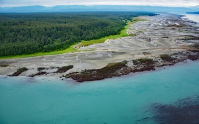
Ancon Rock, Point Gustavus
Ancon Rock is a reef located about 0.5 miles (0.8 km) off Point Gustavus on the eastern shore, at the entrance to Glacier Bay within Glacier Bay National Park and Preserve, about 55 miles (89 km) west of Juneau and 8.5 miles (12 km) southwest of Gustavus, Alaska.
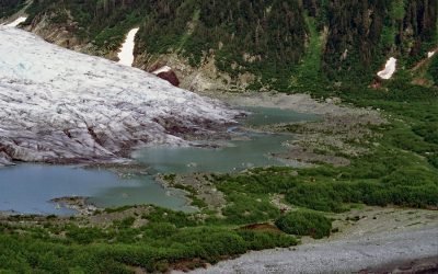
Bainbridge Glacier, Port Bainbridge
Bainbridge Glacier originates on Pinnacle Mountain at the edge of the Sargent Icefield on the Kenai Peninsula, and flows east for 10 miles (16 km) to Port Bainbridge, about 47 miles (76 km) south-southeast of Whittier and 36 miles (58 km) east of Seward, Alaska.
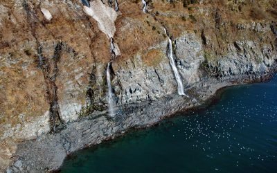
Rookery Falls, Passage Canal
Rookery Falls is on the northern shore of Passage Canal in Prince William Sound, about 50 miles (80 km) southeast of Anchorage and 1.7 miles (1.9 km) north-northeast of Whittier, Alaska.
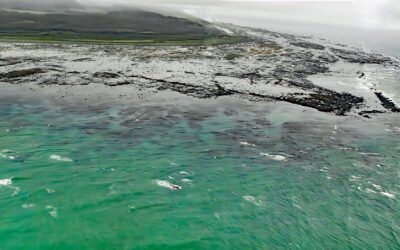
Cape Suckling, Suckling Hills
Cape Suckling is an area of wave eroded rocky reefs backed by dunes, and farther inland lie the Suckling Hills and the terminus of the Bering Glacier, about 150 miles (241 km) west-northwest of Yakutat and 73 miles (117 km) southeast of Cordova, Alaska.
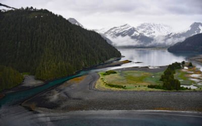
James Lagoon, McCarty Fjord
James Lagoon is a drowned cirque basin about 0.5 miles (0.8 km) wide, partially enclosed by the remains of a terminal moraine, on the western shore of McCarty Fjord in Kenai Fjords National Park, about 51 miles (82 km) southwest of Seward and 40 miles (64 km) east-southeast of Homer, Alaska.
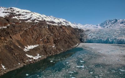
Yale Glacier, College Fjord
Yale Glacier is a massive tidewater glacier in College Fjord of Prince William Sound that starts at an elevation of 9,270 feet (2,826 m) between Mount Cardozo and Mount Einstein in the Chugach Mountains and flows generally southwest for 17 miles (27 km) to Yale Arm, about 48 miles (77 km) northeast of Whittier and 43 miles (69 km) west-northwest of Valdez, Alaska.
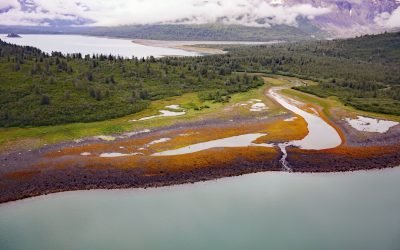
Scidmore Bay, Gilbert Peninsula
Scidmore Bay, enclosed by the Gilbert Peninsula to the east and the Fairweather Mountains to the west, lies in Glacier Bay National Park and Preserve, about 119 miles (192 km) southeast of Yakutat and 43 miles (69 km) northwest of Gustavus, Alaska.
About the background graphic
This ‘warming stripe’ graphic is a visual representation of the change in global temperature from 1850 (top) to 2019 (bottom). Each stripe represents the average global temperature for one year. The average temperature from 1971-2000 is set as the boundary between blue and red. The colour scale goes from -0.7°C to +0.7°C. The data are from the UK Met Office HadCRUT4.6 dataset.
Click here for more information about the #warmingstripes.