
Mines
Recent Articles
More Articles
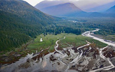
Kitsault River, Alice Arm
Kitsault River drains a watershed area of about 113,668 acres (46,000 ha), including the Kitsault Glacier that flows out of the Cambria Icefield and several smaller glaciers, and flows generally south for 23 miles (37 km) through the Coast Mountains to the head of Alice Arm, about 37 miles (60 km) south-southeast of Stewart and 1.7 miles (2.7 km) north-northwest of Kitsault, British Columbia.
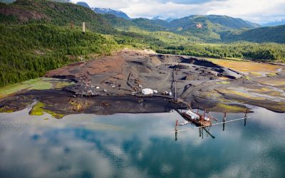
Anyox, Observatory Inlet
Anyox, an abandoned mining community in the Coast Mountains, lies at the mouth of Anyox Creek on Granby Bay in Observatory Inlet, about 79 miles (127 km) north-northeast of Prince Rupert and 37 miles (60 km) south of Stewart, British Columbia.
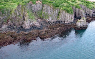
Takli Island, Amalik Bay
Takli Island is in Amalik Bay, between Cape Ilktugitak to the southwest and Cape Atushagvik to the northeast, along the Shelikof Strait coast of the Alaska Peninsula in Katmai National Park and Preserve, about 154 miles (248 kilometers) southwest of Homer and 81 miles (130 kilometers) west-northwest of Kodiak, Alaska.
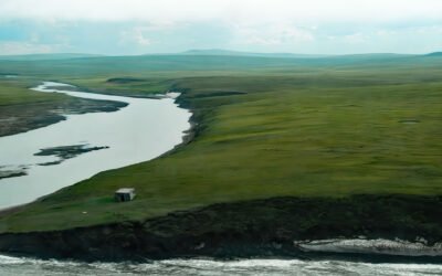
Pitmegea River, Cape Sabine
The Pitmegea River originates at an elevation of about 1,300 feet (396 meters) in the De Long Mountains of the western Brooks Range, and flows northwest for 37 miles (60 kilometers) to the Chukchi Sea at Cape Sabine, about 70 miles (113 kilometers) south-southwest of Point Lay and 66 miles (106 kilometers) northeast of Point Hope, Alaska.
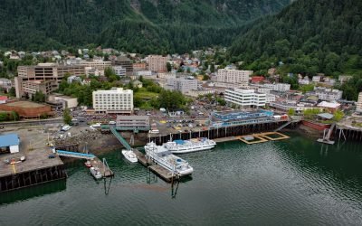
Juneau, Gastineau Channel
Juneau is the state capital, situated at the mouth of Gold Creek on Gastineau Channel, about 93 miles (150 km) northeast of Sitka and 87 miles (140 km) south-southeast of Skagway, Alaska.
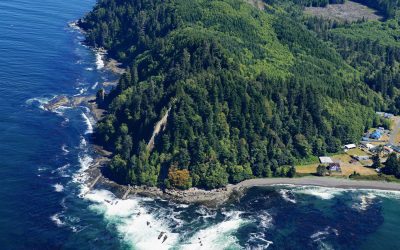
Slip Point, Clallam Bay
Slip Point sits on the southern shore of the Strait of Juan de Fuca at the eastern end of Clallam Bay on the Olympic Peninsula, about 39 miles (63 km) west-northwest of Port Angeles and 0.7 miles (1 km) northeast of the community of Clallam Bay, Washington.
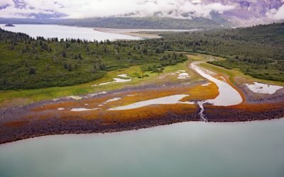
Scidmore Bay, Gilbert Peninsula
Scidmore Bay, enclosed by the Gilbert Peninsula to the east and the Fairweather Mountains to the west, lies in Glacier Bay National Park and Preserve, about 119 miles (192 km) southeast of Yakutat and 43 miles (69 km) northwest of Gustavus, Alaska.
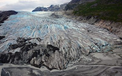
Reid Glacier, Glacier Bay National Park and Preserve
Reid Glacier flows north for 11 miles from the Brady Icefield to Reid Inlet in Glacier Bay National Park and Preserve, about 113 miles (182 km) southeast of Yakutat and 50 miles northwest of Gustavus, Alaska.
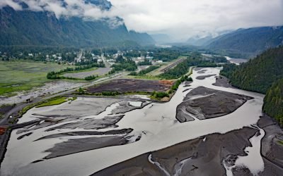
Stewart, Bear River
Stewart is a Canadian border community at the mouth of the Bear River and the head of Portland Canal, connected to Hyder, Alaska by 2 miles (3.2 km) of road, about 99 miles (159 km) east-southeast of Wrangell and 114 miles (183 km) north of Prince Rupert, British Columbia.
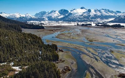
Coghill River, Dartmouth Glacier
The Coghill River in Chugach National Forest flows southwest for 5 miles (8 km) from the terminus of Dartmouth Glacier to Coghill Lake, which is 4.7 miles (7.5 km) long, and then runs west-southwest for 3 miles (4.8 km) to College Fjord near Coghill Point, about 54 miles (87 km) west of Valdez and 32 miles (51 km) northeast of Whittier, Alaska.
About the background graphic
This ‘warming stripe’ graphic is a visual representation of the change in global temperature from 1850 (top) to 2019 (bottom). Each stripe represents the average global temperature for one year. The average temperature from 1971-2000 is set as the boundary between blue and red. The colour scale goes from -0.7°C to +0.7°C. The data are from the UK Met Office HadCRUT4.6 dataset.
Click here for more information about the #warmingstripes.