
Mines
Recent Articles
More Articles
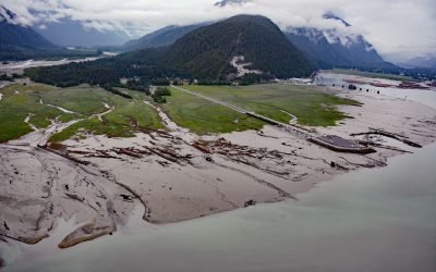
Hyder, Portland Canal
Hyder is a small community at the mouth of the Salmon River, on the western shore and near the head of Portland Canal, about 75 miles (121 km) northeast of Ketchikan and 2.5 miles (4 km) south-southwest of Stewart, British Columbia.
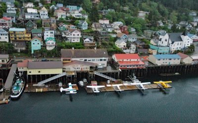
Ketchikan, Revillagigedo Island
Ketchikan is a coastal community and U.S. port of entry on the north shore of Tongass Narrows, on the southern coast of Revillagigedo Island, about 88 miles (142 km) northwest of Prince Rupert and 84 miles (135 km) south-southeast of Wrangell, Alaska.
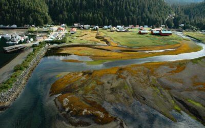
Pelican, Lisianski Inlet
Pelican is a small community located on the east side of Lisianski Inlet on the north coast of Chichagof Island in the Alexander Archipelago of Southeast Alaska, about 71 miles (114 km) north-northwest of Sitka and 17 miles (27 km) south of Elfin Cove, Alaska.
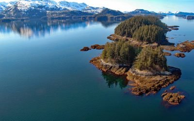
New Year Islands, Knight Island Passage
New Year Islands are at the mouth of Drier Bay in Knight Island Passage on the west coast of Knight Island in Prince William Sound, about 55 miles (89 km) east-northeast of Seward and 41 miles (66 km) southeast of Whittier, Alaska.
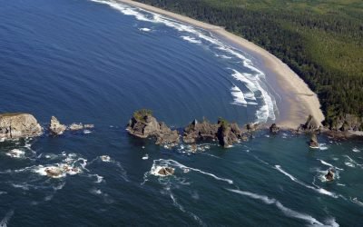
Point of Arches, Olympic National Park
Point of Arches and the adjacent Shi Shi Beach represent a unique section of shoreline located at the edge of the Olympic National Park.

Rudyerd Bay, Misty Fjords National Monument
Rudyerd Bay is a deglaciated fjord in the Coast Range of Southeast Alaska in Misty Fjords National Monument, about 89 miles (143 km) north-northwest of Prince Rupert and 39 miles (63 km) northeast of Ketchikan, Alaska.
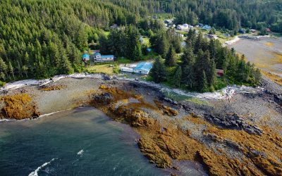
Kasaan, Prince of Wales Island
Kasaan is a small community on the north shore of Kasaan Bay and the southern shore of the Kasaan Peninsula, on the east coast of Prince of Wales Island, about 65 miles (105 km) south of Wrangell and 33 miles (53 km) west-northwest of Ketchikan, Alaska.
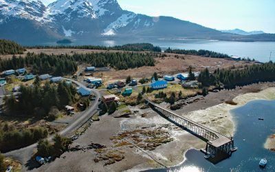
Tatitlek, Prince William Sound
Tatitlek is a small Chugach Alutiiq community located on the northeastern shore of Tatitlek Narrows across from Bligh Island and at the mouth of Boulder Bay on the eastern shore of Prince William Sound, about 24 miles (38 km) southwest of Valdez and 39 miles (63 km) northwest of Cordova, Alaska.
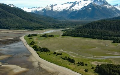
Eagle River Beach, Favorite Channel
Eagle Beach is at the mouth of Eagle River on the eastern shore of Favorite Channel, about 68 miles (109 km) south-southeast of Skagway and 22 miles (35 km) northwest of Juneau, Alaska.
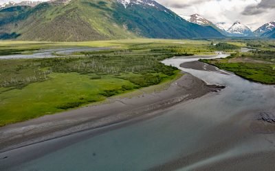
Portage, Turnagain Arm
Portage is a historical community and railroad siding at milepost 64.2 on the Alaska Railroad at the head of Turnagain Arm in the Chugach National Forest, about 41 miles (66 km) south of Anchorage and 11 miles (18 km) northwest of Whittier, Alaska.
About the background graphic
This ‘warming stripe’ graphic is a visual representation of the change in global temperature from 1850 (top) to 2019 (bottom). Each stripe represents the average global temperature for one year. The average temperature from 1971-2000 is set as the boundary between blue and red. The colour scale goes from -0.7°C to +0.7°C. The data are from the UK Met Office HadCRUT4.6 dataset.
Click here for more information about the #warmingstripes.