
Mines
Recent Articles
More Articles
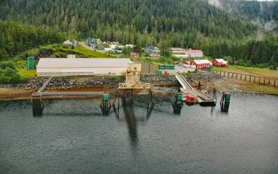
Greens Creek Mine, Hawk Inlet
Greens Creek Mine is the fifth-largest silver producer in the world, located on the eastern shore of Hawk Inlet on Admiralty Island, about 77 miles (124 km) north-northeast of Sitka and 18 miles (29 km) southwest of Juneau, Alaska.
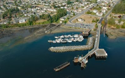
Crofton, Vancouver Island
Crofton is a small coastal community at Osborne Bay on the southeast coast of Vancouver Island, about 34 miles (55 km) north-northwest of Victoria and 26 miles (42 km) southeast of Nanaimo, British Columbia.
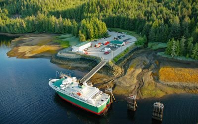
Hollis, Prince of Wales Island
Hollis is a small community on Twelvemile Arm of Kasaan Bay, north of Cat Island, near the center of Prince of Wales Island in the Alexander Archipelago of Southeast Alaska, about 41 miles (66 km) west-northwest of Ketchikan and 20 miles (32 km) east of Craig, Alaska.
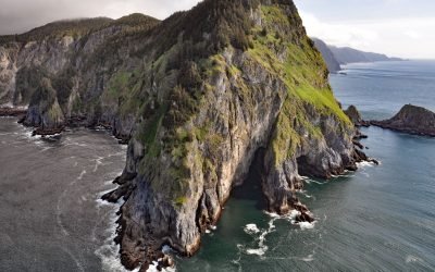
Helm Point, Coronation Island
Helm Point is a prominent headland at the southern tip of Coronation Island in the Alexander Archipelago of Southeast Alaska, between Chatham and Sumner Straits, about 94 miles (151 km) south-southeast of Sitka and 86 miles (138 km) southwest of Wrangell, Alaska.
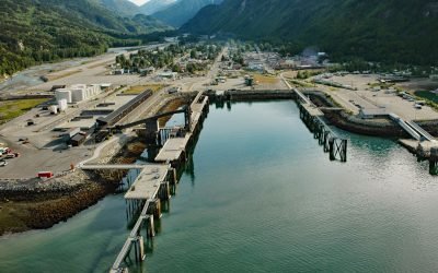
Skagway, Taiya Inlet
Skagway is a community at the mouth of the Skagway River, near the head of Taiya Inlet, about 90 miles (145 km) northwest of Juneau and 16 miles (26 km) north-northeast of Haines, Alaska.
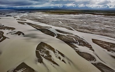
Copper River, Copper River Delta
The Copper River watershed drains about 24,000 square miles (62,000 sq km) in the Wrangell, Chugach, and Saint Elias Mountains and the mainstem flows for about 290 miles (470 km) to the Gulf of Alaska where it creates a wide delta, about 195 miles west-northwest of Yakutat and 30 miles southeast of Cordova, Alaska.
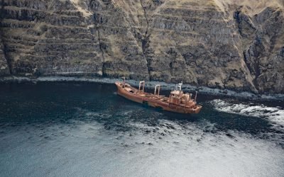
Aoyagi Maru, Lost Harbor
Aoyagi Maru is a Japanese flagged refrigerant ship that grounded on the south shore of Lost Harbor on Akun Island, about 135 miles (218 km) southwest of Cold Bay and 9 miles (14.5 km) northeast of Akutan, Alaska.

Delarof Harbor, Unga Island
Delarof Harbor is an embayment and the site of the historical village of Unga on the southeast coast of Unga Island, the largest of the Shumagin Islands, about 73 miles (118 km) southwest of Perryville and 9.5 miles (15 km) south of Sand Point, Alaska.

Nuka River, Beauty Bay
Nuka River starts from Bradley Pass in the Kenai Mountains at an elevation of roughly 1400 feet (427 m) and flows generally south for 10 miles (16 km), draining a watershed of 34,503 acres (13,963 ha), to Beauty Bay between Storm Mountain to the north and Mount Diablo to the south in West Arm Nuka Bay, about 57 miles (92 km) southwest of Seward and 32 miles (52 km) east-southeast of Homer, Alaska.

Tonsina Bay, Nuka Passage
Tonsina Bay is on the western shore of Nuka Passage at the base of Gore Point on the Kenai Peninsula, across from the southern end of Nuka Island, about 76 miles (122 km) south-southwest of Seward and 31 miles (50 km) south-southeast of Homer, Alaska.
About the background graphic
This ‘warming stripe’ graphic is a visual representation of the change in global temperature from 1850 (top) to 2019 (bottom). Each stripe represents the average global temperature for one year. The average temperature from 1971-2000 is set as the boundary between blue and red. The colour scale goes from -0.7°C to +0.7°C. The data are from the UK Met Office HadCRUT4.6 dataset.
Click here for more information about the #warmingstripes.