
Oregon
Recent Articles
More Articles
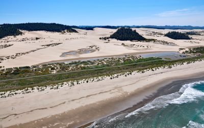
Umpqua Beach, Oregon Dunes National Recreation Area
Umpqua Beach is an off-highway vehicle staging area south of the Umpqua River mouth in the Oregon Dunes National Recreation Area that extends for about 35 miles (56 km) along the coast from the Siuslaw River at Florence in the north to the Coos River at North Bend, Oregon.
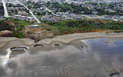
Nye Beach, Newport
Nye Beach is situated in Newport between Agate Beach to the north and Yaquina Beach to the south, and historically was demarcated at the north end by a rocky point with a sea stack known as Jump-Off Joe, about 22 miles (35 km) south of Lincoln City and 1.9 miles (3 km) north of Yaquina Bay, Oregon
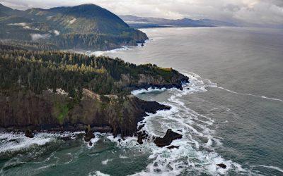
Cape Falcon, Oswald West State Park
Cape Falcon is a headland situated between Short Sand Beach in Smugglers Cove to the south and Cove Beach to the north, and is part of Oswald West State Park and adjacent to Cape Falcon Marine Reserve, about 23 miles (37 km) north-northwest of Tillamook and 9 miles (14.5 km) south of Cannon Beach, Oregon.
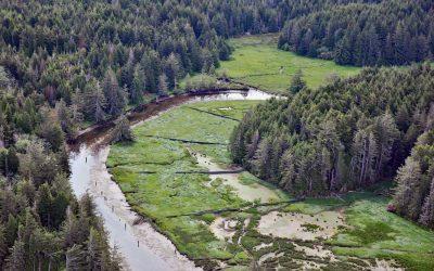
South Slough, Coos Bay
South Slough is a tidal embayment designated as a National Estuarine Research Reserve that extends 6 miles (10 km) south from Coos Bay, which is an estuary of the Coos River, about 13 miles (21 km) north-northeast of Bandon and 4 miles (6.5 km) south of Charleston, Oregon.
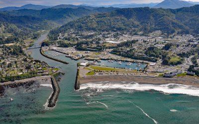
Brookings, Chetco River
Brookings is a community at the mouth of the Chetco River, which flows from the Southern Oregon Coast Range to the Pacific Ocean, about 21 miles (34 km) north-northwest of Crescent City, California and 26 miles (42 km) south-southeast of Gold Beach, Oregon.
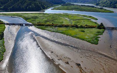
Blacks Island, Smith River
Blacks Island is situated at the confluence of the Smith River and the Umpqua River, on the historic spur line of the Southern Pacific Railroad connecting Eugene with Coos Bay, about 1.7 miles (2.7 km) southeast of Gardiner and 1 mile (1.6 km) northeast of Reedsport, Oregon.
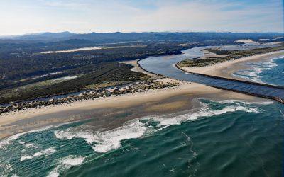
Siuslaw River, Florence
Siuslaw River starts at an elevation of 636 feet (194 m) in the Coast Range and flows generally west-northwest for 110 miles (177 km) to the Pacific Ocean at Florence, draining a watershed of 494,720 acres (200,206 ha), about 53 miles (85 km) west of Eugene and 43 miles (69 km) south of Newport, Oregon.
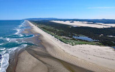
Siltcoos River, Oregon Coastal Dunes
Siltcoos River begins at the outlet of Siltcoos Lake and meanders generally west for 3 miles (4.8 km) through the Oregon Coastal Dunes to the Pacific Ocean, about 8 miles (13 km) south of Florence and 13 miles (21 km) north of Reedsport, Oregon.
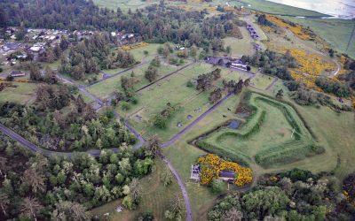
Fort Stevens, Point Adams
Fort Stevens was constructed during the American Civil War as an earthwork battery on the south shore at the mouth of the Columbia River on Point Adams, about 15 miles (24 km) north of Seaside and 6 miles (10 km) west-northwest of Astoria, Oregon.

Peter Iredale, Clatsop Spit
Peter Iredale was a British four-masted bark-rigged sailing ship with a length of 275 feet (84 m) that ran aground in 1906 and wrecked on Clatsop Spit, about 7 miles (11 km) west of Astoria and 2 miles ( km) southwest of Hammond, Oregon.
About the background graphic
This ‘warming stripe’ graphic is a visual representation of the change in global temperature from 1850 (top) to 2019 (bottom). Each stripe represents the average global temperature for one year. The average temperature from 1971-2000 is set as the boundary between blue and red. The colour scale goes from -0.7°C to +0.7°C. The data are from the UK Met Office HadCRUT4.6 dataset.
Click here for more information about the #warmingstripes.