
Oregon
Recent Articles
More Articles
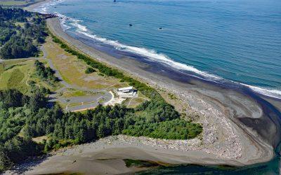
Winchuk River, Crissey Field
Winchuck River starts at an elevation of about 2,000 feet (610 m) and flows generally southwest for 19 miles (31 km) through the Rogue River–Siskiyou National Forest to the Pacific Ocean at Crissey Field, about 17 miles (27 km) north of Crescent City and 4.8 miles (7.7 km) southeast of Brookings, Oregon.
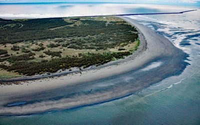
Clatsop Spit, Columbia River Bar
Clatsop Spit is part of Fort Stevens State Park that projects north from the south bank of the Columbia River and the submerged portion forms the Columbia River Bar, about 80 miles (129 km) northwest of Portland and 9 miles (15 km) west-northwest of Astoria, Oregon.

New Carissa, North Spit
New Carissa was a freighter 639 feet (195 m) in length that grounded on North Spit in 1999, causing an oil spill about 5 miles (8 km) northwest of Coos Bay and 4 miles (6.5 km) west of the community of North Bend, Oregon.
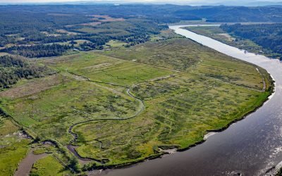
Coquille River Estuary, Bandon
The Coquille River, located in the Coast Range near Bandon, drains a watershed of 37,760 acres (15,281 ha), and flows to the Pacific Ocean approximately 20 miles (32 km) north of Cape Blanco, Oregon.

Depoe Bay, Depoe Creek
Depoe Bay is a community situated on a small natural embayment of the same name, forming the estuary for Depoe Creek, located about 11 miles (18 km) south-southwest of Lincoln City and 12 miles (19 km) north of Newport, Oregon.
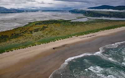
Bayocean, Tillamook Bay
Bayocean was a planned resort community founded in 1906 on a sand spit 4 miles, (6.5 km) long and 0.5 miles (0.8 km) wide, that separates Tillamook Bay from the Pacific Ocean, about 63 miles (102 km) west of Portland and 7 miles (11 km) northwest of Tillamook, Oregon.
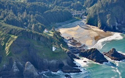
Heceta Head Lighthouse, Heceta Head
Heceta Head Lighthouse is at an elevation of 205 feet (62 m) on the Heceta headland, about 13 miles (21 km) north of Florence, and 13 miles (21 km) south of Yachats, Oregon.
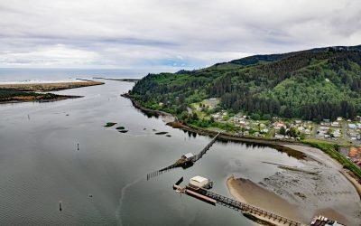
Garibaldi, Tillamook Bay
Coast Guard Station Tillamook Bay is an active duty U.S. Coast Guard facility located in Garibaldi on Tillamook Bay, 7.5 miles (12 km) northwest of the community of Tillamook, Oregon.
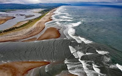
Salishan Spit, Lincoln City
Salishan Spit separates the Pacific Ocean from Siletz Bay and is located 2.5 miles (4 km) south of Lincoln City and 3 miles (4.8 km) north of Gleneden Beach, Oregon.
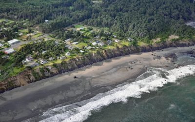
Nesika Beach, Geisel Monument
Nesika Beach is a community located at the south end of the Nesika strand, and the site of the Geisel Monument, about 6 miles (10 km) north of Gold Beach and 4 miles (6 km) south-southeast of Ophir, Oregon.
About the background graphic
This ‘warming stripe’ graphic is a visual representation of the change in global temperature from 1850 (top) to 2019 (bottom). Each stripe represents the average global temperature for one year. The average temperature from 1971-2000 is set as the boundary between blue and red. The colour scale goes from -0.7°C to +0.7°C. The data are from the UK Met Office HadCRUT4.6 dataset.
Click here for more information about the #warmingstripes.