
Oregon
Recent Articles
More Articles
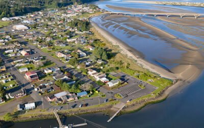
Waldport, Alsea Bay
Waldport is a community situated on the southern shore of Alsea Bay, an estuary of the Alsea River, about 15 miles (24 km) south of Newport and 8 miles (13 km) north of Yachats, Oregon.
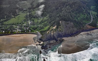
Arch Cape Creek, Arch Cape
Arch Cape is a small community at the mouth of Arch Cape Creek named after a natural sea arch in a basalt headland, about 25 miles (40 km) north-northwest of Tillamook and 6.5 miles (10 km) south of Cannon Beach, Oregon.
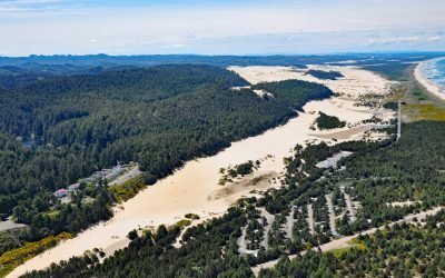
Umpqua River, Winchester Bay
Umpqua River flows generally west-northwest for 111 miles (179 km), draining a watershed of 2.4 million acres (1 million ha), from the Cascade Mountains through the Coast Range to Winchester Bay in the Oregon Dunes, about 20 miles (32 km) north of Coos Bay and 5.5 miles (9 km) southwest of Reedsport, Oregon.
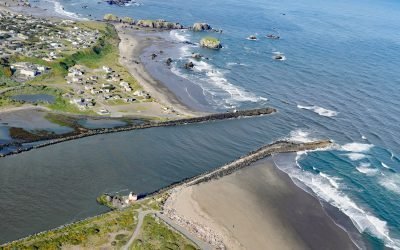
Coquille River, Bandon
Coquille River drains a mountainous watershed of about 6.8 million acres (2.7 million ha) with at least 26 named tributaries and flows for about 36 miles (58 km) from the confluence of the North Fork and South Fork to the Pacific Ocean at Bandon, about 26 miles (42 km) north of Port Orford and 20 miles (32 km) southwest of Coos Bay, Oregon.
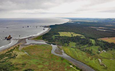
Sixes River, Cape Blanco
Sixes River drains a watershed of about 85,832 acres (34,735 ha) and flows generally west for about 31 miles (50 km) through coastal forests in southwestern Oregon and enters the Pacific Ocean just north of Cape Blanco, about 19 miles (31 km) south-southwest of Bandon and 8 miles (13 km) north-northwest of Port Orford, Oregon.
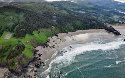
Crescent Beach, Ecola State Park
Crescent Beach lies between Ecola Point and Chapman Point in Ecola State Park, about 20 miles (32 km) south-southwest of Astoria and 2 miles (3.2 km) north-northwest of Cannon Beach, Oregon. It is accessible via a 1.5‑mile (2.4‑km) trail from Ecola Point.
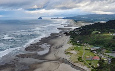
Winema Beach, Oretown
Winema Beach, a coastal strip adjacent to Winema Lake, was once the site of a town platted as Wi‑Ne‑Ma near Oretown in southern Tillamook County, about 15 miles (24 km) north of Lincoln City and 4 miles (6 km) south of Pacific City, Oregon.
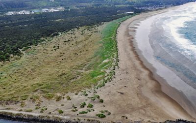
South Beach, Yaquina Bay South Jetty
South Beach is a state park south of the jetty protecting the mouth of Yaquina Bay and extending for 1 mile (1.6 km) along the Pacific coast, about 12 miles (19 km) north of Waldport and 2 miles (3.2 km) south-southwest of Newport, Oregon.
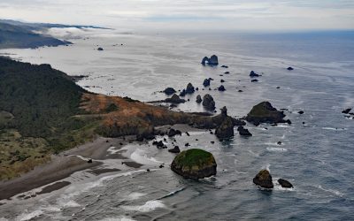
Crook Point, Oregon Islands National Wildlife Refuge
Crook Point is a prominent headland within the Oregon Islands National Wildlife Refuge that includes 1.4 miles (2.3 km) of shoreline with sandy beaches and areas of rocky intertidal, offshore rocks, islets, and subtidal reefs with kelp beds, about 15 miles (24 km) north-northwest of Brookings and 11 miles (18 km) south of Gold Beach, Oregon.
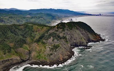
Cape Sebastian, Gold Beach
Cape Sebastian is a prominent headland with an elevation of about 640 feet (195 m) and is one of the 11 named capes along the Oregon coast, about 6.7 miles (10.8 km) south of Gold Beach and 3 miles (4.8 km) north of Pistol River, Oregon.
About the background graphic
This ‘warming stripe’ graphic is a visual representation of the change in global temperature from 1850 (top) to 2019 (bottom). Each stripe represents the average global temperature for one year. The average temperature from 1971-2000 is set as the boundary between blue and red. The colour scale goes from -0.7°C to +0.7°C. The data are from the UK Met Office HadCRUT4.6 dataset.
Click here for more information about the #warmingstripes.