
Oregon
Recent Articles
More Articles
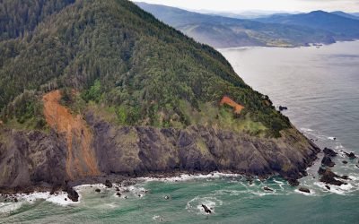
Humbug Mountain, Port Orford
Humbug Mountain rises 1,758 feet (536 m) from sea level on the southern coast of Oregon and lies entirely within Humbug Mountain State Park, about 21 miles (34 km) north of Gold Beach and 6 miles (10 km) south of Port Orford, Oregon.
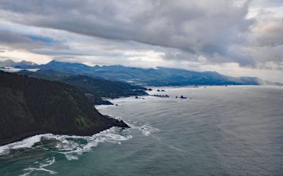
Tillamook Head, Ecola State Park
Tillamook Head is a steep rocky promontory with an elevation of approximately 1,200 feet (366 m), located in Ecola State Park, about 5 miles (8 km) southwest of Seaside and 4 miles (6.4 km) north-northwest of Cannon Beach, Oregon.
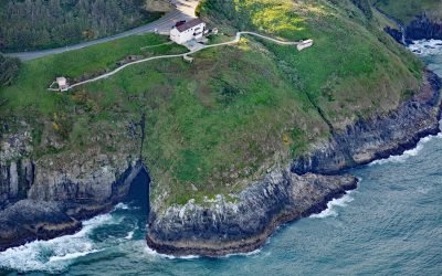
Sea Caves, Sea Lion Point
Sea Lion Caves are a connected system of sea caves and caverns open to the Pacific Ocean at Sea Lion Point, about 36 miles (58 km) south of Newport and 11 miles (18 km) north of Florence, Oregon.
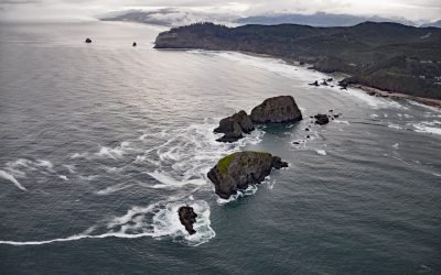
Three Arch Rocks, Oceanside
Three Arch Rocks are massive arched basalt sea stacks located south of Cape Meares and 0.5 miles (0.9 km) offshore from Maxwell Point at the community of Oceanside, about 8 miles (13 km) south-southwest of Garibaldi and 2.7 miles (4 km) northwest of Netarts, Oregon.
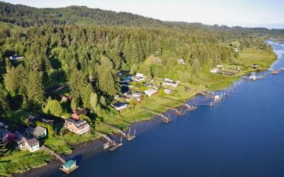
Drift Creek Landing, Alsea River
Drift Creek Landing is a community on the south bank of the Alsea River, opposite the confluence of Drift Creek, a major Coast Range tributary joining the Alsea about 3.4 miles (5.5 km) east of Waldport, about 16 miles (26 km) south-southeast of Newport and 9 miles (15 km) northeast of Yachats, Oregon.
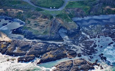
Strawberry Hill, Neptune State Park
Strawberry Hill is part of Neptune State Park, situated between Nancy Creek and Bob Creek, about 19 miles (31 km) north of Florence and 5 miles (8 km) south of Yachats, Oregon.
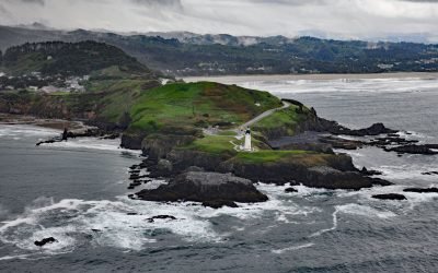
Yaquina Head, Agate Beach
Yaquina Head is a prominent basalt headland, adjacent to the community of Agate Beach, rising over 100 feet (30 m) in elevation and extending 0.75 miles (1.2 km) into the Pacific Ocean, about 9 miles (15 km) south of Depoe Bay and 3 miles (5 km) north-northwest of Newport, Oregon.
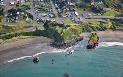
Battle Rock, Port Orford
Battle Rock is a large sea stack connected to the mainland by a narrow rocky ridge, situated 500 feet (152 m) southeast of Fort Point at the head of Port Orford, a shallow embayment or bight, about 23 miles (37 km) north of Gold Beach and adjacent to the community of Port Orford, Oregon.
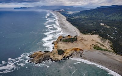
Cape Kiwanda, Pacific City
Cape Kiwanda is a sandstone headland with an elevation of 240 feet (73 m), protected by a basalt island known as Haystack Rock lying 0.5 miles (0.8 km) to the southwest, about 18 miles (29 km) south-southwest of Tillamook and 1 mile (1.6 km) northwest of Pacific City, Oregon.
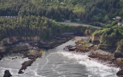
Boiler Bay Intertidal Research Reserve
Boiler Bay Intertidal Research Reserve is a rocky embayment 0.6 miles (1 km) wide between Government Point to the south and Rabbit Rock to the north, about 9 miles (14.5 km) south of Lincoln City and 1.6 miles (2.6 km) north of Depoe Bay, Oregon.
About the background graphic
This ‘warming stripe’ graphic is a visual representation of the change in global temperature from 1850 (top) to 2019 (bottom). Each stripe represents the average global temperature for one year. The average temperature from 1971-2000 is set as the boundary between blue and red. The colour scale goes from -0.7°C to +0.7°C. The data are from the UK Met Office HadCRUT4.6 dataset.
Click here for more information about the #warmingstripes.