
Oregon
Recent Articles
More Articles
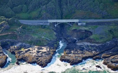
Thor’s Well, Cook’s Chasm
Thor’s Well is at Cook’s Chasm, a fissure in the rock approximately 400 feet (122 m) long and 60 feet (18 m) wide between Captain Cook Point and Cape Perpetua, about 20 miles (32 km) north of Florence and 2 miles (3.2 km) south of Yachats, Oregon.
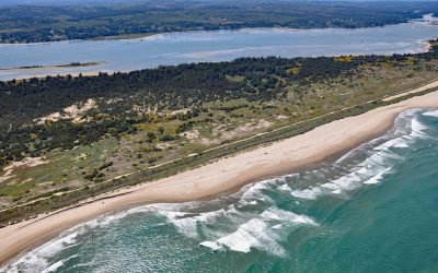
Camp Castaway, North Spit Coos Bay
Camp Castaway is a historical site on North Spit of Coos Bay, a sandy, vegetated peninsula separating the estuary of the Coos River from the Pacific Ocean, about 3.8 miles (6 km) west of North Bend and 1 mile (1.6 km) north of Charleston, Oregon.
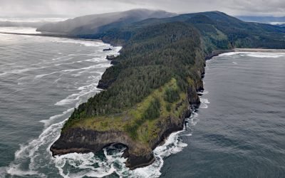
Cape Lookout, Cape Lookout State Park
Cape Lookout is a narrow basalt headland about 2 miles (3.2 km) long with vertical sea cliffs 800 feet (244 m) high in Cape Lookout State Park and the Siuslaw National Forest, about 26 miles (42 km) north of Lincoln City and 11 miles (18 km) southwest of Tillamook, Oregon.
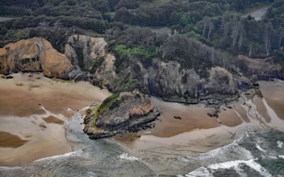
Hug Point, Arch Cape
Hug Point is a headland in Hug Point State Recreation Site on the northern Oregon coast, about 1 mile (1.6 km) north of the community of Arch Cape and 5 miles (8.0 km) south of Cannon Beach, Oregon.
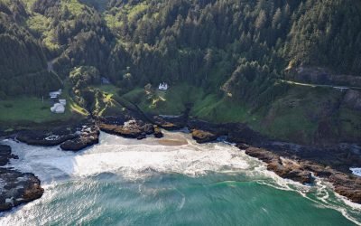
Cleft of the Rock Lighthouse, Cape Perpetua
Cleft of the Rock Light is a privately owned lighthouse located on Cape Perpetua, at the mouth of North Cape Creek, about 21 miles (34 km) north of Florence and 2 miles (3.2 km) south of Yachats, Oregon.
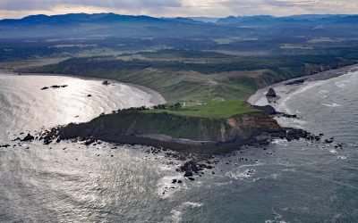
SS South Portland, Cape Blanco
SS South Portland is a historical shipwreck on Cape Blanco, a prominent headland that extends 1.5 miles (2.4 km) into the Pacific Ocean with cliffs 200 feet (61 m) high, about 205 miles (331 km) southwest of Portland and 7 miles (11 km) north-northwest of Port Orford, Oregon.
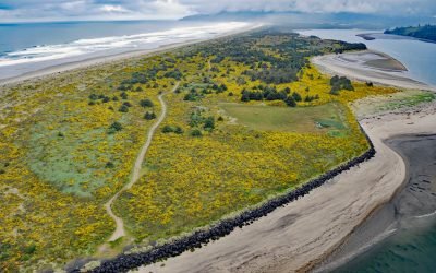
Nehalem Spit, Nehalem Bay State Park
Nehalem Bay is separated from the Pacific Ocean by an along shore dune called Nehalem Spit in Nehalem Bay State Park, about 15 miles (25 km) north-northwest of Tillamook and 3.8 miles (6 km) south of Manzanita, Oregon.
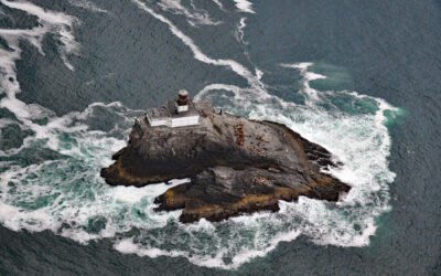
Tillamook Rock, Oregon Islands National Wildlife Refuge
Tillamook Rock is the site of a deactivated lighthouse located about 1.3 miles (2km) west of Tillamook Head in the Oregon Islands National Wildlife Refuge, about 20 miles (32 km) southwest of Astoria and 34 miles (39 km) north-northwest of Tillamook, Oregon.
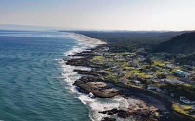
Yachats, Yachats River
Yachats is a small community at the mouth of the Yachats River on the central Oregon coast, about 54 miles (87 km) northwest of Eugene and 22 miles (35 km) south of Newport, Oregon.
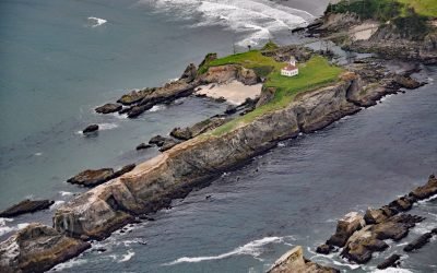
Chiefs Island, Cape Arago
Cape Arago Light is the third of a series of light towers built on Gregory Point and Chiefs Island just south of the entrance to Coos Bay, about 8 miles (13 km) west-southwest of Coos Bay and 3 miles (5 km) west of Charleston, Oregon.
About the background graphic
This ‘warming stripe’ graphic is a visual representation of the change in global temperature from 1850 (top) to 2019 (bottom). Each stripe represents the average global temperature for one year. The average temperature from 1971-2000 is set as the boundary between blue and red. The colour scale goes from -0.7°C to +0.7°C. The data are from the UK Met Office HadCRUT4.6 dataset.
Click here for more information about the #warmingstripes.