
Parks
Recent Articles
More Articles
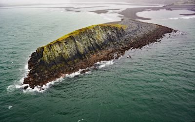
Ark Island, Aniakchak River
Ark Island is situated at the mouth of the Aniakchak River on the north shore of Aniakchak Bay and on the southeastern coast of the Alaska Peninsula, about 205 miles (330 km) southwest of Kodiak and 47 miles (75 km) northeast of Chignik, Alaska.
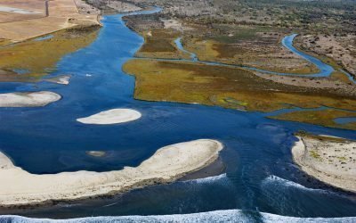
Tijuana River, Imperial Beach
Tijuana River drains a 1.1‑million‑acre (450,000 ha) watershed that originates in the Sierra de Juárez in northern Baja California and flows west‑northwest for 120 miles to the Pacific at the southern edge of Imperial Beach, about 11 miles south of San Diego and 5 miles northwest of Tijuana, Mexico.
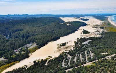
Umpqua River, Winchester Bay
Umpqua River flows generally west-northwest for 111 miles (179 km), draining a watershed of 2.4 million acres (1 million ha), from the Cascade Mountains through the Coast Range to Winchester Bay in the Oregon Dunes, about 20 miles (32 km) north of Coos Bay and 5.5 miles (9 km) southwest of Reedsport, Oregon.
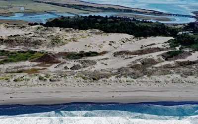
Ma-le’l Dunes, Humboldt Bay
Ma-le’l Dunes, a National Natural Landmark, lie between the Mad River Slough and the Pacific Ocean at the base of the Samoa Peninsula, which partially encloses the northern part of Humboldt Bay, about 1 mile (1.6 km) north of Manila and 3.5 miles (5.6 km) west of Arcata, California.
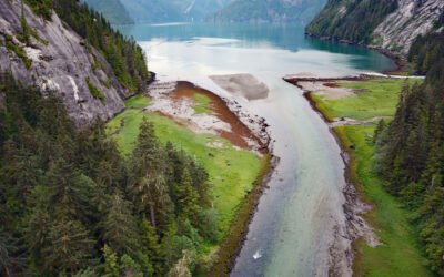
Brim River Hot Springs, Gardner Canal
Brim River Hot Springs and adjoining Owyacumish River Park protect 2,488 acres (1,007 ha) at the head of Owyacumish Bay on the north shore of Gardner Canal, about 96 miles (155 km) southwest of Prince Rupert and 40 miles (64 km) south-southwest of Kitimat, British Columbia.
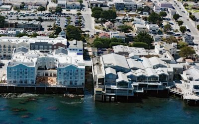
Pacific Biological Laboratories, Cannery Row
Pacific Biological Laboratories is a small, unpainted, two-story wood-frame building toward the northwest end of Cannery Row that served as a biological supply company operated by Edward F. Ricketts from 1937 to 1948, on a small property on Monterey Bay now sandwiched between the Monterey Bay Aquarium and the Intercontinental Hotel in Monterey, California.
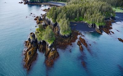
Yalik Point, Nuka Bay
Yalik Point is the site of a historical Alutiiq village in Nuka Bay on the outer coast of the Kenai Peninsula, in present-day Kenai Fjords National Park, about 61 miles (98 km) southwest of Seward and 47 miles (76 km) east of Nanwalek, Alaska.
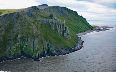
Cape Romanzof, Yukon-Kuskokwim Delta
Cape Romanzof is a massive headland at the western end of the Askinuk Mountains on the Bering Sea coast of Southwest Alaska in the Yukon-Kuskokwim Delta between Kokechik and Scammon Bays, about 161 miles (259 km) northwest of Bethel and 20 miles (32 km) north of Hooper Bay, Alaska.
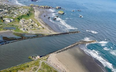
Coquille River, Bandon
Coquille River drains a mountainous watershed of about 6.8 million acres (2.7 million ha) with at least 26 named tributaries and flows for about 36 miles (58 km) from the confluence of the North Fork and South Fork to the Pacific Ocean at Bandon, about 26 miles (42 km) north of Port Orford and 20 miles (32 km) southwest of Coos Bay, Oregon.
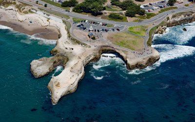
Lighthouse Point Park, Point Santa Cruz
Lighthouse Point Park is located on Point Santa Cruz, adjacent to Lighthouse Field State Beach at the northern boundary of Monterey Bay, about 25 miles (40 km) north-northwest of Monterey and in Santa Cruz, California.
About the background graphic
This ‘warming stripe’ graphic is a visual representation of the change in global temperature from 1850 (top) to 2019 (bottom). Each stripe represents the average global temperature for one year. The average temperature from 1971-2000 is set as the boundary between blue and red. The colour scale goes from -0.7°C to +0.7°C. The data are from the UK Met Office HadCRUT4.6 dataset.
Click here for more information about the #warmingstripes.