
Parks
Recent Articles
More Articles
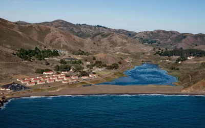
Fort Cronkhite, Marin Headlands
Fort Cronkhite, on the Marin Headlands, is a historic US Army facility that supported Battery Townsley, part of San Francisco Bay’s coastal artillery during World War II, about 8 miles southwest of Stinson Beach and 8 miles west-northwest of San Francisco, California.
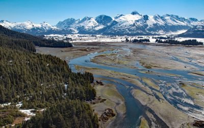
Coghill River, Dartmouth Glacier
The Coghill River in Chugach National Forest flows southwest for 5 miles (8 km) from the terminus of Dartmouth Glacier to Coghill Lake, which is 4.7 miles (7.5 km) long, and then runs west-southwest for 3 miles (4.8 km) to College Fjord near Coghill Point, about 54 miles (87 km) west of Valdez and 32 miles (51 km) northeast of Whittier, Alaska.
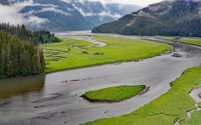
Gilttoyees Creek, Foch-Gilttoyees Provincial Park
Gilttoyees Creek originates in a series of cirque basins on the east and south flanks of Tentacle Peak in the Kitimat Ranges, and flows generally southeast for about 20 miles (32 km) through Foch-Gilttoyees Provincial Park and Protected Area before reaching Gilttoyees Inlet, which opens onto Douglas Channel, about 60 miles (97 km) southeast of Prince Rupert and 20 miles (32 km) southwest of Kitimat, British Columbia.
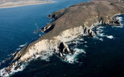
Tomales Point, Point Reyes National Seashore
Tomales Bluff is a headland forming the northern tip of Tomales Point in Point Reyes National Seashore National Seashore, about 45 miles (72 km) northwest of San Francisco and 7 miles (11 km) south-southeast of Bodega Bay, California.
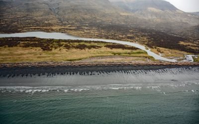
Kanatak, Portage Bay
Kanatak is an uninhabited Alutiiq community of the Native Tribe of Kanatak located at the head of Portage Bay, on the Pacific coast of the Alaska Peninsula, about 136 miles (219 km) west-southwest of Kodiak and 65 miles (105 km) southeast of Egegik, Alaska.
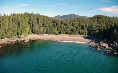
Clo-oose, Cheewhat River
Clo-oose is the site of an abandoned village of the Ditidaht First Nation on the southwest coast of Vancouver Island, above a beach 0.25 miles (0.4 km) west of the Cheewhat River mouth, about 20 miles (32 km) west-northwest of Port Renfrew and 19 miles (31 km) southeast of Bamfield, British Columbia.
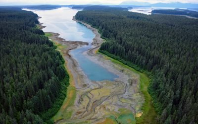
Hutchins Bay, Beardslee Islands
Hutchins Bay is on the eastern shore of Glacier Bay, partially surrounding the Beardslee Islands in Glacier Bay National Park and Preserve, about 155 miles (249 km) southeast of Yakutat and 8 miles (13 km) north of Gustavus, Alaska.
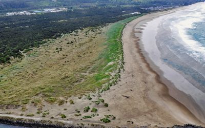
South Beach, Yaquina Bay South Jetty
South Beach is a state park south of the jetty protecting the mouth of Yaquina Bay and extending for 1 mile (1.6 km) along the Pacific coast, about 12 miles (19 km) north of Waldport and 2 miles (3.2 km) south-southwest of Newport, Oregon.
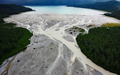
Geikie Inlet, Glacier Bay
Geikie Inlet is a fjord about 8 miles (13 km) long that trends generally northeast from the mouth of the Geikie River to the western coast of Glacier Bay, in Glacier Bay National Park and Preserve, about 130 miles (209 km) southeast of Yakutat and 32 miles (51 km) northwest of Gustavus, Alaska.
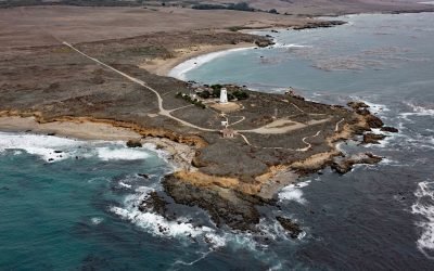
Point Piedras Blancas, San Simeon
Point Piedras Blancas is a prominent headland and the site of a historic light station within the California Coastal National Monument, and surrounded by the Hearst San Simeon State Park, about 73 miles (117 km) south-southeast of Monterey and 6 miles (10 km) west-northwest of San Simeon, California.
About the background graphic
This ‘warming stripe’ graphic is a visual representation of the change in global temperature from 1850 (top) to 2019 (bottom). Each stripe represents the average global temperature for one year. The average temperature from 1971-2000 is set as the boundary between blue and red. The colour scale goes from -0.7°C to +0.7°C. The data are from the UK Met Office HadCRUT4.6 dataset.
Click here for more information about the #warmingstripes.