
Parks
Recent Articles
More Articles
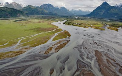
West Glacier Creek, Chinitna Bay
West Glacier Creek flows generally south-southeast for about 7 miles (11 km) to the north shore of Chinitna Bay, draining a watershed between the Chigmit Mountains and Mount Iliamna, about 83 miles (134 km) southwest of Kenai and 60 miles (97 km) west-northwest of Homer, Alaska.
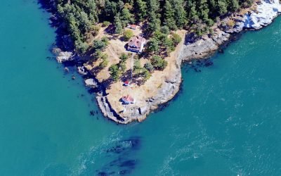
Turn Point, Boundary Pass
Turn Point is a headland with a historic light station on the northwest coast of Stuart Island overlooking Haro Strait to the west and Boundary Pass to the north, located on property that is part of the San Juan Islands National Monument, about 34 miles (55 km) west of Bellingham and 15 miles (24 km) northwest of Friday Harbor, Washington.
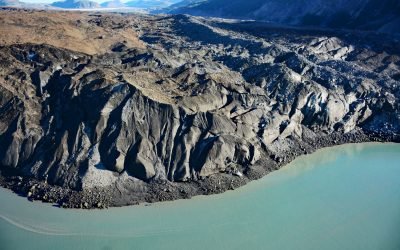
Grand Pacific Glacier, Tarr Inlet
Grand Pacific Glacier flows from elevations between 4,925-9,845 feet (1500–3000 m) on the British Columbia-Alaska boundary to Tarr Inlet in Glacier Bay National Park and Preserve, about 100 miles (161 km) southeast of Yakutat and 66 miles (106 km) north-northwest of Gustavus, Alaska.
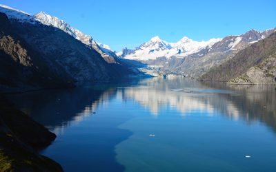
Johns Hopkins Inlet, Glacier Bay National Park and Preserve
Johns Hopkins Inlet is a fjord in Glacier Bay National Park and Preserve that starts at the terminus of the Johns Hopkins Glacier and extends for about 10 miles (16 km) to the head of Glacier Bay, about 106 miles (171 km) southeast of Yakutat and 58 miles (93 km) northwest of Gustavus, Alaska.
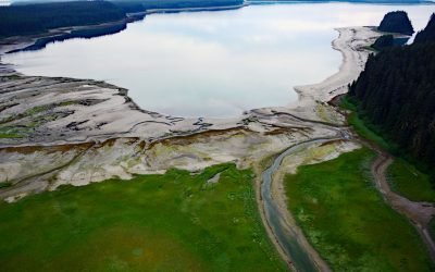
Beartrack Cove, Glacier Bay National Park and Preserve
Beartrack Cove is an estuary about 3 miles (4.8 km) long and 1.6 miles (2.6 km) wide situated at the mouth of the Beartrack River in Glacier Bay National Park and Preserve, about 46 miles (74 km) south-southwest of Haines and 14 miles (23 km) north-northwest of Gustavus, Alaska.
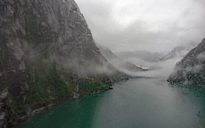
Fords Terror, Endicott Arm
Fords Terror is a fjord in the Coast Mountains of Southeast Alaska that trends generally south for 8 miles (13 km) to Endicott Arm, about 64 miles (103 km) southeast of Juneau and 57 miles (92 km) north-northwest of Petersburg, Alaska.
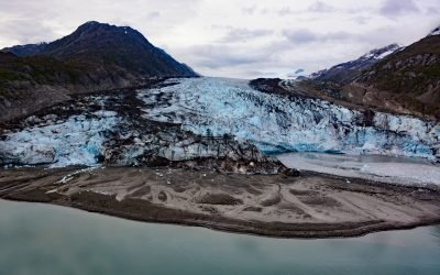
Lamplugh Glacier, Glacier Bay National Park and Preserve
Lamplugh Glacier is situated on the western shore of Glacier Bay at the entrance to Johns Hopkins Inlet in Glacier Bay National Park and Preserve, about 109 miles (175 km) southeast of Yakutat and 55 miles (89 km) northwest of Gustavus, Alaska.
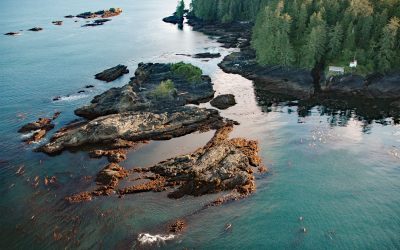
Cerantes Rocks, San Juan Point
Cerantes Rocks is a group of reefs and one large islet situated off of San Juan Point, a rocky headland forming the eastern entrance to Port San Juan on Vancouver Island, about 51 miles (82 km) west-northwest of Victoria and 2.4 miles (4 km) southwest of Port Renfrew, British Columbia.
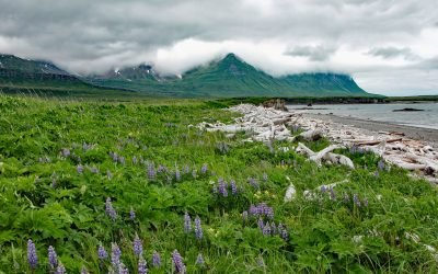
Sukoi Bay, Cape Douglas
Sukoi Bay is situated at Cape Douglas on the western shore of Shelikof Strait, in Katmai National Park and Preserve, about 121 miles (195 km) east of King Salmon and 83 miles (134 km) southwest of Homer, Alaska.
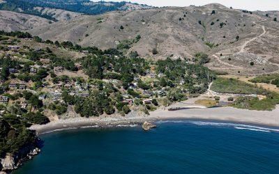
Muir Beach, Marin Peninsula
Muir Beach is a small community situated on the west coast of the Marin Peninsula overlooking the Pacific Ocean, with the adjacent sand beach in the Golden Gate National Recreation Area, about 11 miles (18 km) northwest of San Francisco and 5 miles (8 km) southeast of Stinson Beach, California.
About the background graphic
This ‘warming stripe’ graphic is a visual representation of the change in global temperature from 1850 (top) to 2019 (bottom). Each stripe represents the average global temperature for one year. The average temperature from 1971-2000 is set as the boundary between blue and red. The colour scale goes from -0.7°C to +0.7°C. The data are from the UK Met Office HadCRUT4.6 dataset.
Click here for more information about the #warmingstripes.