
Parks
Recent Articles
More Articles
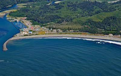
La Push, Quillayute River
La Push is the traditional community of the Quileute people situated at the mouth of the Quillayute River within the Quileute Indian Reservation and surrounded by the coastal strip of Olympic National Park, about 32 miles (51 km) south of Neah Bay and 12 miles (19 km) west-southwest of Forks, Washington.
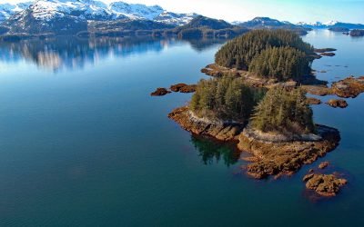
New Year Islands, Knight Island Passage
New Year Islands are at the mouth of Drier Bay in Knight Island Passage on the west coast of Knight Island in Prince William Sound, about 55 miles (89 km) east-northeast of Seward and 41 miles (66 km) southeast of Whittier, Alaska.
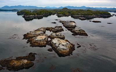
Prager Islands, Hecate Strait
Prager Islands is a group of islands, islets, and tidal reefs in Hecate Strait, situated between Dolphin Island to the east and Goschen Island to the northwest, which are part of the Gitxaala Nii Luutiksm Conservancy within the Great Bear Rainforest, about 39 miles (63 km) south-southwest of Prince Rupert and 4 miles (6.4 km) west-southwest of Kitkatla, British Columbia.
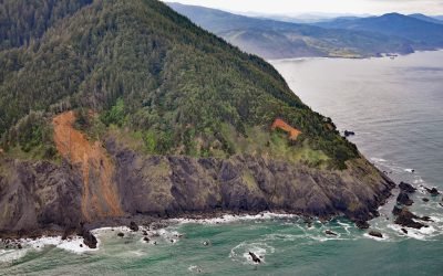
Humbug Mountain, Port Orford
Humbug Mountain rises 1,758 feet (536 m) from sea level on the southern coast of Oregon and lies entirely within Humbug Mountain State Park, about 21 miles (34 km) north of Gold Beach and 6 miles (10 km) south of Port Orford, Oregon.
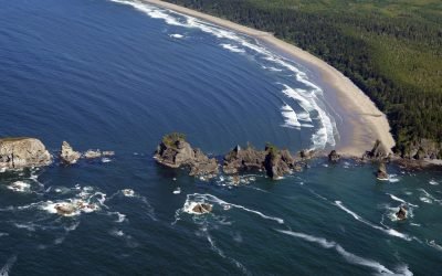
Point of Arches, Olympic National Park
Point of Arches and the adjacent Shi Shi Beach represent a unique section of shoreline located at the edge of the Olympic National Park.
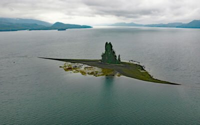
New Eddystone Rock, Behm Canal
The New Eddystone Rock is a pillar of basalt 237 feet (72 m) high, situated in Misty Fjords National Monument and in the eastern arm of Behm Canal, about 87 miles (140 km) north-northwest of Prince Rupert and 32 miles (52 km) northeast of Ketchikan, Alaska.
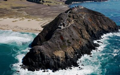
Point Sur Light Station, Big Sur
Point Sur Light Station is situated on a prominent volcanic rock just offshore from the Big Sur coast, and connected to the mainland by a sandy tombolo, about 60 miles (97 km) northwest of San Simeon and 20 miles (32 km) south of Monterey, California.
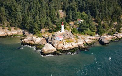
Point Atkinson Lighthouse, Burrard Inlet
Lighthouse Park was historically called Point Atkinson, a headland that together with Point Grey to the south, defines the entrance to Burrard Inlet, a fjord incising the lower mainland of British Columbia, about 33 miles (53 km) northeast of Nanaimo and 8 miles (13 km) northwest of downtown Vancouver, British Columbia.

Rudyerd Bay, Misty Fjords National Monument
Rudyerd Bay is a deglaciated fjord in the Coast Range of Southeast Alaska in Misty Fjords National Monument, about 89 miles (143 km) north-northwest of Prince Rupert and 39 miles (63 km) northeast of Ketchikan, Alaska.
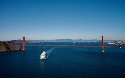
The Golden Gate, San Francisco Bay
The Golden Gate is a turbulent strait about 1 mile (1.6 km) wide, between Lime Point to the north and Fort Point to the south, that connects San Francisco Bay to the Pacific Ocean, about 4 miles (6.4 km) west-northwest of downtown San Francisco and 2.2 miles (3.5 km) south of Sausalito, California.
About the background graphic
This ‘warming stripe’ graphic is a visual representation of the change in global temperature from 1850 (top) to 2019 (bottom). Each stripe represents the average global temperature for one year. The average temperature from 1971-2000 is set as the boundary between blue and red. The colour scale goes from -0.7°C to +0.7°C. The data are from the UK Met Office HadCRUT4.6 dataset.
Click here for more information about the #warmingstripes.