
Parks
Recent Articles
More Articles
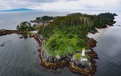
Lucy Islands, Chatham Sound
Lucy Islands is a small group of islets and reefs situated 26 miles (42 km) south of the Alaska border at the intersection of Brown Passage and Chatham Sound, about 83 miles (134 km) southeast of Ketchikan and 12 miles (19 km) west of Prince Rupert, British Columbia.
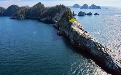
Chiswell Islands, Kenai Fjords
Chiswell Islands are a group of rocky uninhabited islands In the Alaska Maritime National Wildlife Refuge situated at the entrance to Aialik Bay on the south coast of Kenai Fjords National Park, about 67 miles (108 km) east of Homer and 35 miles (56 km) south of Seward, Alaska.
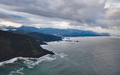
Tillamook Head, Ecola State Park
Tillamook Head is a steep rocky promontory with an elevation of approximately 1,200 feet (366 m), located in Ecola State Park, about 5 miles (8 km) southwest of Seaside and 4 miles (6.4 km) north-northwest of Cannon Beach, Oregon.
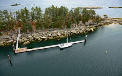
Kendrick Island, Wakes Cove Provincial Park
Kendrick Island is surrounded by Wakes Cove Provincial Park near the eastern entrance to Gabriola Passage, 0.1 miles (0.2 km) off the northeast coast of Valdes Island, about 28 miles (45 km) southwest of Vancouver and 12 miles (19 km) east-southeast of Nanaimo, British Columbia.

Taz Basin, Granite Island
Taz Basin is a small cove on the west coast of Granite Island, one of the Chiswell Islands on the south coast of Kenai Fjords National Park, about 61 miles (98 km) east of Homer and 34 miles (55 km) south-southwest of Seward, Alaska.
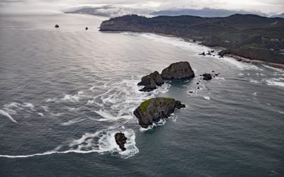
Three Arch Rocks, Oceanside
Three Arch Rocks are massive arched basalt sea stacks located south of Cape Meares and 0.5 miles (0.9 km) offshore from Maxwell Point at the community of Oceanside, about 8 miles (13 km) south-southwest of Garibaldi and 2.7 miles (4 km) northwest of Netarts, Oregon.
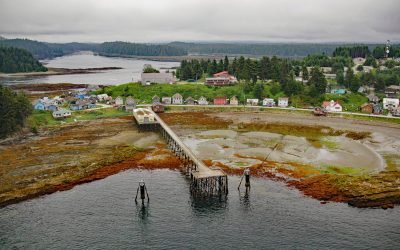
Angoon, Kootznahoo Inlet
Angoon is a historic Tlingit village located on an isthmus at the mouth of Kootznahoo Inlet on the eastern shore of Chatham Strait and the west coast of Admiralty Island, about 77 miles (124 km) northwest of Petersburg and 60 miles (97 km) southwest of Juneau, Alaska.
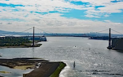
Lions Gate Bridge, Burrard Inlet
Lions Gate Bridge spans Burrard Inlet at the First Narrows, a strait about 1,312 feet (400 m) wide between Prospect Point in Stanley Park to the south and the sandy shoals of the Capilano River mouth to the north, about 2 miles (3.2 km) southeast of West Vancouver and 2 miles (3.2 km) northwest of downtown Vancouver, British Columbia.
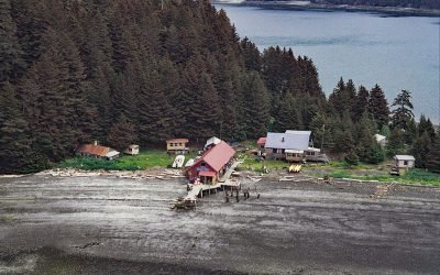
Hogg Island, Bluefox Bay
Hogg Island is the site of a historical fox farm and herring reduction plant situated in Bluefox Bay on Shelikof Strait and the northwest coast of Afognak Island, about 91 miles (147 km) southwest of Homer and 47 miles (76 km) north-northwest of Kodiak, Alaska.
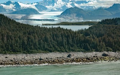
Grand Plateau Glacier, Fairweather Range
Grand Plateau Glacier starts on the north flank of Mount Fairweather in the Fairweather Range of the Saint Elias Mountains and flows generally northwest for 19 miles (31 km) where it splits into two terminal lobes, with the southern lobe flowing 6 miles (10 km) to Grand Plateau Lake, about 142 miles (229 km) northwest of Juneau and 70 miles (113 km) southeast of Yakutat, Alaska.
About the background graphic
This ‘warming stripe’ graphic is a visual representation of the change in global temperature from 1850 (top) to 2019 (bottom). Each stripe represents the average global temperature for one year. The average temperature from 1971-2000 is set as the boundary between blue and red. The colour scale goes from -0.7°C to +0.7°C. The data are from the UK Met Office HadCRUT4.6 dataset.
Click here for more information about the #warmingstripes.