
Parks
Recent Articles
More Articles
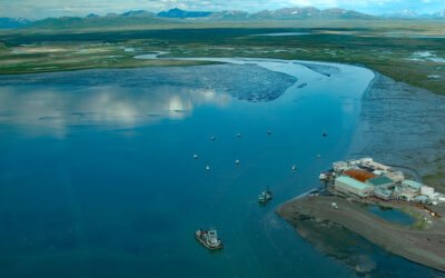
Togiak River, Bristol Bay
Togiak River starts at Togiak Lake and flows southwest for 37 miles (60 km) to a wetland marsh about 4 miles (6 km) wide where the river channel splits, with the east channel flowing past the village of Twin Hills to Togiak Bay, and the main channel flowing 11 miles (18 km) to Togiak Bay near the village of Togiak on Bristol Bay, about 129 miles (208 km) southeast of Bethel and 66 miles (106 km) west of Dillingham, Alaska.
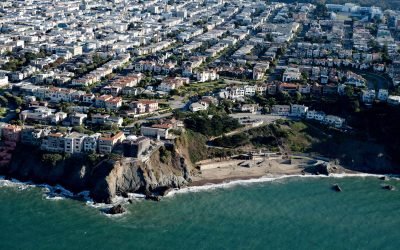
China Beach, San Francisco
China Beach is a small sandy cove on the South Bay of the Golden Gate tucked between Lands End and Baker Beach, once used as a campsite by Chinese fishermen, about 7 miles (11 km) north of Daly City and 5 miles (8 km) west of downtown San Francisco, California.
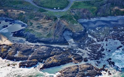
Strawberry Hill, Neptune State Park
Strawberry Hill is part of Neptune State Park, situated between Nancy Creek and Bob Creek, about 19 miles (31 km) north of Florence and 5 miles (8 km) south of Yachats, Oregon.
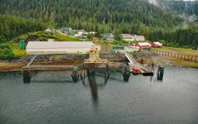
Greens Creek Mine, Hawk Inlet
Greens Creek Mine is the fifth-largest silver producer in the world, located on the eastern shore of Hawk Inlet on Admiralty Island, about 77 miles (124 km) north-northeast of Sitka and 18 miles (29 km) southwest of Juneau, Alaska.
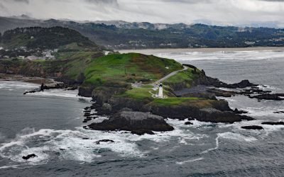
Yaquina Head, Agate Beach
Yaquina Head is a prominent basalt headland, adjacent to the community of Agate Beach, rising over 100 feet (30 m) in elevation and extending 0.75 miles (1.2 km) into the Pacific Ocean, about 9 miles (15 km) south of Depoe Bay and 3 miles (5 km) north-northwest of Newport, Oregon.
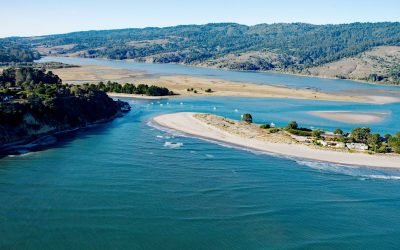
Bolinas Lagoon, Bolinas Bay
Bolinas Lagoon is a tidal estuary situated between the communities of Bolinas to the west and Stinson Beach to the east, about 35 miles (56 km) south-southeast of Bodega Bay and 17 miles (27 km) northwest of San Francisco, California.
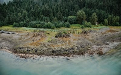
Taku Cannery, Taku Harbor
Taku Harbor is a historical community and the site of an abandoned cannery in a small embayment on the eastern shore of Stephens Passage near Taku Inlet, about 86 miles (138 km) northeast of Sitka and 22 miles (35 km) southeast of Juneau, Alaska. Read more here: https://coastview.org/2024/08/28/taku-cannery-taku-harbor/
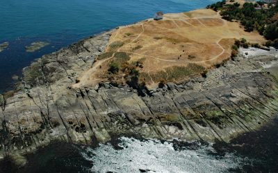
East Point, Saturna Island
East Point is the end of a long peninsula at the easternmost tip of Saturna Island in the Gulf Islands National Park Reserve, about 35 miles (56 km) south of Vancouver and 18 miles (29 km) northeast of Sidney, British Columbia.
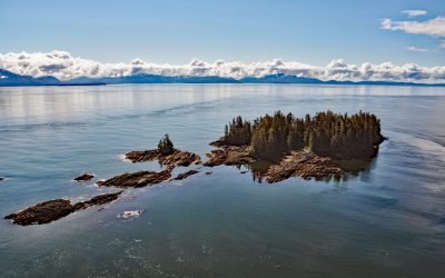
Beauclerc Island, Sumner Strait
Beauclerc Island is in Sumner Strait, at the entrance to Port Beauclerc on Kuiu Island, in the Alexander Archipelago of Southeast Alaska, about 80 miles (129 km) southeast of Sitka and 11 miles (18 km) southwest of Point Baker, Alaska.
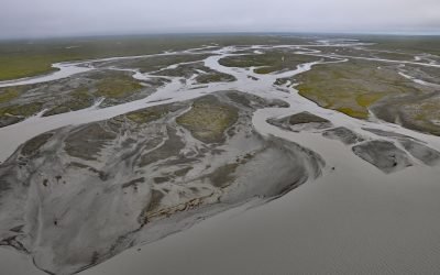
Jago River, Arctic National Wildlife Refuge
Jago River starts at an unnamed glacier on the continental divide of the Romanzof Mountains in the Brooks Range and flows north for about 90 miles (145 km) through the Arctic National Wildlife Refuge to Jago Lagoon, about 88 miles (142 km) east-northeast of Deadhorse and 7 miles (11 km) east-southeast of Kaktovik, Alaska.
About the background graphic
This ‘warming stripe’ graphic is a visual representation of the change in global temperature from 1850 (top) to 2019 (bottom). Each stripe represents the average global temperature for one year. The average temperature from 1971-2000 is set as the boundary between blue and red. The colour scale goes from -0.7°C to +0.7°C. The data are from the UK Met Office HadCRUT4.6 dataset.
Click here for more information about the #warmingstripes.