
Parks
Recent Articles
More Articles
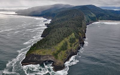
Cape Lookout, Cape Lookout State Park
Cape Lookout is a narrow basalt headland about 2 miles (3.2 km) long with vertical sea cliffs 800 feet (244 m) high in Cape Lookout State Park and the Siuslaw National Forest, about 26 miles (42 km) north of Lincoln City and 11 miles (18 km) southwest of Tillamook, Oregon.
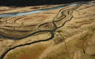
King Slough, Stikine River
King Slough is a water passage between Farm Island and Dry Island in the Stikine River delta, about 22 miles (36 km) southeast of Petersburg and 11 miles (18 km) north-northwest of Wrangell, Alaska.
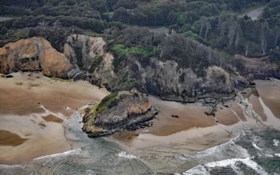
Hug Point, Arch Cape
Hug Point is a headland in Hug Point State Recreation Site on the northern Oregon coast, about 1 mile (1.6 km) north of the community of Arch Cape and 5 miles (8.0 km) south of Cannon Beach, Oregon.
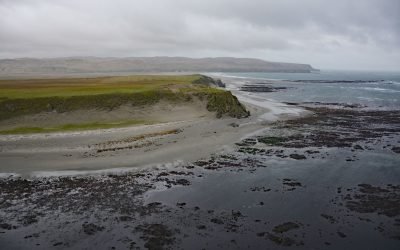
Chirikof Island, Kodiak Archipelago
Chirikof Island is about 33,000 acres (13,000 ha) and part of the Kodiak Island Archipelago located in the western Gulf of Alaska, about 180 miles (290 km) southwest of Kodiak and 137 miles (221 km) east of Perryville, Alaska.
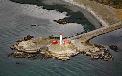
Fisgard Island, Esquimalt Harbour
Fisgard Island Light Station is located in Royal Roads off the southern shore of Vancouver Island at the entrance to Esquimalt Harbour, about 3.6 miles (5.8 km) west of Victoria and in the community of Colwood, British Columbia.
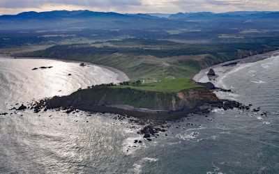
SS South Portland, Cape Blanco
SS South Portland is a historical shipwreck on Cape Blanco, a prominent headland that extends 1.5 miles (2.4 km) into the Pacific Ocean with cliffs 200 feet (61 m) high, about 205 miles (331 km) southwest of Portland and 7 miles (11 km) north-northwest of Port Orford, Oregon.
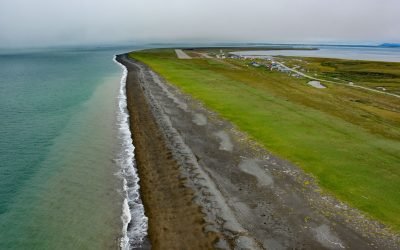
Platinum, Goodnews Bay
Platinum is a mining community located on the Smalls River at the base of South Spit in Goodnews Bay, about 123 miles (198 km) south of Bethel and 11 miles (18 km) southwest of the village of Goodnews, Alaska.
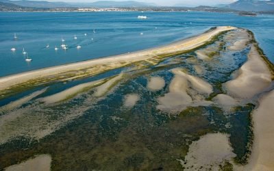
Sidney Spit, Sidney Island
Sidney Island is one of the southern Gulf Islands located in Haro Strait, about 45 miles (73 km) south-southwest of Vancouver and 2.8 miles (4.5 km) east of Sidney, British Columbia.
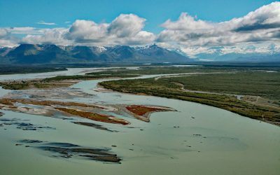
Alsek River, Dry Bay
Alsek River flows into the Gulf of Alaska at Dry Bay, close to the northern boundary of Glacier Bay National Park and Preserve, about 162 miles (261 km) northwest of Juneau and 50 miles (81 km) southeast of Yakutat, Alaska.
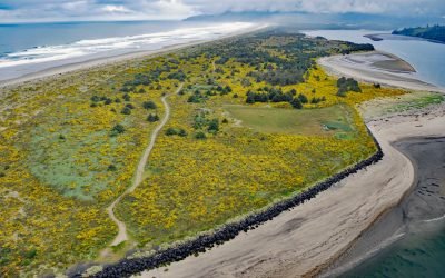
Nehalem Spit, Nehalem Bay State Park
Nehalem Bay is separated from the Pacific Ocean by an along shore dune called Nehalem Spit in Nehalem Bay State Park, about 15 miles (25 km) north-northwest of Tillamook and 3.8 miles (6 km) south of Manzanita, Oregon.
About the background graphic
This ‘warming stripe’ graphic is a visual representation of the change in global temperature from 1850 (top) to 2019 (bottom). Each stripe represents the average global temperature for one year. The average temperature from 1971-2000 is set as the boundary between blue and red. The colour scale goes from -0.7°C to +0.7°C. The data are from the UK Met Office HadCRUT4.6 dataset.
Click here for more information about the #warmingstripes.