
Parks
Recent Articles
More Articles

McNeil River, Kamishak Bay
McNeil River starts from glaciers and alpine lakes in the Aleutian Range of the Alaska Peninsula and flows generally northeast for 35 miles (56 km) to McNeil Cove in Kamishak Bay, 103 miles (166 km) southwest of Homer and 101 miles (163 km) northwest of Kodiak, Alaska.
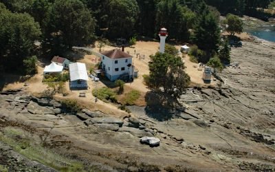
Active Pass, Gulf Islands
Active Pass is a narrow strait about 3.4 miles (5.5 km) long separating Mayne Island from Galiano Island in the southern Gulf Islands, about 16.4 miles (26.5 km) north-northeast of Sidney and 12.5 miles (20 km) southwest of Tsawwassen, British Columbia.
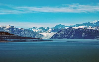
Icy Bay, Wrangell-Saint Elias National Park and Preserve
Icy Bay is on the Gulf of Alaska coast in Wrangell-Saint Elias National Park and Preserve, about 154 miles (248 km) southeast of Cordova and 65 miles (105 km) northwest of Yakutat, Alaska.
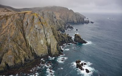
Aghiyuk, Semidi Islands
The Semidi Islands are a group of rocks, reefs, and islands lying off the coast of the Alaska Peninsula in the Gulf of Alaska, about 92 miles (148 km) east-northeast of Perryville, and 61 miles (98 km) east of Chignik, Alaska.
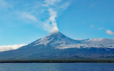
Mount Shishaldin, Unimak Island
Mount Shishaldin is a volcano on Unimak Island that rises over 9,000 feet (2,800 m) directly from the Pacific Ocean and is the highest of several volcanos on the island, about 120 miles (194 km) northeast of Dutch Harbor and 24 miles (39 km) west-southwest of False Pass, Alaska.
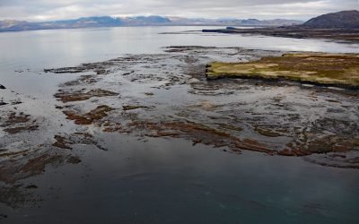
Aniakchak Bay, Aniakchak National Monument and Preserve
Aniakchak Bay is on the Pacific coast of Aniakchak National Monument and Preserve that surrounds Mount Aniakchak, a caldera in the Aleutian Range, about 200 miles (323 km) southwest of Kodiak and 50 miles (81 km) northeast of Chignik, Alaska.
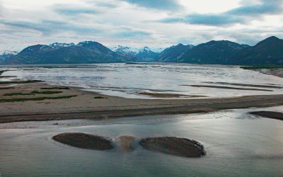
Katmai Bay, Katmai National Park and Preserve
Katmai Bay is about 9 miles (14.5 km) across, located at the mouth of the Katmai River on the Shelikof Strait coast of the Alaska Peninsula in Katmai National Park and Preserve, about 93 miles (150 km) west-northwest of Kodiak and 77 miles (124 km) southeast of King Salmon, Alaska.
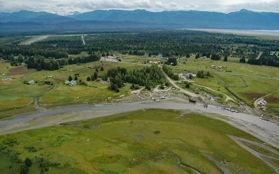
Gustavus, Icy Strait
Gustavus is a community on the north shore of Icy Strait, at the mouth of the Salmon River and across from Pleasant Island, about 48 miles (77 km) west-northwest of Juneau, and 28 miles (45 km) northeast of Elfin Cove, Alaska.
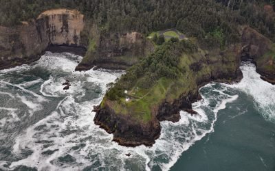
Cape Meares Lighthouse, Cape Meares
Cape Meares is the site of a historic lighthouse on a prominent headland that forms a high steep bluff on the south end of Tillamook Bay, about 48 miles (77 km) south of Astoria and 7 miles (11 km) west-northwest of Tillamook, Oregon.
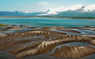
Hallo Bay, Katmai National Park and Preserve
Hallo Bay is a bight in Shelikof Strait on the south coast of the Alaska Peninsula in Katmai National Park and Preserve, about 122 miles (197 km) southwest of Homer and 76 miles (123 km) northwest of Kodiak, Alaska.
About the background graphic
This ‘warming stripe’ graphic is a visual representation of the change in global temperature from 1850 (top) to 2019 (bottom). Each stripe represents the average global temperature for one year. The average temperature from 1971-2000 is set as the boundary between blue and red. The colour scale goes from -0.7°C to +0.7°C. The data are from the UK Met Office HadCRUT4.6 dataset.
Click here for more information about the #warmingstripes.