
Parks
Recent Articles
More Articles
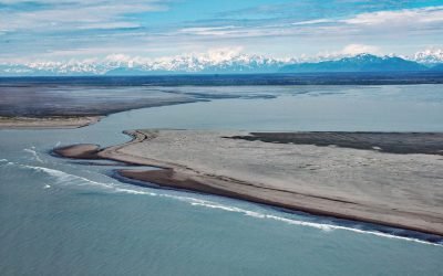
Dangerous River, Brabazon Mountains
Dangerous River starts at Harlequin Lake in the Brabazon Mountains of the Fairweather Range and flows southwest for 16 miles (26 km) to the Gulf of Alaska, about 102 miles (165 km) northwest of Gustavus and 50 miles (81 km) southeast of Yakutat, Alaska.
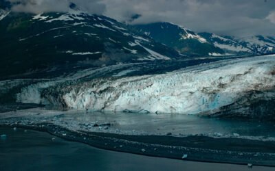
Turner Glacier, Disenchantment Bay
Turner Glacier starts at an elevation of roughly 11,000 feet (3,353 m) on the eastern flank of Mount Cook in the Saint Elias Mountains and flows generally southeast for 21 miles (34 km) to Disenchantment Bay at the head of Yakutat Bay, about 214 miles (344 km) east-southeast of Cordova and 33 miles (53 km) north of Yakutat, Alaska.

Cape Spencer, Cross Sound
Cape Spencer is a prominent headland in Glacier Bay National Park and Preserve marking the northern entrance to Cross Sound adjacent to an area with numerous offshore islets, rocks, and islands, one of which, near the entrance to Dicks Arm, is the site of a historic lighthouse, about 45 miles (73 km) northwest of Hoonah and 37 miles (60 km) southwest of Gustavus, Alaska.

Cape Disappointment, Columbia River
Cape Disappointment is a prominent headland and navigational landmark with a historic lighthouse on the north side of the Columbia River, 12 miles (19 km) northwest of Astoria, and 2.2 miles (3.5 km) south of Ilwaco, Washington.

Teahwhit Head, La Push
Teahwhit Head is a rocky headland with a natural sea arch and the site of a historical shipwreck on the coast of Olympic National Park in the Olympic Coast National Marine Sanctuary, about 12 miles (19 km) southwest of Forks and 2.8 miles (4.5 km) south-southeast of La Push, Washington.

Sudden Stream, Malaspina Coastal Plain
Sudden Stream drains the Malaspina Coastal Plain, flowing generally south for 2 miles (3.2 km) from the outlet of Malaspina Lake, a proglacial lake at the terminus of the Malaspina Glacier, to a lagoon formed by a barrier spit called Schooner Beach on Yakutat Bay, about 207 miles (333 km) east-southeast of Cordova and 18 miles (29 km) northwest of Yakutat, Alaska.
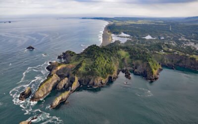
Nellies Cove, The Heads
Nellies Cove is situated on the south side of a rocky headland known as The Heads, between Agate Beach to the north and Port Orford to the south, and is the site of a historic lifeboat station in Port Orford Heads State Park, about 23 miles (37 km) north of Gold Beach and 1 mile (1.6 km) southwest of Port Orford, Oregon.

Blake Island, Puget Sound
Blake Island is a Washington State Marine Park in Puget Sound situated between Bainbridge Island to the north and Vashon Island to the south, about 8 miles (13 km) southwest of downtown Seattle and 7 miles (11 km) east of Port Orchard, Washington.

Green Island, Chatham Sound
Green Island is part of the Dundas Island Archipelago situated on the west side of Chatham Sound and is the site of a historic lighthouse, about 65 miles (105 km) south-southeast of Ketchikan and 24 miles (39 km) northwest of Prince Rupert, British Columbia.

Nuka River, Beauty Bay
Nuka River starts from Bradley Pass in the Kenai Mountains at an elevation of roughly 1400 feet (427 m) and flows generally south for 10 miles (16 km), draining a watershed of 34,503 acres (13,963 ha), to Beauty Bay between Storm Mountain to the north and Mount Diablo to the south in West Arm Nuka Bay, about 57 miles (92 km) southwest of Seward and 32 miles (52 km) east-southeast of Homer, Alaska.
About the background graphic
This ‘warming stripe’ graphic is a visual representation of the change in global temperature from 1850 (top) to 2019 (bottom). Each stripe represents the average global temperature for one year. The average temperature from 1971-2000 is set as the boundary between blue and red. The colour scale goes from -0.7°C to +0.7°C. The data are from the UK Met Office HadCRUT4.6 dataset.
Click here for more information about the #warmingstripes.