
Parks
Recent Articles
More Articles
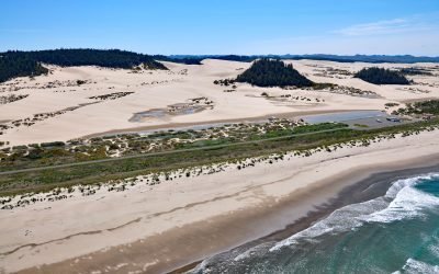
Umpqua Beach, Oregon Dunes National Recreation Area
Umpqua Beach is an off-highway vehicle staging area south of the Umpqua River mouth in the Oregon Dunes National Recreation Area that extends for about 35 miles (56 km) along the coast from the Siuslaw River at Florence in the north to the Coos River at North Bend, Oregon.
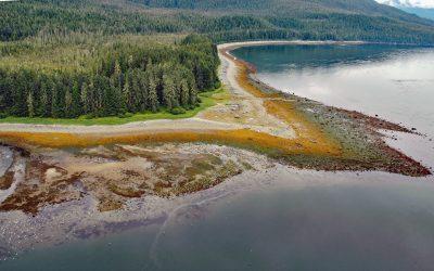
Sumdum, Endicott Arm
Sumdum is a historical Tlingit village of the S’awdaan Kwáan located north of Powers Creek at the northern end of Endicott Arm where it meets Holkham Bay in Tracy Arm-Fords Terror Wilderness, about 70 miles (113 km) north-northwest of Petersburg and 49 miles (79 km) southeast of Juneau, Alaska.
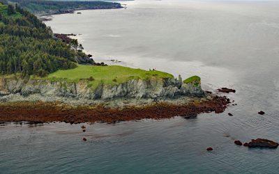
Point Pogibshi, Kachemak Bay
Point Pogibshi is a prominent flat-topped grassy headland with rocky sides about 50 feet (15 m) high on the southern shore of Kachemak Bay, about 20 miles (23 km) southwest of Homer, and 5 miles (8 km) north-northeast of Nanwalek, Alaska.
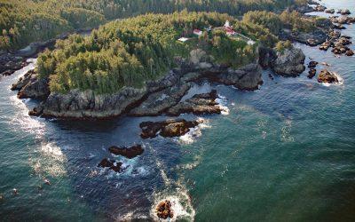
Cape Beale, Barkley Sound
Cape Beale is the site of a historic lighthouse marking the southern entrance to Barkley Sound on the west coast of Vancouver Island in Pacific Rim National Park Reserve, about 89 miles (143 km) west-northwest of Victoria and 4.7 miles (7.6 km) southwest of Bamfield, British Columbia.

Hubbard Glacier, Disenchantment Bay
Hubbard Glacier originates from icefields at an elevation of around 11,000 feet (3,400 m) in the Centennial Range of the Saint Elias Mountains in Kluane National Park and Reserve and flows about 48 miles (77 km) to the Alaska border and then continues for another 28 miles (45 km) through Wrangell-Saint Elias National Park to its terminus in Disenchantment Bay, about 220 miles (355 km) east-southeast of Cordova and 32 miles (52 km) north-northeast of Yakutat, Alaska.
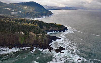
Cape Falcon, Oswald West State Park
Cape Falcon is a headland situated between Short Sand Beach in Smugglers Cove to the south and Cove Beach to the north, and is part of Oswald West State Park and adjacent to Cape Falcon Marine Reserve, about 23 miles (37 km) north-northwest of Tillamook and 9 miles (14.5 km) south of Cannon Beach, Oregon.
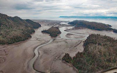
China Poot Creek, Kachemak Bay
China Poot Creek starts at an elevation of about 3,500 feet (1,067 m) on the western flank of the Kenai Mountains and flows for 5.6 miles (9 km) to China Poot Lake, also called Leisure Lake, at an elevation of 168 feet (51 m), and then for another 0.9 miles (1.5 km) to China Poot Bay on the southeastern shore of Kachemak Bay, about 19 miles (31 km) northeast of Seldovia and 13 miles (21 km) southeast of Homer, Alaska.
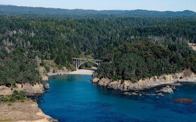
Russian Gulch, Mendocino Coast
Russian Gulch is a river that starts at an elevation of about 800 feet (244 m) on the northwestern flank of Hi Chute Ridge in the California Coast Ranges and flows generally northwest for 5 miles (8 km) to the Pacific Ocean, draining a watershed of 2,456 acres (994 ha) in Russian Gulch State Park, about 2 miles (3.3 km) north of Mendocino and 7 miles (11 km) south of Fort Bragg, California.
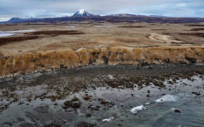
Unga Island Petrified Forest, Shumagin Islands
Unga Island is part of the Shumagin Islands situated south of the Alaska Peninsula in the Gulf of Alaska, and the site of a petrified forest exposed along the eroding northern shore, about 64 miles (103 km) northeast of King Cove and 11 miles (18 km) northwest of Sand Point, Alaska.
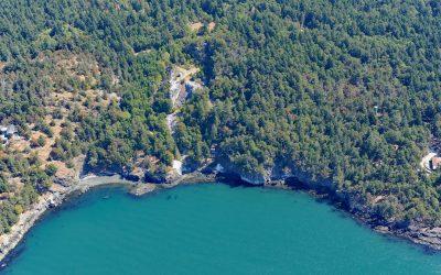
Lime Kiln Point, San Juan Island
Lime Kiln Point is a state park of 42 acres (17 ha) and the site of a historic limestone quarry and kiln on the western shore of San Juan Island, about 6 miles (10 km) south of Roche Harbor and 6 miles (10 km) west of Friday Harbor, Washington.
About the background graphic
This ‘warming stripe’ graphic is a visual representation of the change in global temperature from 1850 (top) to 2019 (bottom). Each stripe represents the average global temperature for one year. The average temperature from 1971-2000 is set as the boundary between blue and red. The colour scale goes from -0.7°C to +0.7°C. The data are from the UK Met Office HadCRUT4.6 dataset.
Click here for more information about the #warmingstripes.