
Parks
Recent Articles
More Articles
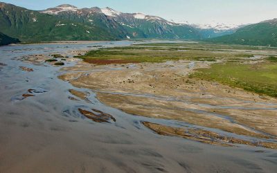
Aguchik River, Kukak Bay
Aguchik River starts at the terminus of Aguchik Glacier at an elevation of about 1,060 feet (323 m) and flows generally southeast for 8 miles (13 km) to the head of Kukak Bay in Katmai National Park and Preserve, about 138 miles (222 km) southwest of Homer and 80 miles (129 km) northwest of Kodiak, Alaska.
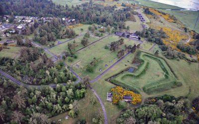
Fort Stevens, Point Adams
Fort Stevens was constructed during the American Civil War as an earthwork battery on the south shore at the mouth of the Columbia River on Point Adams, about 15 miles (24 km) north of Seaside and 6 miles (10 km) west-northwest of Astoria, Oregon.
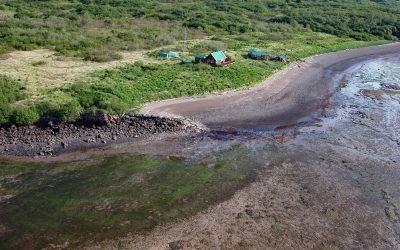
Old Kukak Village, Devils Cove
Old Kukak was a historical Sugpiaq Alutiiq village located on Kukak Point that forms the northern shore of Devils Cove on the Alaska Peninsula in Katmai National Park and Preserve, about 94 miles (152 km) southwest of King Salmon and 74 miles (119 km) northwest of Kodiak, Alaska.
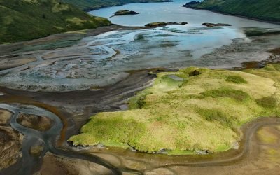
Viekoda Bay, Kodiak National Wildlife Refuge
Viekoda Bay is a deglaciated fjord that extends southeast for 18 miles (29 km) from Shelikof Strait on the northwestern coast of Kodiak Island, with the southern shore in the Kodiak National Wildlife Refuge, about 134 miles (216 km) southwest of Homer and 26 miles (42 km) west-northwest of Kodiak, Alaska.
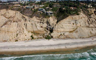
Black’s Beach, Torrey Pines
Black’s Beach is the secluded southern section of Torrey Pines State Beach, which starts at the mouth of Los Peñasquitos Lagoon to the north and extends south for about 4.5 miles (7.2 km) to Scripps Beach, about 10 miles (16 km) south of Encinitas and 4 miles (6.5 km) north-northeast of La Jolla, California.
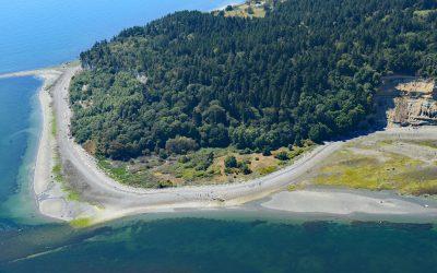
Lily Point, Boundary Bay
Lily Point Marine Reserve is a park located on Boundary Bay at the southeastern tip of Point Roberts, an exclave of the United States on the southern coast of the Tsawwassen Peninsula, about 22 miles (35 km) south-southeast of Vancouver and 30 miles (48 km) northwest of Bellingham, Washington.

Cape Scott, Cape Scott Provincial Park
Cape Scott is a headland about 500 feet (150 m) high at the extreme northwestern point of Vancouver Island in Cape Scott Provincial Park, about 256 miles 412 km) south-southeast of Prince Rupert and 41 miles (66 km) west of Port Hardy, British Columbia.
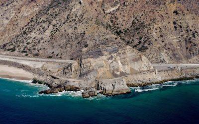
Mugu Rock, Point Mugu State Park
Mugu Rock is a distinctive feature at Point Mugu, a headland in Point Mugu State Park, situated between Thornhill Broome Beach to the east and Mugu Beach to the west in Santa Monica National Recreation Area, about 17 miles (27 km) west-northwest of Malibu, and 9 miles (14.5 km) southeast of Port Hueneme, California.

Peter Iredale, Clatsop Spit
Peter Iredale was a British four-masted bark-rigged sailing ship with a length of 275 feet (84 m) that ran aground in 1906 and wrecked on Clatsop Spit, about 7 miles (11 km) west of Astoria and 2 miles ( km) southwest of Hammond, Oregon.
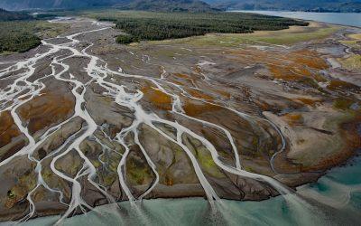
Grewingk Creek, Kachemak Bay
Grewingk Creek drains a glaciated watershed of 29,138 acres (11,792 ha) and flows generally northwest for 3.5 miles (5.6 km) from the terminus lake of the retreating Grewingk Glacier to the southeastern shore of Kachemak Bay, about 24 miles (39 km) northeast of Seldovia and 13 miles (21 km) east of Homer, Alaska.
About the background graphic
This ‘warming stripe’ graphic is a visual representation of the change in global temperature from 1850 (top) to 2019 (bottom). Each stripe represents the average global temperature for one year. The average temperature from 1971-2000 is set as the boundary between blue and red. The colour scale goes from -0.7°C to +0.7°C. The data are from the UK Met Office HadCRUT4.6 dataset.
Click here for more information about the #warmingstripes.