
Parks
Recent Articles
More Articles
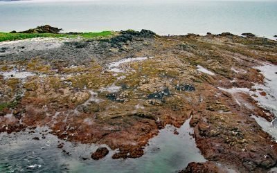
Shakun Islets, Swikshak Bay
Shakun Islets is a group of grass-covered islands and submerged reefs extending 1.8 miles (2.9 km) north to south at the entrance of Swikshak Bay in Shelikof Strait, about 108 miles (174 km) southwest of Homer and 57 miles (92 km) northwest of Kodiak, Alaska.
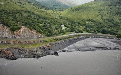
Rainbow Valley, Turnagain Arm
Rainbow Valley is a watershed located on Turnagain Arm between Rainbow Peak to the west and Indianhouse Mountain to the east, approximately 17 miles (27 km) south-southeast of Anchorage and 17 miles (27 km) west-northwest of Girdwood, Alaska.
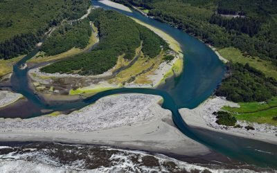
Queets River, Olympic National Park
The Queets River flows approximately 53 miles (85 km), mostly through Olympic National Park, to the Pacific Ocean, about 60 miles (96 km) southwest of Aberdeen and 5 miles (8 km) south of Kalaloch, Washington.
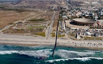
Border Field State Park, Playas de Tijuana
Border Field State Park is part of the Tijuana River National Estuarine Research Reserve, adjacent to the urban neighborhood of Playas de Tijuana, Mexico, located about 12 miles (19 km) south of San Diego, it lies within the city limits of Imperial Beach, California.
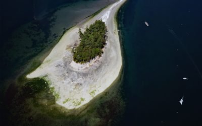
Cutts Island, Carr Inlet
Cutts Island is a state park located about 0.5 miles (0.8 km) off the eastern shore of Carr Inlet in South Puget Sound, approximately 12 miles (19 km) northwest of Tacoma and 5 miles (8 km) west of Gig Harbor, Washington.

McArthur River, Trading Bay
McArthur River flows southeast to Trading Bay on the west coast of Cook Inlet, approximately 65 miles (105 km) southwest of Anchorage and 29 miles (46 km) northwest of Kenai, Alaska.
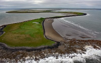
Cape Etolin, Nunivak Island
Cape Etolin is a point of land extending about 4.6 miles (7.4 km) north into the Bering Sea on the northern coast of Nunivak Island, about 50 miles (80 km) west of Nightmute on the mainland and 4 miles (6 km) north-northeast of Mekoryuk, Alaska.
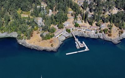
Friday Harbor Laboratories, San Juan Island
Friday Harbor Laboratories is a marine biology field station of the University of Washington situated on the northern shore of Friday Harbor, an embayment on the eastern coast of San Juan Island, about 72 miles (116 km) northwest of Seattle and 18 miles (29 km) west of Anacortes, Washington.
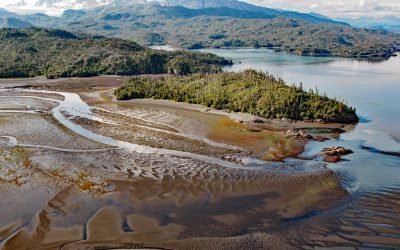
Chugachik Island, Kachemak Bay
Chugachik Island lies between Bear Cove to the south and Martin River to the north on the Kenai Peninsula, about 18 miles (29 km) northeast of Homer and 3.3 miles (5.3 km) south-southeast of Kachemak Selo, Alaska.
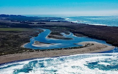
Garcia River, Manchester Beach
The Garcia River flows generally northwest for 44 miles (71 km) to Manchester Beach, north of Point Arena Lighthouse and at Manchester State Park, about 34 miles (55 km) south of Fort Bragg and 4 miles (6.4 km) northwest of the community of Point Arena, California.
About the background graphic
This ‘warming stripe’ graphic is a visual representation of the change in global temperature from 1850 (top) to 2019 (bottom). Each stripe represents the average global temperature for one year. The average temperature from 1971-2000 is set as the boundary between blue and red. The colour scale goes from -0.7°C to +0.7°C. The data are from the UK Met Office HadCRUT4.6 dataset.
Click here for more information about the #warmingstripes.