
Rivers
Recent Articles
More Articles
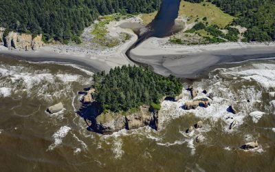
Tunnel Island, Raft River
The Raft River, a stream located entirely within the Quinault Indian Reservation on the Olympic Peninsula, flows into the Pacific Ocean at Tunnel Island, approximately 9 miles (14 km) north of Taholah, Washington.
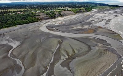
Anchor River, Anchor Point
Anchor River is on the Kenai Peninsula, flowing west for about 30 miles (48 km) from Bald Mountain to a lagoon at Anchor Point on Cook Inlet’s eastern shore, about 14 miles (23 km) northwest of Homer, Alaska.
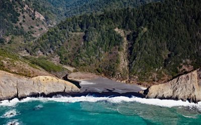
Jackass Creek, Sinkyone Wilderness State Park
Jackass Creek flows generally west for 2.5 miles (4 km) to the Pacific Ocean, about 18 miles (30 km) north-northwest of Westport and 14 miles (22.5 km) southeast of Shelter Cove, California.
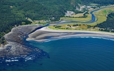
Wa’atch River, Makah Bay
Wa’atch River flows generally north for 5 miles (8 km) to the confluence of Educket Creek and then west-southwest for 4.5 miles (7 km) to Makah Bay, about 20 miles (32 km) west-northwest of Clallam Bay and 3.3 miles (5.3 km) southwest of Neah Bay, Washington.
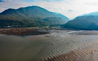
Gingolx, Kincolith River
Gingolx is one of four Nisga’a villages that make up the Nisga’a First Nation and is situated at the confluence of the Kincolith River and the Nass River on the northern shore of Nass Bay, about 70 miles (113 km) east-southeast of Ketchikan and 50 miles (80 km) north-northeast of Prince Rupert, British Columbia.
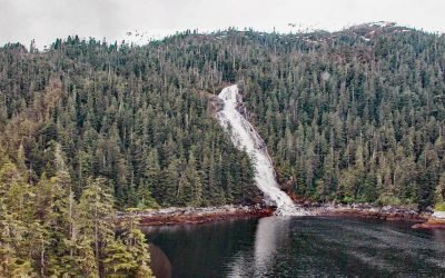
Kasnyku Falls, Waterfall Cove
Kasnyku Falls is a waterfall located on Kasnyku Creek that drains Kasnyku Lake from an elevation of 650 feet (198 m) on the northeast coast of Baranof Island and flows about 1 mile (1.6 km) to Waterfall Cove on Chatham Strait, about 23 miles (37 km) south-southwest of Angoon and 21 miles (34 km) northeast of Sitka, Alaska.
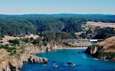
Albion River, Mendocino Coast
Albion River flows generally west-southwest for 18 miles (29 km) to the Mendocino Coast, about 22 miles (35 km) north of Point Arena and 6 miles (10 km) south-southeast of Mendocino, California.
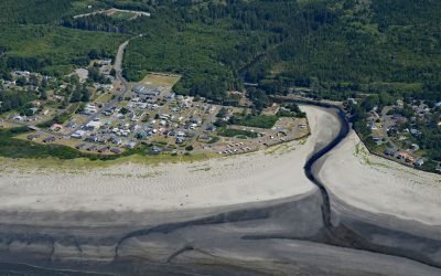
Joe Creek, Pacific Beach
Pacific Beach is a community situated at the mouth of Joe Creek, where the estuary is a strongly stratified lagoon with freshwater overlying saline water caused by a shallow sill that restricts circulation, about 25 miles (40 km) northwest of Hoquiam and 11 miles (18 km) south of Moclips, Washington.
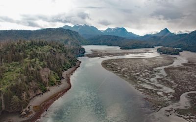
Moss Harbor, China Poot Bay
Moss Harbor is a low tide lagoon at the head of China Poot Bay on the southern shore of Kachemak Bay, about 17 miles (27 km) northeast of Seldovia and 10 miles (16 km) southeast of Homer, Alaska.
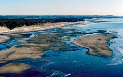
SS Pezuta, Tlell River
The Tlell River flows generally north-northeast for 28 miles (45 km) to Hecate Strait, near the wreck of the steamship SS Pezuta, about 29 miles (47 km) south-southeast of Masset and 4.5 miles (7 km) north of Tlell, British Columbia.
About the background graphic
This ‘warming stripe’ graphic is a visual representation of the change in global temperature from 1850 (top) to 2019 (bottom). Each stripe represents the average global temperature for one year. The average temperature from 1971-2000 is set as the boundary between blue and red. The colour scale goes from -0.7°C to +0.7°C. The data are from the UK Met Office HadCRUT4.6 dataset.
Click here for more information about the #warmingstripes.