
Rivers
Recent Articles
More Articles
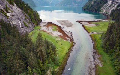
Brim River Hot Springs, Gardner Canal
Brim River Hot Springs and adjoining Owyacumish River Park protect 2,488 acres (1,007 ha) at the head of Owyacumish Bay on the north shore of Gardner Canal, about 96 miles (155 km) southwest of Prince Rupert and 40 miles (64 km) south-southwest of Kitimat, British Columbia.
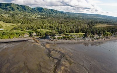
Fritz Creek, Kachemak Bay
Fritz Creek is a stream on the Kenai Peninsula that starts from a watershed divide between Lookout Mountain to the south and Bald Mountain to the north and flows generally south for 7 miles (11 km) to the north shore of Kachemak Bay, about 17 miles (27 km) southeast of Anchor Point and 6 miles (10 km) northeast of Homer, Alaska.
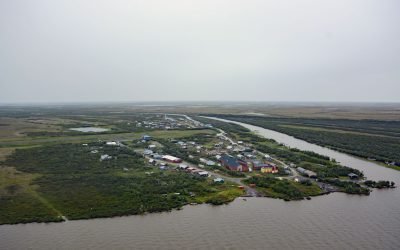
Napakiak, Kuskokwim River
Napakiak is a village located on an island situated between the Kuskokwim River to the south and Johnson Slough to the north, about 167 miles (269 km) southeast of Emmonak and 10 miles (16 km) southwest of Bethel, Alaska.
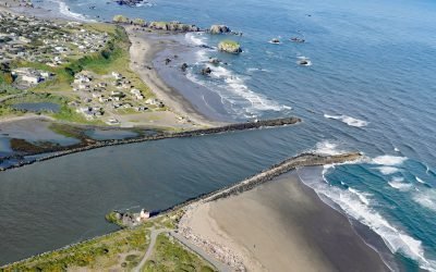
Coquille River, Bandon
Coquille River drains a mountainous watershed of about 6.8 million acres (2.7 million ha) with at least 26 named tributaries and flows for about 36 miles (58 km) from the confluence of the North Fork and South Fork to the Pacific Ocean at Bandon, about 26 miles (42 km) north of Port Orford and 20 miles (32 km) southwest of Coos Bay, Oregon.
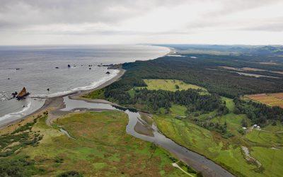
Sixes River, Cape Blanco
Sixes River drains a watershed of about 85,832 acres (34,735 ha) and flows generally west for about 31 miles (50 km) through coastal forests in southwestern Oregon and enters the Pacific Ocean just north of Cape Blanco, about 19 miles (31 km) south-southwest of Bandon and 8 miles (13 km) north-northwest of Port Orford, Oregon.
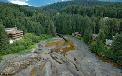
Auke Creek, Mendenhall Peninsula
Auke Creek lies on the west coast of the Mendenhall Peninsula at the head of Auke Bay—a three‐mile (5 km) inlet at the northern end of Stephens Passage, about 66 miles (106 km) south‐southeast of Haines and 10 miles (16 km) northwest of Juneau, Alaska.
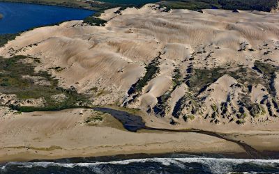
Oso Flaco Creek, Guadalupe-Nipomo Dunes
Oso Flaco Creek drains a watershed of approximately 7,400 acres (2,995 ha) consisting mostly of agricultural land before forming Oso Flaco Lake, now part of the Oso Flaco Lake Natural Area in the Guadalupe-Nipomo Dunes, and then flows into the Pacific Ocean, about 68 miles (109 km) northwest of Santa Barbara and 5 miles (8 km) south of Oceano, California.
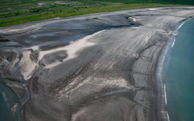
Dakavak Bay, Katmai National Park and Preserve
Dakavak Bay is a 3.4-mile (5.5 km) wide inlet on the southeastern coast of the Alaska Peninsula in Katmai National Park and Preserve, that extends north from Shelikof Strait for about 3 miles (5 km), roughly 87 miles (140 km) west-northwest of Kodiak and 83 miles (134 km) southeast of King Salmon, Alaska.
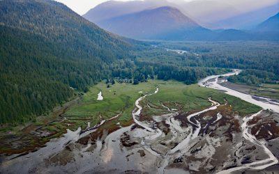
Kitsault River, Alice Arm
Kitsault River drains a watershed area of about 113,668 acres (46,000 ha), including the Kitsault Glacier that flows out of the Cambria Icefield and several smaller glaciers, and flows generally south for 23 miles (37 km) through the Coast Mountains to the head of Alice Arm, about 37 miles (60 km) south-southeast of Stewart and 1.7 miles (2.7 km) north-northwest of Kitsault, British Columbia.
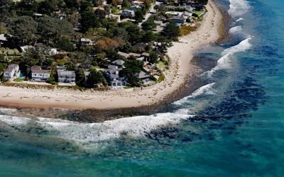
Rincon Creek, Santa Barbara Channel
Rincon Creek is a stream that begins in the Santa Ynez Mountains near Divide Peak, at an elevation of 4,800 feet (1,463 m), and drains a watershed of 9,352 acres (3,785-ha) while flowing generally south for 10 miles (16 km) to the Santa Barbara Channel at Rincon Point, about 12 miles (19 km) northwest of Ventura and 3 miles (5 km) southeast of Carpinteria, California.
About the background graphic
This ‘warming stripe’ graphic is a visual representation of the change in global temperature from 1850 (top) to 2019 (bottom). Each stripe represents the average global temperature for one year. The average temperature from 1971-2000 is set as the boundary between blue and red. The colour scale goes from -0.7°C to +0.7°C. The data are from the UK Met Office HadCRUT4.6 dataset.
Click here for more information about the #warmingstripes.