
Rivers
Recent Articles
More Articles
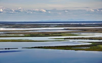
Selawik River, Kotzebue Sound
The Selawik River is about 140 miles (226 km) long, originating in the Purcell Mountains near the Zane Hills, and flows generally west through the Selawik National Wildlife Refuge to Selawik Lake that drains into Hotham Inlet on Kotzebue Sound, about 65 miles (105 km) southeast of Kotzebue and 9 miles (14.5 km) west of the village of Selawik, Alaska.
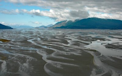
Dry Strait, Stikine River Delta
Dry Strait is a tidal channel in the Stikine Flats, part of the Stikine River delta separating Mitkof Island to the west from Dry Island to the east in the Stikine-LeConte Wilderness, about 21 miles (34 km) southeast of Petersburg and 11 miles (18 km) north-northwest of Wrangell, Alaska.
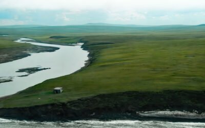
Pitmegea River, Cape Sabine
The Pitmegea River originates at an elevation of about 1,300 feet (396 meters) in the De Long Mountains of the western Brooks Range, and flows northwest for 37 miles (60 kilometers) to the Chukchi Sea at Cape Sabine, about 70 miles (113 kilometers) south-southwest of Point Lay and 66 miles (106 kilometers) northeast of Point Hope, Alaska.
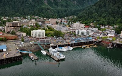
Juneau, Gastineau Channel
Juneau is the state capital, situated at the mouth of Gold Creek on Gastineau Channel, about 93 miles (150 km) northeast of Sitka and 87 miles (140 km) south-southeast of Skagway, Alaska.
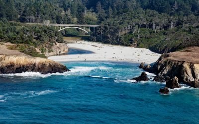
Jug Handle Cove, Ecological Staircase
Jug Handle Cove is a California State Natural Preserve made up of a series of ancient marine terraces, known as the Ecological Staircase, which exhibit different stages of ecological succession at the mouth of Jug Handle Creek, about 5 miles (8 km) south of Fort Bragg and 5 miles (8 km) north of Mendocino, California.
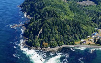
Slip Point, Clallam Bay
Slip Point sits on the southern shore of the Strait of Juan de Fuca at the eastern end of Clallam Bay on the Olympic Peninsula, about 39 miles (63 km) west-northwest of Port Angeles and 0.7 miles (1 km) northeast of the community of Clallam Bay, Washington.
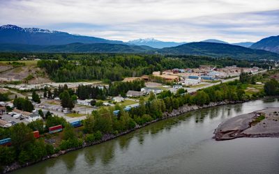
Terrace, Skeena River
Terrace, a community at the confluence of the Skeena and Kitsumkalum Rivers, lies about 71 miles (114 km) east-northeast of Prince Rupert and 64 miles (103 km) southwest of Hazelton, British Columbia.
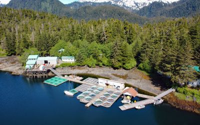
Little Port Walter, Baranof Island
Little Port Walter is an embayment and research facility on the southern shore of Port Walter, situated on the southeastern coast of Baranof Island and the western shore of Chatham Strait, about 53 miles (85 km) south-southeast of Sitka and 9 miles (14.5 km) north of Port Alexander, Alaska.
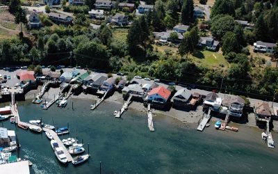
Cowichan Bay, Vancouver Island
Cowichan Bay is a community situated on the south shore of an estuary shared by the Cowichan and Koksilah Rivers that form an extensive tidal flat on the east coast of southern Vancouver Island, about 26 miles (42 km) north-northwest of Victoria and 4 miles (6 km) southeast of Duncan, British Columbia.
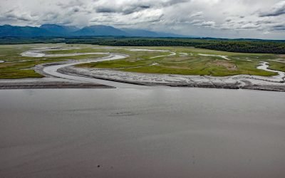
Eagle River Flats, Knik Arm
Eagle River Flats is a 2,471‐acre (1,000‐ha) tidal flat and salt marsh at the mouth of Eagle River on Eagle Bay, on the eastern shore of Knik Arm at Joint Base Elmendorf–Richardson, about 10 miles (16 km) northeast of Anchorage and 7 miles (11 km) west of Eagle River, Alaska.
About the background graphic
This ‘warming stripe’ graphic is a visual representation of the change in global temperature from 1850 (top) to 2019 (bottom). Each stripe represents the average global temperature for one year. The average temperature from 1971-2000 is set as the boundary between blue and red. The colour scale goes from -0.7°C to +0.7°C. The data are from the UK Met Office HadCRUT4.6 dataset.
Click here for more information about the #warmingstripes.