
Rivers
Recent Articles
More Articles
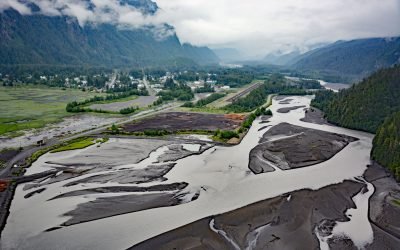
Stewart, Bear River
Stewart is a Canadian border community at the mouth of the Bear River and the head of Portland Canal, connected to Hyder, Alaska by 2 miles (3.2 km) of road, about 99 miles (159 km) east-southeast of Wrangell and 114 miles (183 km) north of Prince Rupert, British Columbia.
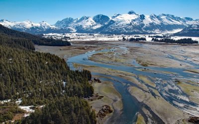
Coghill River, Dartmouth Glacier
The Coghill River in Chugach National Forest flows southwest for 5 miles (8 km) from the terminus of Dartmouth Glacier to Coghill Lake, which is 4.7 miles (7.5 km) long, and then runs west-southwest for 3 miles (4.8 km) to College Fjord near Coghill Point, about 54 miles (87 km) west of Valdez and 32 miles (51 km) northeast of Whittier, Alaska.
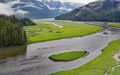
Gilttoyees Creek, Foch-Gilttoyees Provincial Park
Gilttoyees Creek originates in a series of cirque basins on the east and south flanks of Tentacle Peak in the Kitimat Ranges, and flows generally southeast for about 20 miles (32 km) through Foch-Gilttoyees Provincial Park and Protected Area before reaching Gilttoyees Inlet, which opens onto Douglas Channel, about 60 miles (97 km) southeast of Prince Rupert and 20 miles (32 km) southwest of Kitimat, British Columbia.
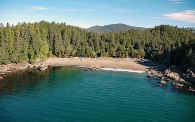
Clo-oose, Cheewhat River
Clo-oose is the site of an abandoned village of the Ditidaht First Nation on the southwest coast of Vancouver Island, above a beach 0.25 miles (0.4 km) west of the Cheewhat River mouth, about 20 miles (32 km) west-northwest of Port Renfrew and 19 miles (31 km) southeast of Bamfield, British Columbia.
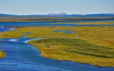
Noatak River, Kotzebue Sound
Noatak River starts from several small cirque glaciers on the northeast flank of Mount lgikpak in the Schwatka Mountains and flows generally west for 425 miles (684 km) to Hotham Inlet in Kotzebue Sound, about 75 miles (121 km) southeast of Kivalina and 6 miles (10 km) north-northeast of Kotzebue, Alaska.
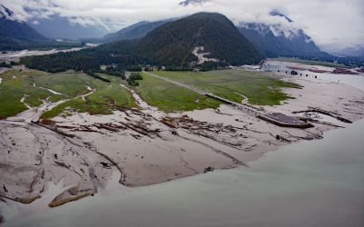
Hyder, Portland Canal
Hyder is a small community at the mouth of the Salmon River, on the western shore and near the head of Portland Canal, about 75 miles (121 km) northeast of Ketchikan and 2.5 miles (4 km) south-southwest of Stewart, British Columbia.
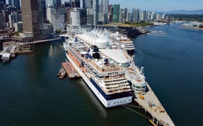
Vancouver, Fraser River Delta
Vancouver is a coastal seaport located on the Burrard Peninsula in the Fraser River Delta, between Burrard Inlet to the north and the Fraser River to the south, about 60 miles (97 km) north-northeast of Victoria and 38 miles (61 km) east-northeast of Nanaimo, British Columbia.
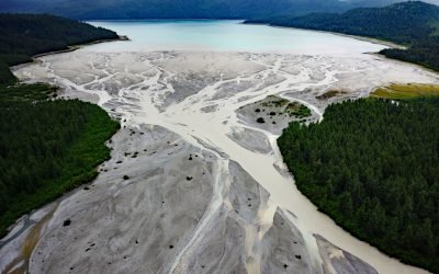
Geikie Inlet, Glacier Bay
Geikie Inlet is a fjord about 8 miles (13 km) long that trends generally northeast from the mouth of the Geikie River to the western coast of Glacier Bay, in Glacier Bay National Park and Preserve, about 130 miles (209 km) southeast of Yakutat and 32 miles (51 km) northwest of Gustavus, Alaska.
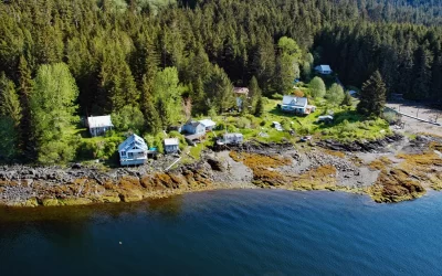
Loring, Naha Bay
Loring is a small community at the site of a historical salmon cannery on the west coast of Revillagigedo Island, at the head of Naha Bay and near the mouth of the Naha River, about 66 miles (106 km) south-southeast of Wrangell and 17 miles (27 km) north of Ketchikan, Alaska.
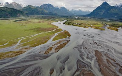
West Glacier Creek, Chinitna Bay
West Glacier Creek flows generally south-southeast for about 7 miles (11 km) to the north shore of Chinitna Bay, draining a watershed between the Chigmit Mountains and Mount Iliamna, about 83 miles (134 km) southwest of Kenai and 60 miles (97 km) west-northwest of Homer, Alaska.
About the background graphic
This ‘warming stripe’ graphic is a visual representation of the change in global temperature from 1850 (top) to 2019 (bottom). Each stripe represents the average global temperature for one year. The average temperature from 1971-2000 is set as the boundary between blue and red. The colour scale goes from -0.7°C to +0.7°C. The data are from the UK Met Office HadCRUT4.6 dataset.
Click here for more information about the #warmingstripes.