
Rivers
Recent Articles
More Articles
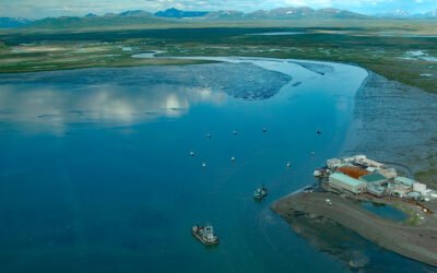
Togiak River, Bristol Bay
Togiak River starts at Togiak Lake and flows southwest for 37 miles (60 km) to a wetland marsh about 4 miles (6 km) wide where the river channel splits, with the east channel flowing past the village of Twin Hills to Togiak Bay, and the main channel flowing 11 miles (18 km) to Togiak Bay near the village of Togiak on Bristol Bay, about 129 miles (208 km) southeast of Bethel and 66 miles (106 km) west of Dillingham, Alaska.
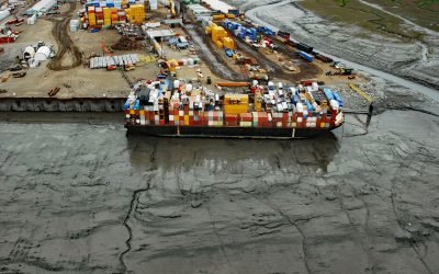
Ship Creek, Knik Arm
Ship Creek flows generally northwest for about 28 miles (45 km) from the Chugach Mountains to Knik Arm, about 22 miles (35 km) southwest of the village of Knik and 0.5 miles (0.8 km north of downtown Anchorage, Alaska.

Soquel Creek, Capitola
Soquel Creek runs through Capitola, a community adjacent to Santa Cruz on the north coast of Monterey Bay, about 75 miles (120 km) south of San Francisco and 26 miles (42 km) north of Monterey, California.
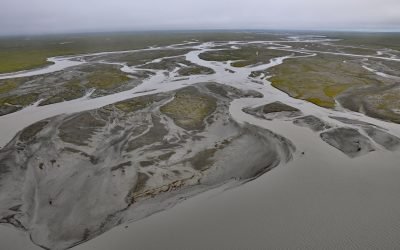
Jago River, Arctic National Wildlife Refuge
Jago River starts at an unnamed glacier on the continental divide of the Romanzof Mountains in the Brooks Range and flows north for about 90 miles (145 km) through the Arctic National Wildlife Refuge to Jago Lagoon, about 88 miles (142 km) east-northeast of Deadhorse and 7 miles (11 km) east-southeast of Kaktovik, Alaska.
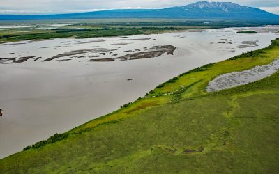
Mount Susitna, Susitna River Flats
Mount Susitna is a prominent mountain and landmark in northern Cook Inlet, with an elevation of 4,396 feet (1,340 m) rising from the Susitna Flats on the west bank of the Susitna River, about 65 miles (105 km) north-northeast of Kenai and 33 miles (53 km) northwest of Anchorage, Alaska.
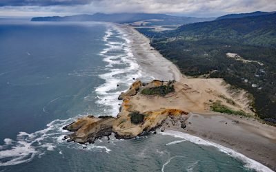
Cape Kiwanda, Pacific City
Cape Kiwanda is a sandstone headland with an elevation of 240 feet (73 m), protected by a basalt island known as Haystack Rock lying 0.5 miles (0.8 km) to the southwest, about 18 miles (29 km) south-southwest of Tillamook and 1 mile (1.6 km) northwest of Pacific City, Oregon.
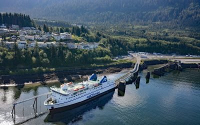
Prince Rupert, Kaien Island
Prince Rupert is a port community on Kaien Island, just north of the mouth of the Skeena River, and linked by a short bridge to the British Columbia mainland, about 465 miles (748 km) northwest of Vancouver and 90 miles (145 km) southeast of Ketchikan, Alaska.
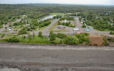
Tyonek, Cook Inlet
Tyonek is a historical Dena’ina Athabascan community situated on a bluff on the northwest shore of Cook Inlet, about 43 miles (69 km) west-southwest of Anchorage and 35 miles (56 km) north of Kenai, Alaska.
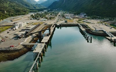
Skagway, Taiya Inlet
Skagway is a community at the mouth of the Skagway River, near the head of Taiya Inlet, about 90 miles (145 km) northwest of Juneau and 16 miles (26 km) north-northeast of Haines, Alaska.
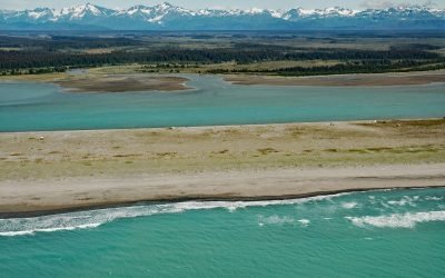
Situk River, Johnson Slough
Situk River starts at Situk Lake and flows southwest for about 18 miles (29 km) through the Yakutat Forelands in Tongass National Forest to Johnson Slough on the Gulf of Alaska, about 200 miles (322 km) northwest of Juneau and 9 miles (15 km) southeast of Yakutat, Alaska.
About the background graphic
This ‘warming stripe’ graphic is a visual representation of the change in global temperature from 1850 (top) to 2019 (bottom). Each stripe represents the average global temperature for one year. The average temperature from 1971-2000 is set as the boundary between blue and red. The colour scale goes from -0.7°C to +0.7°C. The data are from the UK Met Office HadCRUT4.6 dataset.
Click here for more information about the #warmingstripes.