
Rivers
Recent Articles
More Articles
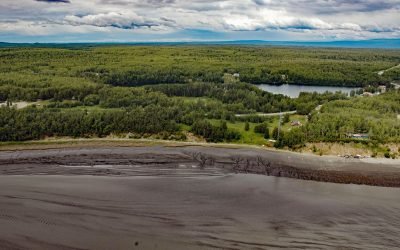
Knik Village, Knik Arm
Knik village is a historic Dena’ina community situated between the northwest shore of Knik Arm in Cook Inlet to the east and Knik Lake to the west, about 18 miles (29 km) north-northeast of Anchorage and 13 miles (21 km) southwest of Wasilla, Alaska.
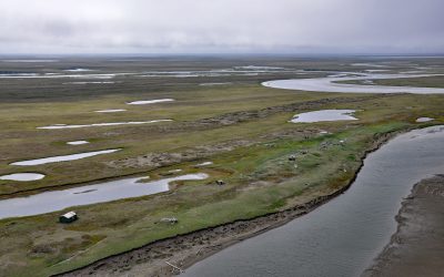
Cape Espenberg, Seward Peninsula
Espenberg is a historic Iñupiaq settlement and present-day fish camp at Cape Espenberg, a peninsula composed of a series of dune-covered beach ridges on the Chukchi Sea coast of the Seward Peninsula that extends eastward into Kotzebue Sound, about 63 miles (101 km) east-northeast of Shishmaref and 43 miles (69 km) southwest of Kotzebue, Alaska.
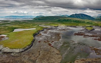
Chenik, Kamishak Bay
Chenik was a historical community at the mouth of Chenik Creek, between Chenik Lake to the west and Chenik Head to the east, on the west shore of Kamishak Bay, about 98 miles (158 km) northeast of King Salmon and 98 miles (158 km) southwest of Homer, Alaska.
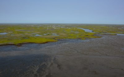
Kwigillingok, Kuskokwim Bay
Kwigillingok is a Central Yup’ik community situated on the west bank of the Kwigillingok River about 2 miles (3.2 km) inland from the northern shore of Kuskokwim Bay, about 80 miles (129 km) south-southwest of Bethel and 45 miles (72 km) west-northwest of Quinhagak, Alaska.
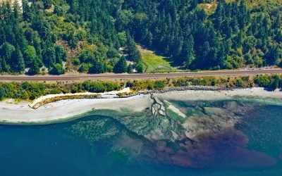
Fort Nisqually, Sequalitchew Creek
Fort Nisqually was a historical trading post established by the Hudson’s Bay Company in 1833 on Sequalitchew Creek, 1.3 miles (2.1 km) east of South Puget Sound at an elevation of 220 feet (67 m), about 14 miles (22.5 km) southwest of Tacoma and 2 miles (3.2 km) northwest of Dupont, Washington.
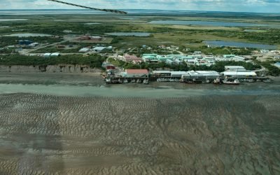
Naknek, Kvichak Bay
Naknek is a community situated on a bluff overlooking the northern bank of the mouth of the Naknek River, at Kvichak Bay which forms the northeastern arm of Bristol Bay, about 56 miles (90 km) southeast of Dillingham and 13 miles (21 km) west-northwest of King Salmon, Alaska.
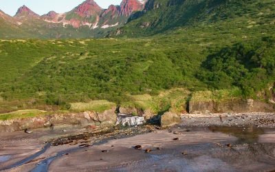
Kaflia Bay, Katmai National Park and Preserve
Kaflia Bay is a funnel-shaped embayment that extends west for 4 miles (6.5 km) from the coast of Shelikof Strait between Cape Ugyak to the north and Cape Gull to the south in Katmai National Park and Preserve, about 93 miles (150 km) southeast of King Salmon and 75 miles (121 km) northwest of Kodiak, Alaska.

Karluk Village, Kodiak Island
Karluk Village is situated on the southern shore of Karluk Lagoon, an embayment formed by a barrier spit that partially encloses the mouth of the Karluk River, on the Shelikof Strait coast of Kodiak Island, about 77 miles (124 km) west-southwest of Kodiak and 44 miles (71 km) north-northwest of Akhiok, Alaska.
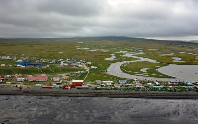
Tununak, Nelson Island
Tununak is a traditional Central Yup’ik community located on the northwest coast of Nelson Island on a narrow barrier spit between the Bering Sea and the mouth of the Tununak River, about 119 miles (192 km) west-southwest of Bethel and 71 miles (114 km) south-southeast of Hooper Bay, Alaska.
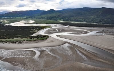
Whalen Island, Sand Lake
Whalen Island is located in Sand Lake which is the estuary of Sand Creek that starts at an elevation of 770 feet (235 m) in the Oregon Coast Range and flows generally south-southwest for 8 miles (13 km) to the Pacific Ocean draining a watershed of 10,880 acres (4,403 ha), about 13 miles (21 km) south-southwest of Tillamook and 5 miles (8 km) north of Pacific City, Oregon.
About the background graphic
This ‘warming stripe’ graphic is a visual representation of the change in global temperature from 1850 (top) to 2019 (bottom). Each stripe represents the average global temperature for one year. The average temperature from 1971-2000 is set as the boundary between blue and red. The colour scale goes from -0.7°C to +0.7°C. The data are from the UK Met Office HadCRUT4.6 dataset.
Click here for more information about the #warmingstripes.