
Rivers
Recent Articles
More Articles
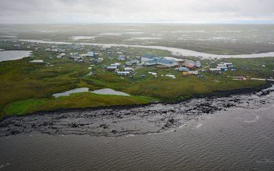
Newtok, Yukon-Kuskokwim Delta
Newtok is a Central Yup’ik community located between the Ningaluk River to the south and a tidal slough to the north, 19 miles (31 km) upstream from the Bering Sea in the Yukon-Kuskokwim Delta, about 125 miles (202 km) south of Emmonak and 96 miles (155 km) west of Bethel, Alaska.
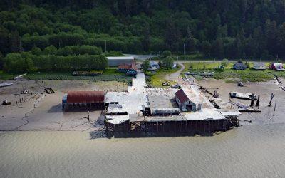
Cassiar Cannery, Skeena River
Cassiar is a historic salmon cannery situated on the northern shoreline of Inverness Passage at the mouth of the Skeena River, about 67 miles (18 km) southwest of Terrace and 11 miles (18 km) southeast of Prince Rupert, British Columbia.
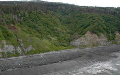
Diamond Creek, Kachemak Bay
Diamond Creek starts at an elevation of about 1,000 feet (305 m) on the southern Kenai Peninsula and drains a watershed of 3,424 acres (1,386 ha) while flowing generally west for about 5 miles (8 km) from Diamond Ridge to the northern shore of Kachemak Bay, about 10 miles (16 km) southeast of Anchor Point and 6 miles (10 km) west-northwest of Homer, Alaska.
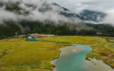
Speel Arm, Port Snettisham
Speel Arm extends generally northeast for 9 miles (14.5 km) from the head of Port Snettisham to the mouth of the Speel River, and is the site of a hydroelectric facility powered by water from Crater Lake and Long Lake, about 95 miles (153 km) northeast of Sitka and 30 miles (48 km) southeast of Juneau, Alaska.
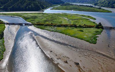
Blacks Island, Smith River
Blacks Island is situated at the confluence of the Smith River and the Umpqua River, on the historic spur line of the Southern Pacific Railroad connecting Eugene with Coos Bay, about 1.7 miles (2.7 km) southeast of Gardiner and 1 mile (1.6 km) northeast of Reedsport, Oregon.
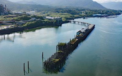
Port Edward, Porpoise Harbour
Port Edward is a community located on the eastern shore of Porpoise Harbour on the Tsimshian Peninsula near the mouth of the Skeena River, about 98 miles (158 km) southeast of Ketchikan and 9 miles (15 km) south of Prince Rupert, British Columbia.
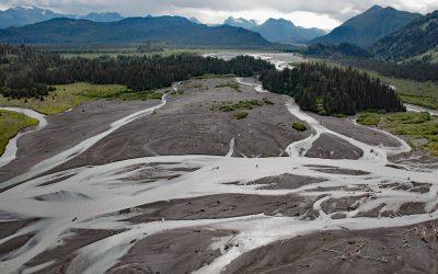
McKeon Flats, Wosnesenski River
McKeon Flats is formed by the Wosnesenski River that flows into Neptune Bay on the south shore of Kachemak Bay on the Kenai Peninsula, about 14 miles (23 km) northeast of Seldovia and 9 miles (14.5 km) southeast of Homer, Alaska.
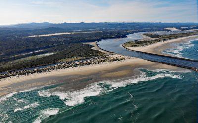
Siuslaw River, Florence
Siuslaw River starts at an elevation of 636 feet (194 m) in the Coast Range and flows generally west-northwest for 110 miles (177 km) to the Pacific Ocean at Florence, draining a watershed of 494,720 acres (200,206 ha), about 53 miles (85 km) west of Eugene and 43 miles (69 km) south of Newport, Oregon.
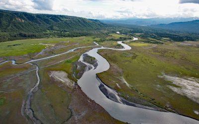
Fox River, Kenai Mountains
Fox River starts at the terminus of the Chernof Glacier in the Kenai Mountains at an elevation of 1,100 feet (335 m) and flows northwest for 11 miles (18 km) and then southwest for 16 miles (26 km) to the Fox River Flats at the head of Kachemak Bay, about 52 miles (84 km) south-southeast of Kenai and 22 miles (35 km) northeast of Homer, Alaska.
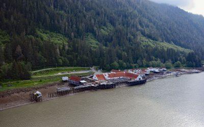
North Pacific Cannery, Inverness Passage
North Pacific Cannery was built in 1889 on 183 acres (74 ha) of Crown land on the north shore of Inverness Passage across from Smith Island and near the mouth of the Skeena River, about 70 miles (113 km) southwest of Terrace and 9 miles (14.5 km) south-southeast of Prince Rupert, British Columbia.
About the background graphic
This ‘warming stripe’ graphic is a visual representation of the change in global temperature from 1850 (top) to 2019 (bottom). Each stripe represents the average global temperature for one year. The average temperature from 1971-2000 is set as the boundary between blue and red. The colour scale goes from -0.7°C to +0.7°C. The data are from the UK Met Office HadCRUT4.6 dataset.
Click here for more information about the #warmingstripes.