
Rivers
Recent Articles
More Articles
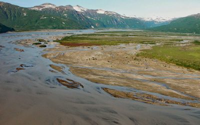
Aguchik River, Kukak Bay
Aguchik River starts at the terminus of Aguchik Glacier at an elevation of about 1,060 feet (323 m) and flows generally southeast for 8 miles (13 km) to the head of Kukak Bay in Katmai National Park and Preserve, about 138 miles (222 km) southwest of Homer and 80 miles (129 km) northwest of Kodiak, Alaska.
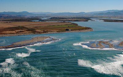
Eel River Delta, Eel River
A delta of 33,000 acres (13,355 ha) is formed by the Eel River, which starts at an elevation of 6,245 feet (1,903 m) on the southern flank of Bald Mountain in Mendocino National Forest and flows generally northwest for 196 miles (315 km) draining a watershed of 2,357,761 acres (954,152 ha) in the California Coast Ranges, about 13 miles (21 km) south-southwest of Eureka and 5 miles (8 km) northwest of Ferndale, California.
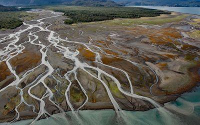
Grewingk Creek, Kachemak Bay
Grewingk Creek drains a glaciated watershed of 29,138 acres (11,792 ha) and flows generally northwest for 3.5 miles (5.6 km) from the terminus lake of the retreating Grewingk Glacier to the southeastern shore of Kachemak Bay, about 24 miles (39 km) northeast of Seldovia and 13 miles (21 km) east of Homer, Alaska.
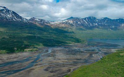
Terror Bay, Kodiak National Wildlife Refuge
Terror Bay is on the northern coast of Kodiak Island and extends about 7 miles (11 km) south from Uganik Passage to the mouth of Terror River in Kodiak National Wildlife Refuge, about 32 miles (52 km) east-northeast of Larsen Bay and 30 miles (48 km) west-southwest of Kodiak, Alaska.
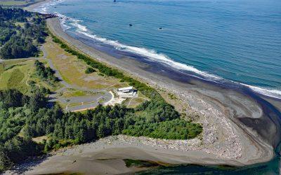
Winchuk River, Crissey Field
Winchuck River starts at an elevation of about 2,000 feet (610 m) and flows generally southwest for 19 miles (31 km) through the Rogue River–Siskiyou National Forest to the Pacific Ocean at Crissey Field, about 17 miles (27 km) north of Crescent City and 4.8 miles (7.7 km) southeast of Brookings, Oregon.
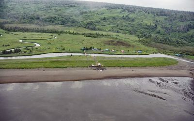
Polly Creek, Cook Inlet
Polly Creek and Little Polly Creek drain a combined watershed of 16,113 acres (6,521 ha), on the southern flank of an unnamed ridge that extends southeast from the summit of Mount Redoubt, and flow generally south for 9 miles (14.5 km) and 8 miles (12.8 km) respectively to the western shore of Cook Inlet, about 56 miles (90 km) northwest of Homer and 46 miles (74 km) southwest of Kenai, Alaska.
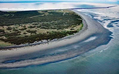
Clatsop Spit, Columbia River Bar
Clatsop Spit is part of Fort Stevens State Park that projects north from the south bank of the Columbia River and the submerged portion forms the Columbia River Bar, about 80 miles (129 km) northwest of Portland and 9 miles (15 km) west-northwest of Astoria, Oregon.
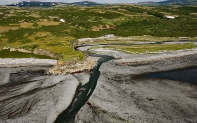
Amakdedori Creek, Kamishak Bay
Amakdedori Creek drains a watershed of 17,781 acres (7,196 ha) on the eastern flank of the Aleutian Range and flows southeast for 10 miles (16 km) to Kamishak Bay, about 26 miles (42 km) southwest of Augustine Island, and 95 miles (153 km) southwest of Homer, Alaska.
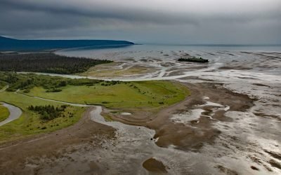
Crescent River, Lake Clark National Park and Preserve
Crescent River is formed by the junction of the North Fork and Lake Fork tributaries, that start in Lake Clark National Park and Preserve, and flows southeast for 12 miles (19 km) to the northern shore of Tuxedni Bay near the entrance on the western coast of Cook Inlet, about 55 miles (89 km) northwest of Homer and 51 miles (82 km) southwest of Kenai, Alaska.

Bradley River, Kachemak Bay
Bradley River is located on the Kenai Peninsula and flows generally northwest for 7 miles (11 km) from Bradley Lake at an elevation of 1,090 feet (332 m) to Kachemak Bay, about 31 miles (50 km) southeast of Ninilchik and 25 miles (40 km) northeast of Homer, Alaska.
About the background graphic
This ‘warming stripe’ graphic is a visual representation of the change in global temperature from 1850 (top) to 2019 (bottom). Each stripe represents the average global temperature for one year. The average temperature from 1971-2000 is set as the boundary between blue and red. The colour scale goes from -0.7°C to +0.7°C. The data are from the UK Met Office HadCRUT4.6 dataset.
Click here for more information about the #warmingstripes.