
Rivers
Recent Articles
More Articles
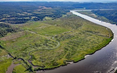
Coquille River Estuary, Bandon
The Coquille River, located in the Coast Range near Bandon, drains a watershed of 37,760 acres (15,281 ha), and flows to the Pacific Ocean approximately 20 miles (32 km) north of Cape Blanco, Oregon.
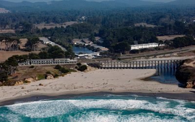
Pudding Creek, Fort Bragg
Pudding Creek is a small coastal watershed in Mendocino County that drains 18 square miles (4,662 ha) before entering the Pacific Ocean about 2.4 miles (3.9 km) southwest of Cleone and 1 mile (1.6 km) north of Fort Bragg, California.
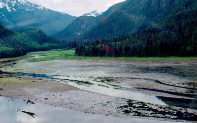
Kiltuish River, Gardner Canal
Kiltuish River originates in the Kitimat Ranges and flows about 16 miles (25 km) north to the Pacific Ocean at Kiltuish Inlet, an arm of Gardner Canal, about 103 miles (166 km) southeast of Prince Rupert and 51 miles (82 km) south of Kitimat, British Columbia.
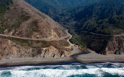
Blues Beach, Chadbourne Gulch
Chadbourne Gulch is a small stream that flows to the Pacific Ocean at Blues Beach between Bell Point to the north and Bruhel Point to the south, about 12 miles (19 km) north of Fort Bragg and 1.8 miles (2.9 km) south of Westport, California.
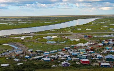
Scammon Bay, Kun River
Scammon Bay is a small community at the base of the Askinuk Mountains, on the left bank and about 1 mile (1.6 km) upstream from the mouth of the Kun River in the Yukon-Kuskokwim Delta, about 147 miles (237 km) northwest of Bethel and 73 miles (118 km) southwest of Emmonak, Alaska.
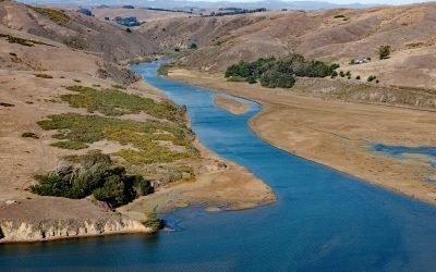
Ocean Roar, Walker Creek
Ocean Roar is a small group of buildings at the mouth of Walker Creek, and formerly a community on the North Pacific Coast Railroad, about 2.3 miles (3.7 km) southwest of Tomales and 16 miles (26 km) west of Petaluma, California.
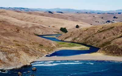
Estero de San Antonio, Bodega Bay
Estero de San Antonio is a small coastal lagoon formed by a sand bar that dams Stemple Creek, a stream that starts in the hills of Marin and Sonoma Counties and flows generally west to Bodega Bay near the mouth of Tomales Bay, 5.75 miles (9 km) southeast of the community of Bodega Bay and 1.5 mi (2.4 km) northwest of Dillon Beach, California.
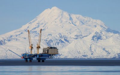
Redoubt Volcano, Drift River
Redoubt Volcano has a summit elevation of 10,197 feet (3,109 m) in the Aleutian Range on the Alaska Peninsula, and is located between the Drift River to the north and Crescent River to the south, about 9 miles (14.5 km) northeast of Crescent Lake and 52 miles (84 km) west of Kenai, Alaska.
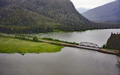
Skeena City, Khyex River
Skeena City is an abandoned community on the north shore of the Skeena River, at the mouth of the Khyex River, 22 miles (35 km) south-southeast of Prince Rupert, and 52 miles (84 km) southwest of Terrace, British Columbia.
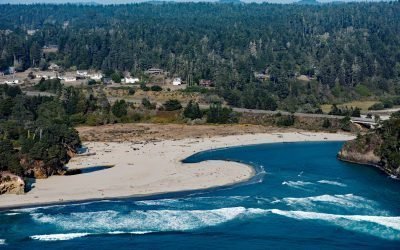
Big River, Mendocino
Big River flows for 42 miles (68 km) through the northern California Coast Range starting at an elevation of approximately 2,800 feet (865 m), draining a watershed of 181 square miles (46,880 ha) and entering the Pacific Ocean at Mendocino, California.
About the background graphic
This ‘warming stripe’ graphic is a visual representation of the change in global temperature from 1850 (top) to 2019 (bottom). Each stripe represents the average global temperature for one year. The average temperature from 1971-2000 is set as the boundary between blue and red. The colour scale goes from -0.7°C to +0.7°C. The data are from the UK Met Office HadCRUT4.6 dataset.
Click here for more information about the #warmingstripes.