
Rivers
Recent Articles
More Articles
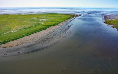
Chefornak, Kinia River
Chefornak is a small village, 16 miles (26 km) upriver from Etolin Strait on the Bering Sea, at the junction of the Keguk and Kinia Rivers, on the Yukon-Kuskokwim Delta about 93 miles (150 km) southwest of Bethel, Alaska.
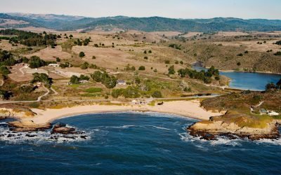
Arroyo de Los Frijoles, Bean Hollow State Park
Arroyo de Los Frijoles and Pebble Beach are in Bean Hollow State Park, located 17.5 miles (28.2 km) south of Half Moon Bay and 3 miles (4.8 km) south of Pescadero, California.
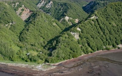
Eastland Creek, Kachemak Bay
Eastland Creek is a stream on the Kenai Peninsula that flows south for 3 miles (5 km) to Kachemak Bay, about 16 miles (26 km) northeast of Homer, Alaska.

Indian Valley, Turnagain Arm
Indian is an Alaska Railroad siding and small community at the entrance to a deep valley on the northern shore of Turnagain Arm, about 21 miles (34 km) northwest of Portage and 21 miles (34 km) southeast of Anchorage, Alaska.
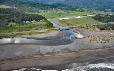
Pistol River, Pistol River State Scenic Viewpoint
Pistol River flows generally southwest for 21 miles (34 km) to the Pistol River State Scenic Viewpoint overlooking the Pacific Ocean near the community of Pistol River, about 17 miles (27 km) north-northwest of Brookings and 10 miles (16 km) south of Gold Beach, Oregon.
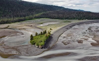
Mermaid Island, Neptune Bay
Mermaid Island is located on McKeon Flats, a tidal flat formed by the Wosnesenski River as it flows into Neptune Bay, about 13 miles (21 km) northeast of Seldovia and 8 miles (13 km) south-southeast of Homer, Alaska.
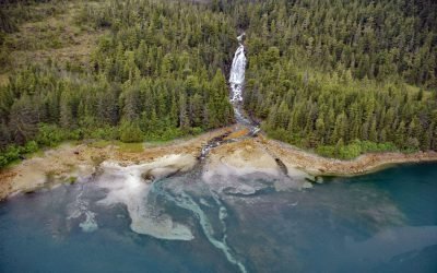
Sahlin Falls, Sheep Bay
Sahlin Falls is located at the base of Sahlin Creek on the northern shore of Sheep Bay, approximately 33 miles (53 km) southeast of Valdez and 13 miles (21 km) northwest of Cordova, Alaska.
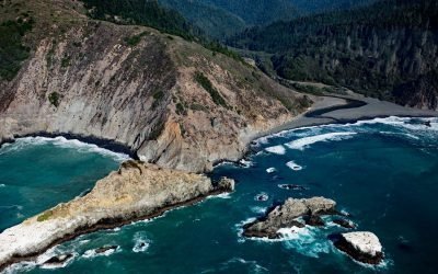
Cottoneva Creek, Rockport Bay
Cottoneva Creek originates at an elevation of approximately 1,300 feet (400 m) in the Coast Range and flows generally south-southwest for 7 miles (11 km) to Rockport Bay, about 11 miles (18 km) southwest of Leggett and 7 miles (11 km) north-northwest of Westport, California.
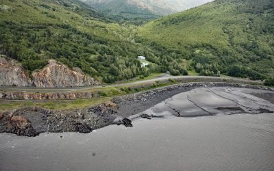
Rainbow Valley, Turnagain Arm
Rainbow Valley is a watershed located on Turnagain Arm between Rainbow Peak to the west and Indianhouse Mountain to the east, approximately 17 miles (27 km) south-southeast of Anchorage and 17 miles (27 km) west-northwest of Girdwood, Alaska.
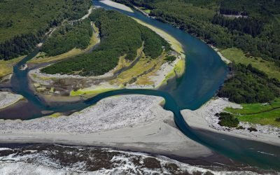
Queets River, Olympic National Park
The Queets River flows approximately 53 miles (85 km), mostly through Olympic National Park, to the Pacific Ocean, about 60 miles (96 km) southwest of Aberdeen and 5 miles (8 km) south of Kalaloch, Washington.
About the background graphic
This ‘warming stripe’ graphic is a visual representation of the change in global temperature from 1850 (top) to 2019 (bottom). Each stripe represents the average global temperature for one year. The average temperature from 1971-2000 is set as the boundary between blue and red. The colour scale goes from -0.7°C to +0.7°C. The data are from the UK Met Office HadCRUT4.6 dataset.
Click here for more information about the #warmingstripes.