
Washington
Recent Articles
More Articles
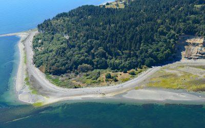
Lily Point, Boundary Bay
Lily Point Marine Reserve is a park located on Boundary Bay at the southeastern tip of Point Roberts, an exclave of the United States on the southern coast of the Tsawwassen Peninsula, about 22 miles (35 km) south-southeast of Vancouver and 30 miles (48 km) northwest of Bellingham, Washington.

Lime Kiln Lighthouse, San Juan Island
Lime Kiln Light was established in 1919 on Lime Kiln Point, a day-use park of 36 acres (15 ha) overlooking Deadman Bay to the south and Haro Strait to the west on the west coast of San Juan Island, about 12 miles (19 km) northeast of Victoria and 6.4 miles (10 km) west-southwest of Friday Harbor, Washington.
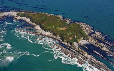
Destruction Island, Quillayute Needles National Wildlife Refuge
Destruction Island is part of the Quillayute Needles National Wildlife Refuge, located 3.5 miles (6 km) offshore from the Olympic Peninsula, about 56 miles (90 km) southwest of Port Angeles and 17 miles (27 km) south-southeast of La Push, Washington.
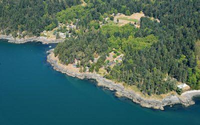
Doe Bay, Orcas Island
Doe Bay is a small community on the southeastern shore of Orcas Island in the San Juan Islands of Puget Sound, about 7 miles (11.3 km) southeast of the community of Eastsound, and 3 miles (4.8 km) northeast of Olga, Washington.

Minter, Henderson Bay
Minter is a community on the northwestern shore of Henderson Bay, at the head of Carr Inlet in South Puget Sound, about 24 miles (39 km) southwest of Seattle and 5.5 miles (9 km) northwest of Gig Harbor, Washington.
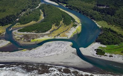
Queets River, Olympic National Park
The Queets River flows approximately 53 miles (85 km), mostly through Olympic National Park, to the Pacific Ocean, about 60 miles (96 km) southwest of Aberdeen and 5 miles (8 km) south of Kalaloch, Washington.
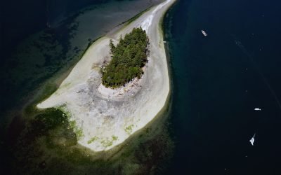
Cutts Island, Carr Inlet
Cutts Island is a state park located about 0.5 miles (0.8 km) off the eastern shore of Carr Inlet in South Puget Sound, approximately 12 miles (19 km) northwest of Tacoma and 5 miles (8 km) west of Gig Harbor, Washington.
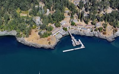
Friday Harbor Laboratories, San Juan Island
Friday Harbor Laboratories is a marine biology field station of the University of Washington situated on the northern shore of Friday Harbor, an embayment on the eastern coast of San Juan Island, about 72 miles (116 km) northwest of Seattle and 18 miles (29 km) west of Anacortes, Washington.

Anacortes Ferry Terminal, Guemes Channel
Anacortes ferry terminal is located at Ship Harbor, an embayment on the northwestern shore of Fidalgo Island and the southern shore of Guemes Channel, about 85 miles (137 km) north of Seattle and 3.7 miles (6 km) west of the community of Anacortes, Washington.
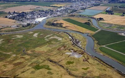
Leque Island, South Pass Stillaguamish River
Leque Island is located at the mouth of the Stillaguamish River on South Pass channel that separates Camano Island from the mainland, about 43 miles (69 km) north of Seattle and 0.6 miles (1 km) southwest of Stanwood, Washington.
About the background graphic
This ‘warming stripe’ graphic is a visual representation of the change in global temperature from 1850 (top) to 2019 (bottom). Each stripe represents the average global temperature for one year. The average temperature from 1971-2000 is set as the boundary between blue and red. The colour scale goes from -0.7°C to +0.7°C. The data are from the UK Met Office HadCRUT4.6 dataset.
Click here for more information about the #warmingstripes.