
Washington
Recent Articles
More Articles
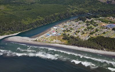
Taholah, Quinault River
Taholah is a community located at the mouth of the Quinault River on lands of the Quinault Indian Nation, about 9 miles (14 km) north of Moclips and 41 miles (66 km) north of Hoquiam on the Olympic Peninsula, Washington.
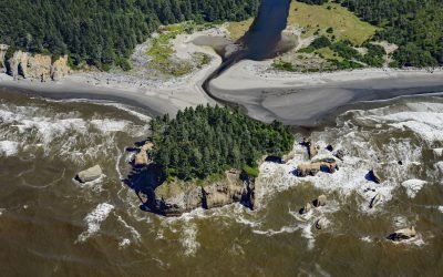
Tunnel Island, Raft River
The Raft River, a stream located entirely within the Quinault Indian Reservation on the Olympic Peninsula, flows into the Pacific Ocean at Tunnel Island, approximately 9 miles (14 km) north of Taholah, Washington.
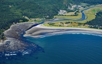
Wa’atch River, Makah Bay
Wa’atch River flows generally north for 5 miles (8 km) to the confluence of Educket Creek and then west-southwest for 4.5 miles (7 km) to Makah Bay, about 20 miles (32 km) west-northwest of Clallam Bay and 3.3 miles (5.3 km) southwest of Neah Bay, Washington.
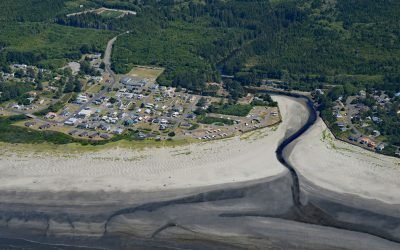
Joe Creek, Pacific Beach
Pacific Beach is a community situated at the mouth of Joe Creek, where the estuary is a strongly stratified lagoon with freshwater overlying saline water caused by a shallow sill that restricts circulation, about 25 miles (40 km) northwest of Hoquiam and 11 miles (18 km) south of Moclips, Washington.
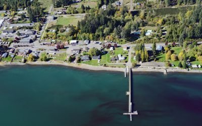
Allyn, Case Inlet
Allyn is a community at the mouth of Sherwood Creek on the western shore of Case Inlet in the North Bay region of South Puget Sound, about 21 miles (34 km) northwest of Tacoma and 17 miles (27 km) northeast of Shelton, Washington.
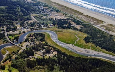
Copalis River, Copalis Beach
The Copalis River flows southwest for 22 miles (35 km) to the community of Copalis Beach, then another 2 miles (3.2 km) to the Pacific Ocean at Griffith-Priday State Park, about 21 miles (34 km) northwest of Hoquiam and 5 miles (8 km) south of Pacific Beach, Washington.
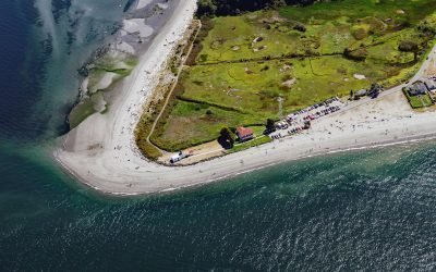
Point No Point, Admiralty Inlet
Point No Point is a sand spit on the northern end of the Kitsap Peninsula, between Norwegian Point to the northwest and Pilot Point to the southeast, near the southern end of Admiralty Inlet that connects the Salish Sea with Puget Sound, about 8 miles (13 km) north of Kingston and 1.3 miles (2.1 km) southeast of Hansville, Washington.
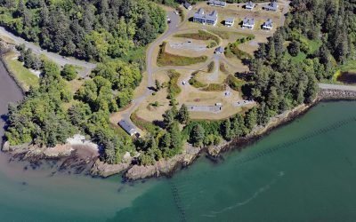
Fort Columbia, Chinook Point
Fort Columbia, a historic military facility situated on Chinook Point, defended the entrance to the Columbia River from 1896 to 1947 and is now a state park, about 7 miles (11 km) southeast of Ilwaco and 6 miles (10 km) northwest of Astoria, Oregon.
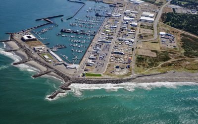
Westport, Point Chehalis
Westport is a community located on Point Chehalis, a peninsula between South Bay and the Pacific Ocean that partially encloses Grays Harbor from the south, about 53 miles (85 km) north-northwest of Astoria and 15 miles (24 km) west-southwest of Aberdeen, Washington.
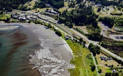
Blyn, Sequim Bay
Blyn is a small community located where Jimmycomelately Creek flows into Sequim Bay on the northern coast of the Olympic Peninsula, about 13 miles (21 km) southwest of Port Townsend and 7 miles (11 km) southeast of Sequim, Washington.
About the background graphic
This ‘warming stripe’ graphic is a visual representation of the change in global temperature from 1850 (top) to 2019 (bottom). Each stripe represents the average global temperature for one year. The average temperature from 1971-2000 is set as the boundary between blue and red. The colour scale goes from -0.7°C to +0.7°C. The data are from the UK Met Office HadCRUT4.6 dataset.
Click here for more information about the #warmingstripes.