
Washington
Recent Articles
More Articles
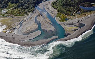
Elwha River, Angeles Point
The Elwha River starts from a perennial snowfield at an elevation of 4,763 feet (1,452 m) in the Olympic Mountains and flows generally north for 45 miles (72 km) to Angeles Point at Freshwater Bay on the southern shore of the Strait of Juan de Fuca, about 33 miles (53 km) east-southeast of Clallam Bay and 6 miles (10 km) west-northwest of Port Angeles, Washington.

Dismal Nitch, Columbia River
Dismal Nitch is a cove on the north shore of the lower Columbia River, historically significant as the last campsite of the Lewis and Clark Expedition before they sighted the Pacific Ocean, about 9 miles (15 km) southeast of Ilwaco, Washington and 4.5 miles (7 km) north-northwest of Astoria, Oregon.
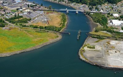
Hoquiam River, Grays Harbor
Hoquiam River drains a watershed of 62,720 acres (25,382 ha) with three principal tributaries that merge into a single channel that trends generally south for 2.5 miles (4 km) to the confluence with the Chehalis River at the head of Grays Harbor between the communities of Hoquiam to the west and Aberdeen to the east, about 47 miles (76 km) west of Olympia and 12 miles (19 km) northeast of Westport, Washington.
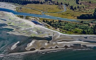
Pysht River, Pillar Point
Pysht River originates near Ellis Mountain on the Olympic Peninsula and flows generally northeast for 16 miles (26 km), draining a watershed of 29,632 acres (11,992 ha), to the Strait of Juan de Fuca at Pillar Point, about 31 miles (50 km) west-northwest of Port Angeles and 26 miles (42 km) southeast of Neah Bay, Washington.
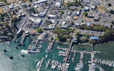
Friday Harbor, San Juan Island
Friday Harbor is a community at the head of a protected embayment on the eastern coast of San Juan Island, the archipelago’s second-largest and most populous island, about 18 miles (29 km) northeast of Victoria and 18 miles (29 km) west of Anacortes, Washington.
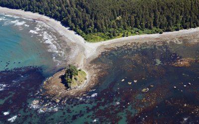
Ozette Village, Cape Alava
Ozette is a historical Makah village at Cape Alava, the Olympic Peninsula’s westernmost point, about 19 miles (31 km) north-northwest of La Push and 15 miles (24 km) south-southwest of Neah Bay, Washington.
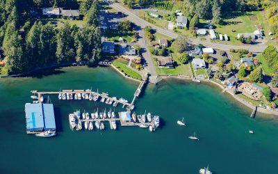
Grapeview, Case Inlet
Grapeview is a community that includes Allyn, Stretch Island, and Reach Island located on the western shore at the head of Case Inlet in South Puget Sound, about 19 miles (31 km) west-northwest of Tacoma and 16 miles (26 km) northeast of Shelton, Washington.
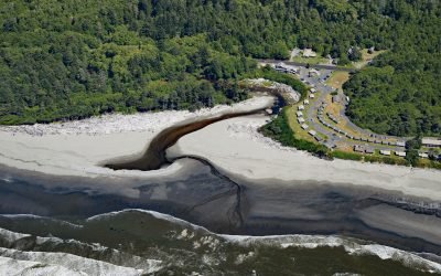
Kalaloch, Olympic National Park
Kalaloch is a resort, campground and ranger station on the west coast of the Olympic Peninsula, at the mouth of Kalaloch Creek in Olympic National Park, about 24 miles (39 km) southeast of La Push and 19 miles (31 km) north-northwest of Taholah, Washington.
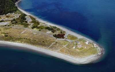
Point Wilson Light Station, Fort Worden
Point Wilson is the site of a historic light station on the grounds of former Fort Worden, situated on a low, broad sand spit that extends northeast for 1.5 miles (0.8 km) from the northern end of the Quimper Peninsula into Admiralty Inlet, about 31 miles (50 km) east of Port Angeles and 2 miles (3.2 km) north of Port Townsend, Washington.
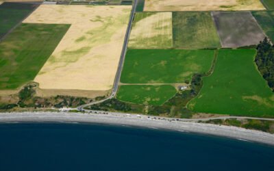
Ebey’s Landing, Whidbey Island
Ebey’s Landing is a beach on the southwest coast of Whidbey Island, on Admiralty Inlet in northern Puget Sound, about 45 miles (72 km) north-northwest of Seattle and 2 miles (3.2 km) south-southwest of Coupeville, Washington.
About the background graphic
This ‘warming stripe’ graphic is a visual representation of the change in global temperature from 1850 (top) to 2019 (bottom). Each stripe represents the average global temperature for one year. The average temperature from 1971-2000 is set as the boundary between blue and red. The colour scale goes from -0.7°C to +0.7°C. The data are from the UK Met Office HadCRUT4.6 dataset.
Click here for more information about the #warmingstripes.