
Washington
Recent Articles
More Articles
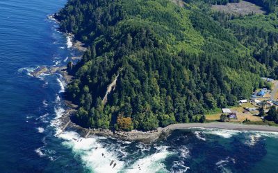
Slip Point, Clallam Bay
Slip Point sits on the southern shore of the Strait of Juan de Fuca at the eastern end of Clallam Bay on the Olympic Peninsula, about 39 miles (63 km) west-northwest of Port Angeles and 0.7 miles (1 km) northeast of the community of Clallam Bay, Washington.
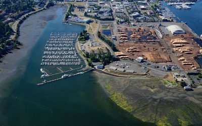
Swantown, Budd Inlet
Swantown is a historic neighborhood at the southern end of Budd Inlet in South Puget Sound, about 26 miles (42 km) southwest of Tacoma and now part of downtown Olympia, Washington.
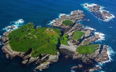
Tatoosh Island, Cape Flattery
Tatoosh Island is the largest of a small group of islands offshore from Cape Flattery and the site of a historic light station, situated on the Makah Reservation, about 34 miles (55 km) north of La Push and 6 miles (10 km) west-northwest of Neah Bay, Washington.
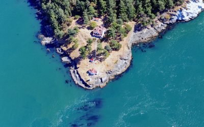
Turn Point, Boundary Pass
Turn Point is a headland with a historic light station on the northwest coast of Stuart Island overlooking Haro Strait to the west and Boundary Pass to the north, located on property that is part of the San Juan Islands National Monument, about 34 miles (55 km) west of Bellingham and 15 miles (24 km) northwest of Friday Harbor, Washington.
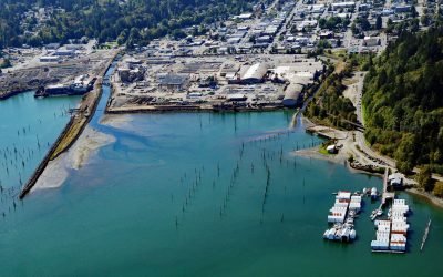
Shelton, Hammersley Inlet
Shelton is a community located on the southwest shore of Oakland Bay, an estuary connected to South Puget Sound by Hammersley Inlet, about 40 miles (64 km) southwest of Seattle and 15 miles (24 km) northwest of Olympia, Washington.
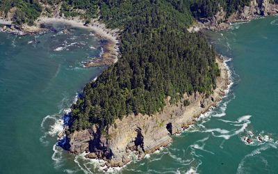
Hoh Head, Olympic National Park
Hoh Head is a sandstone headland situated 2.3 miles (3.7 km) northwest of the Hoh River in Olympic National Park, about 30 miles (48 km) north-northwest of Taholah and 12 miles (19 km) southeast of La Push, Washington.
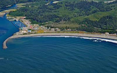
La Push, Quillayute River
La Push is the traditional community of the Quileute people situated at the mouth of the Quillayute River within the Quileute Indian Reservation and surrounded by the coastal strip of Olympic National Park, about 32 miles (51 km) south of Neah Bay and 12 miles (19 km) west-southwest of Forks, Washington.
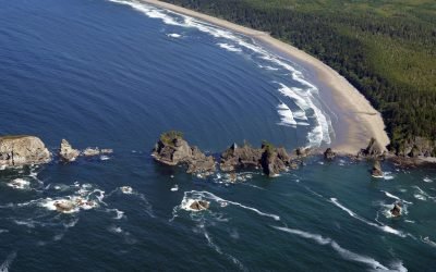
Point of Arches, Olympic National Park
Point of Arches and the adjacent Shi Shi Beach represent a unique section of shoreline located at the edge of the Olympic National Park.
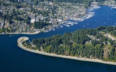
Gig Harbor, Puget Sound
Gig Harbor is an embayment and community on the western shore of Puget Sound across from Point Defiance at the confluence of Tacoma Narrows, Dalco Passage, and Colvos Passage, about 21 miles (34 km) south-southwest of Seattle and 8.5 miles (14 km) northwest of Tacoma, Washington.
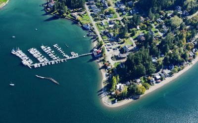
Dofflemyer Point, Boston Harbor
Dofflemyer Point is located in the community of Boston Harbor, on the eastern shore of South Puget Sound, and defines the entrance to Budd Inlet, about 23 miles (37 km) west-southwest of Tacoma and 7 miles (11 km) north of Olympia, Washington.
About the background graphic
This ‘warming stripe’ graphic is a visual representation of the change in global temperature from 1850 (top) to 2019 (bottom). Each stripe represents the average global temperature for one year. The average temperature from 1971-2000 is set as the boundary between blue and red. The colour scale goes from -0.7°C to +0.7°C. The data are from the UK Met Office HadCRUT4.6 dataset.
Click here for more information about the #warmingstripes.