
Washington
Recent Articles
More Articles
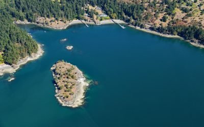
Skull Island, Massacre Bay
Skull Island is about 0.13 miles (0.2 km) long with an area of 2.5 acres (1.0 ha) situated at the head of Massacre Bay in West Sound, a large embayment on the southern shore of Orcas Island, about 25 miles (40 km) west-southwest of Bellingham and 8.5 miles (14 km) north-northeast of Friday Harbor, Washington.
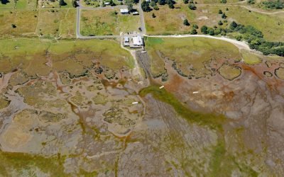
Oysterville, Willapa Bay
Oysterville is located in Willapa Bay on the Long Beach Peninsula, about 28 miles (45 km) north-northwest of Astoria and 17 miles (27 km) southwest of Raymond, Washington.

Point Grenville, Quinault Nation
Point Grenville is a headland with cliffs 120 feet (37 m) high, located on the Quinault Nation lands about 5.6 miles (9 km) north of Moclips and 3 miles (5 km) south-southeast of Taholah, Washington.

Cape Disappointment, Columbia River
Cape Disappointment is a prominent headland and navigational landmark with a historic lighthouse on the north side of the Columbia River, 12 miles (19 km) northwest of Astoria, and 2.2 miles (3.5 km) south of Ilwaco, Washington.

Teahwhit Head, La Push
Teahwhit Head is a rocky headland with a natural sea arch and the site of a historical shipwreck on the coast of Olympic National Park in the Olympic Coast National Marine Sanctuary, about 12 miles (19 km) southwest of Forks and 2.8 miles (4.5 km) south-southeast of La Push, Washington.

Blake Island, Puget Sound
Blake Island is a Washington State Marine Park in Puget Sound situated between Bainbridge Island to the north and Vashon Island to the south, about 8 miles (13 km) southwest of downtown Seattle and 7 miles (11 km) east of Port Orchard, Washington.

Cape Alava, Olympic National Park
Cape Alava is a point of land on the outer coast of the Olympic Peninsula in Olympic National Park, and bordering the Olympic Coast National Marine Sanctuary, about 22 miles (35 km) northwest of Forks and 15 miles (24 km) southwest of Neah Bay, Washington.

Portage Head, Makah Bay
Portage Head is a prominent headland south of Cape Flattery on the Olympic Peninsula that separates Makah Bay Beach from Shi Shi Beach, about 58 miles (94 km) west-northwest of Port Angeles and 6 miles (10 km) southwest of Neah Bay, Washington.

Tongue Point, Crescent Bay
Tongue Point is a rocky ledge in the Strait of Juan de Fuca that projects from a peninsula forming the eastern shore of Crescent Bay on the north coast of the Olympic Peninsula and the site of a historical port and shipwreck, about 44 miles (71 km) east-southeast of Neah Bay and 13 miles (21 km) west-northwest of Port Angeles, Washington.

Toke Point, Willapa Bay
Toke Point is at the end of Tokeland Spit that projects southeast for 3 miles (5 km) from the northern shore of Willapa Bay, a large estuary formed by several streams, the largest being Willapa River, about 55 miles (89 km) southwest of Olympia and 15 miles (24 km) south-southeast of Westport, Washington.
About the background graphic
This ‘warming stripe’ graphic is a visual representation of the change in global temperature from 1850 (top) to 2019 (bottom). Each stripe represents the average global temperature for one year. The average temperature from 1971-2000 is set as the boundary between blue and red. The colour scale goes from -0.7°C to +0.7°C. The data are from the UK Met Office HadCRUT4.6 dataset.
Click here for more information about the #warmingstripes.