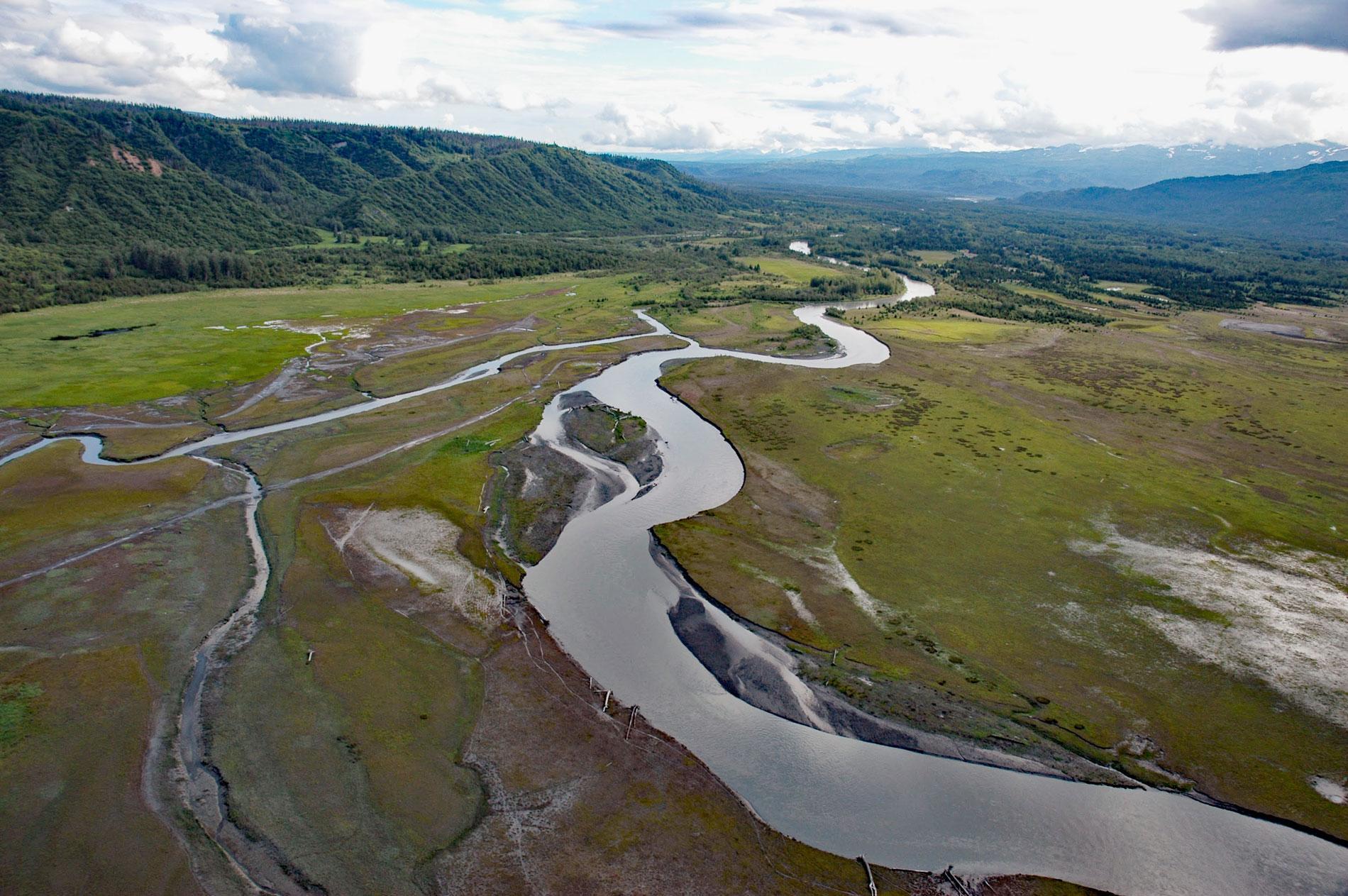
Fox River starts at the terminus of the Chernof Glacier in the Kenai Mountains at an elevation of 1,100 feet (335 m) and flows northwest for 11 miles (18 km) and then southwest for 16 miles (26 km) to the Fox River Flats at the head of Kachemak Bay, about 52 miles (84 km) south-southeast of Kenai and 22 miles (35 km) northeast of Homer, Alaska. The river drains a watershed of 124,856 acres (50,527 ha) and was named in 1895 by William H. Dall, probably for Theodore Fox of the North Pacific Mining and Transportation Company that operated coal mines in Kachemak Bay. The watershed is formed by rocks representing the Chugach-Prince William composite terrane comprising partially metamorphosed sedimentary rocks from the highest elevations under the Harding Icefield to about 1,100 feet (335 m) on the western flank of the Kenai Mountains. From there to about 300 feet (90 m) the rocks consist of McHugh Complex greywacke of turbidite origins. At lower elevations, the watershed is bounded to the east by the McHugh Complex and to the west by glacial deposits that in the last 8 miles (13 km0 of river transition to rocks of the Sterling Formation that developed during the Miocene and Pliocene and consist of siltstone, mudstone, shale, and lignite coal.
The Chernof Glacier starts at an elevation of about 5,400 feet (1,646 m), one of the highest glaciers in the Harding Icefield, and flows north-northwest for 15 miles (24 km) descending to about 1,100 feet (335 m). About 40 glaciers originate from the Harding Icefield which covers over 448,000 acres (181,300 ha). The icefield is one of two icefields in the Kenai Mountains, the other being the Grewingk-Yalik Glacier Complex, and receives over 400 inches (10 m) of snow each year. Some of the more notable glaciers on the eastern flank of the icefield that descend to the ocean include the Aialik, Holgate, Northwestern, and McCarty. Lesser-known glaciers include Dinglestadt, Petrof, Yalik, Killey, Kachemak, Lowell, and Chernof, which are all land or lake terminating glaciers descending from the western flank of the icefield. From 1950 to 2015, Chernof Glacier retreated about 1.6 miles (2.5 km). From 1950 to 1985, the rate of retreat averaged 130 feet (39 m) per year, and over the following three decades retreat rates were 115 feet (35 m), 118 feet (36 m), and 150 feet (45 m) per year resulting in the Chernof Glacier having one of the fastest retreat rates in the region.
The Fox River Flats is an area of extensive intertidal mudflats and braided channels in the floodplain formed by the combined deltas of the Fox River, Sheep Creek, and Bradley River. Access to this area is either overland or by boat from Kachemak Bay. Overland access is by following the beach below the coastal bluffs on the north side of Kachemak Bay and descending the Switchback Trail to Kachemak Selo. In 1886, gold prospectors pioneered an overland route up the Fox River valley to Turnagain Arm via a low pass leading to the head of Tustumena Lake and eventually following the Resurrection River to Hope. Early settlers in Kachemak Bay recognized the value of the flats as rangeland for livestock and several homesteads were claimed nearby. In 1955, the Bureau of Land Management issued the Fox River Cattlemen’s Association a grazing lease of about 15,670 acres (6,342 ha). The lease provides for up to 500 head of cattle per year. In 1972, a portion of the lease (4,500 acres) adjacent to the intertidal zone was included in the newly created Fox River Flats Critical Habitat Area that was set aside for the conservation of salmon, migratory birds, and game animals. Read more here and here. Explore more of Fox River and Kenai Mountains here:

