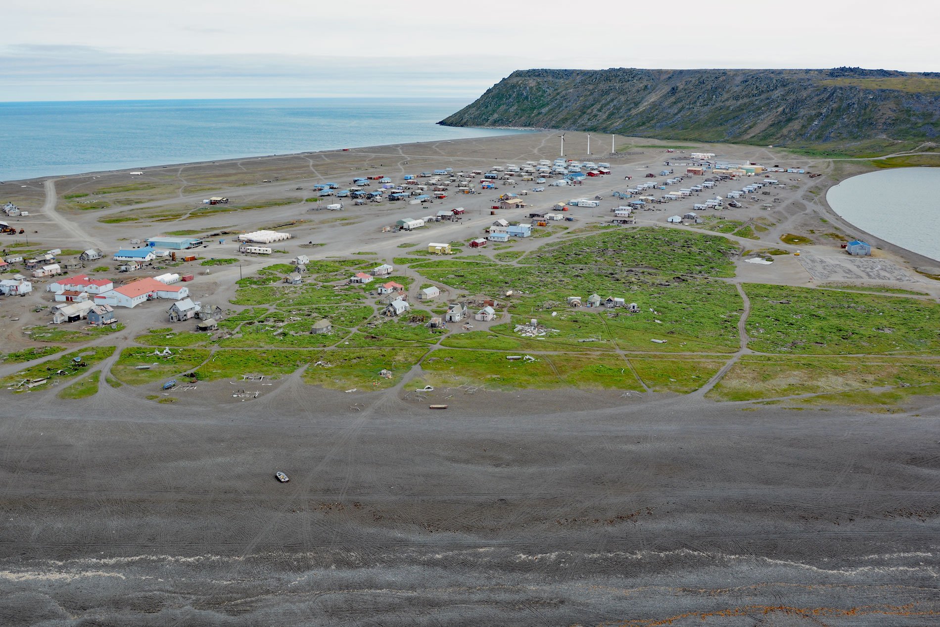
Gambell is a community on Saint Lawrence Island at Northwest Cape in the northern Bering Sea on a broad, shallow-water continental shelf that extends from western Alaska to northeastern Russia, about 196 miles (316 km) southwest of Nome, Alaska, and 62 miles (100 km) southeast of Provideniya, Russia. The village was named for Mr. and Mrs. Vene C. Gambell, who were Presbyterian missionaries and teachers here from 1894-1898. The couple and 32 others drowned when the schooner Jane Grey sank off Cape Flattery, Washington while en route to Kotzebue Sound. St. Lawrence Island is 100 miles (160 km) long in an east-west direction and from 9.5 miles (15 km) to 34 miles (55 km) wide in a north-south direction and situated on a northwest-trending structural uplift exposing rocks as old as Paleozoic above sea level. Northwest Cape is formed by unconsolidated sediments deposited in the lee of Sevuokok Mountain that consists of the Sevuokuk pluton, a long narrow granite body that extends from Gambell in the north to near Boxer Bay in the south.
St. Lawrence Island has been inhabited intermittently for the past 2,000 years by Siberian Yupik people and their name for the island is Sivuqaq. There is archaeological evidence of severe famine and that prehistorical occupations of the island were never permanent. The island was used as a hunting base with travel to and from the Chukotna mainland during calm weather. In the 18th and 19th centuries, there were 8 historical village sites, and Gambell and Savoonga are the only remaining communities. Diseases introduced by Euro-Americans followed by a tragic famine between 1878 and 1880 decimated the island population. In 1900, reindeer were introduced as food for local use, and in 1903, President Theodore Roosevelt established a reindeer reservation. Because of its proximity to the former Soviet Union, St. Lawrence Island has been an important defense site since World War II. The U.S. Army and the U.S. Navy independently built and maintained radar, sonar, and communication installations on the island at Northwest Cape where Gambell is located, and at Northeast Cape.
About 95% of the present-day island population is Siberian Yupik. The Yupik language of St. Lawrence Island is closely related to Chaplino, a dialect spoken by the Indigenous Peoples along the coast of Chukotka in the Russian Far East. Originally this was one language, one culture, and one people but divisions appeared when the border was closed to cultural contacts during the Cold War from 1948-1988. On the Russian side, the Yupik language has been used in schools since the late 1920s and on the American side, the Yupik language was not used in schools until the 1970s. Today, most residents of St. Lawrence Island are bilingual. In 1971, the Alaska Native Claims Settlement Act was passed by the U.S. Congress to resolve long-standing issues surrounding aboriginal land claims in Alaska. The villages of Gambell and Savoonga decided not to participate and instead opted for joint ownership of the 1.136 million acres (459,723 ha) of land in the former St. Lawrence Island Reserve. The isolation of Gambell has helped to maintain their traditional Yupik culture, language, and subsistence lifestyle, which is based on marine mammals and was recently documented by the film ‘One With the Whale‘. Read more here and here. Explore more of Gambell and St. Lawrence Island here:

