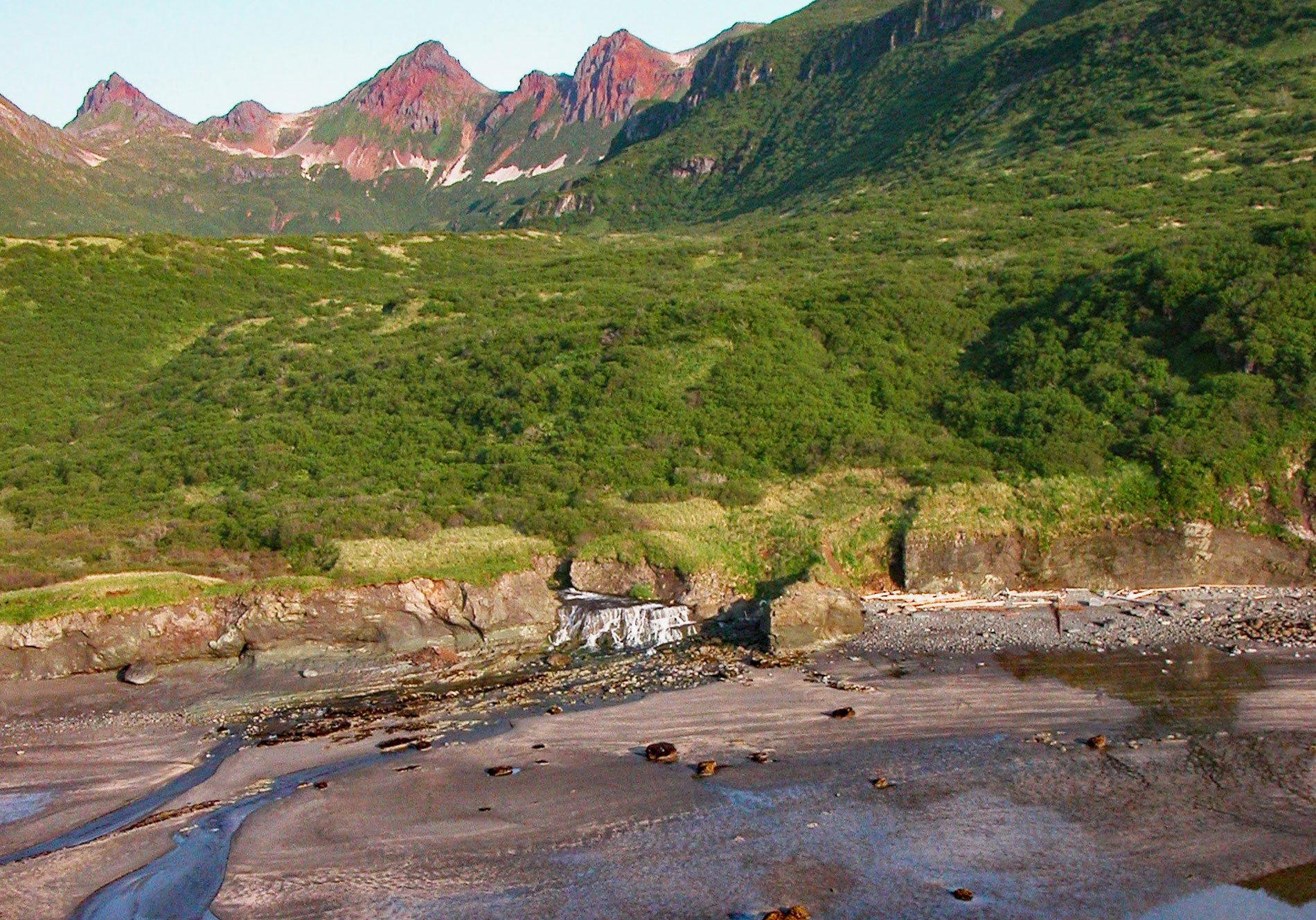
Kaflia Bay is a funnel-shaped embayment that extends west for 4 miles (6.5 km) from the coast of Shelikof Strait between Cape Ugyak to the north and Cape Gull to the south in Katmai National Park and Preserve, about 93 miles (150 km) southeast of King Salmon and 75 miles (121 km) northwest of Kodiak, Alaska. The bay was named in 1831 by Mikhail N. Vasilyev of the Imperial Russian Navy and is from the word ‘kafel’ referring to a piece of baked clay used in covering roofs, presumably for the red-colored volcanic rocks on the surrounding mountains. The volcanic rocks represent deposits of the Aleutian volcanic arc that include breccia, lava flows, sills, and local pyroclastic, and epiclastic tuff located southeast of the active part of the volcanic arc between Katmai Bay to the south and Kukak Bay to the north. Tuffs and breccias are light to medium greenish brown. and large areas of oxidized iron marked by red and orange are common.
Kaflia Bay is characterized by an exposed outer bay that leads through a narrow pass into a restricted and more convoluted inner bay, which is the estuary for an unnamed sockeye salmon spawning stream. In the early 1900s, a saltery was established in Kaflia Bay by a man named Foster who supplied the growing market for preserved salmon. The saltery was apparently so successful that by 1912, Alutiiq people living in the villages at Katmai and Douglas flocked to the site and beach-seined for salmon. The eruption of Novarupta in June 1912, abruptly ended that activity. Ash from the volcano buried the Kaflia settlement to a depth of 3 feet (1 m) and forced all the villagers to flee. The site has since been uninhabited; however, the site has been known by fishery regulators as a favorite with twentieth-century fish poachers.
From 1994 to 2003, Timothy Treadwell spent the early part of each summer camping at an open area of grass in Hallo Bay, about 15 miles (24 km) north of Kaflia Bay. Treadwell was known for getting extremely close to the bears he observed, sometimes even touching them and playing with bear cubs. During the later part of each summer, he would move to Kaflia Bay and camp in an area of especially thick brush he called the ‘Grizzly Maze’. Here the chances of crossing paths with grizzlies were much higher since the location intersected bear trails. Treadwell recorded almost 100 hours of video footage and produced a large collection of still photographs. In 2003, Treadwell chose to set his campsite near a salmon stream where grizzlies commonly feed in autumn. Treadwell was in the park later in the year than normal, at a time when bears attempt to gain as much fat as possible before winter. Food was scarce that fall, causing the bears to be even more aggressive than usual. On October 6, Treadwell and his girlfriend were attacked and killed by a brown bear. This story was later documented in a film called Grizzly Man by Werner Herzog. In the 85-year history of Katmai National Park, this was the first known incident of a person being killed by a bear. Read more here and here. Explore more of Kaflia Bay and Katmai National Park and Preserve here:

