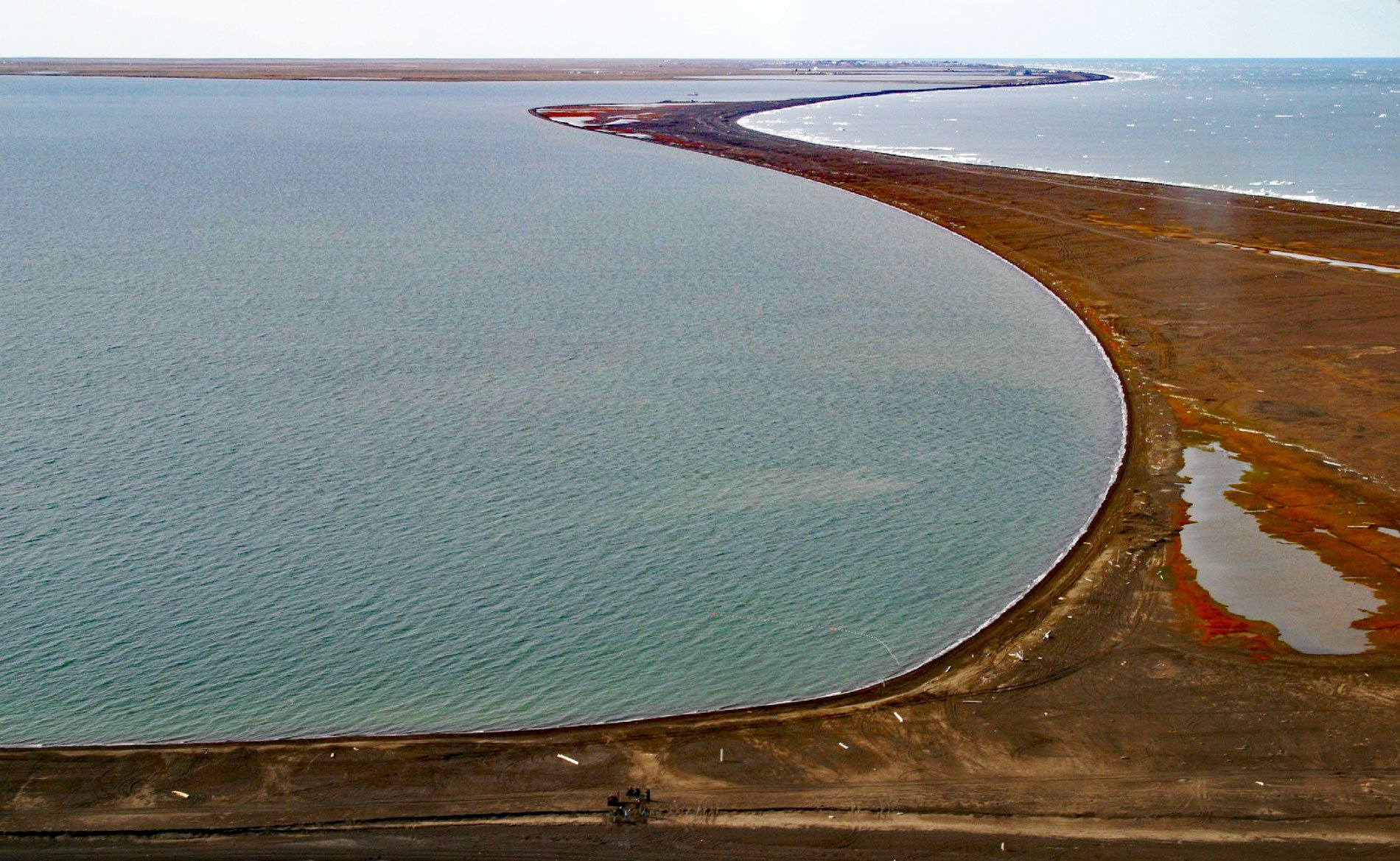
Point Barrow is a spit that extends northeast from the mainland for 4 miles (6.4 km) into the Arctic Ocean forming Elson Lagoon to the southeast, about 150 miles (242 km) northwest of Nuiqsut and 9.8 miles (16 km) northeast of Utqiaġvik, Alaska. The point is a spit formed by sediments deposited mostly by storm-driven waves at the convergence of a northward-flowing current in the Chukchi Sea and a westward-flowing current in the Beaufort Sea rather than by ice shoving. This is the northernmost point in Alaska and was named by Captain Frederick W. Beechey of the Royal Navy in September 1826, for Sir John Barrow of the British Admiralty, ‘to mark the progress of northern discovery’. The point was discovered by Thomas Elson, William Smyth, and the crew of an open boat that Beechey sent to explore the coast northeast from Icy Cape when the HMS Blossom was unable to proceed farther due to sea ice. The Iñupiat name for the point is ‘Nuwak’ or ‘Nuvuk‘ meaning ‘point of land’.
Humans first inhabited northern Alaska around 6000 years ago and left behind archaeological evidence representing different cultures including the early Paleo-Eskimo and the later Thule cultures. The arrival of Paleo-Eskimos likely represented a single migration pulse into the Americas from Siberia and evidence suggests a genetic continuity of more than 4000 years. The Thule people, who are the ancestors of present-day Inuit and other Native Americans including Athabascan speakers, represent a population replacement of the Paleo-Eskimos that occurred less than 700 years ago. Archaeological evidence indicates that Point Barrow was occupied by humans for almost 1,000 years prior to the arrival of the first Europeans. Burial mounds near the base of the spit associated with an ancient village site were first identified in 1912 by Vilhjalmur Stefansson. In 1853, a village called Nuvuk, consisting of 54 inhabited houses, was located near the end of the spit presumably to be near the migration path of bowhead whales.
Point Barrow has historically been an important geographical landmark and a jumping-off point for many Arctic expeditions. The water around the point is now ice-free for two or three months a year, but this was not the experience of early explorers. For example in 1826, Beechey could not reach the point by ship due to pack ice and sent a ship’s boat northeast from Icy Cape. That same year, Sir John Franklin tried to reach the point from the east and was blocked by ice. In 1837, Thomas Simpson walked 50 miles (81 km) west to Point Barrow after his boats were stopped by ice at present-day Cape Simpson. In 1849, William Pullen finally rounded the point with two whaleboats. From 1913 to 1916, Karluk, the principal vessel of the Canadian Arctic Expedition led by Vilhjalmur Stefansson, was beset and eventually crushed by ice, leading to the loss of eleven lives before a famous rescue involving the King and Winge and the USS Bear. Read more here and here. Explore more of Point Barrow and Elson Lagoon here:

