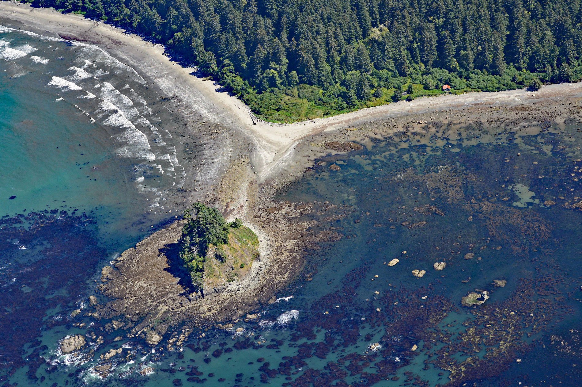
Cape Alava is a point of land on the outer coast of the Olympic Peninsula in Olympic National Park, and bordering the Olympic Coast National Marine Sanctuary, about 22 miles (35 km) northwest of Forks and 15 miles (24 km) southwest of Neah Bay, Washington. The cape is the westernmost point in the contiguous United States, although nearby Cape Flattery to the north, and Cape Blanco in southern Oregon, are also very close longitudinally. The cape is located in the coastal strip of Olympic National Park and is accessible either via a boardwalk hike of 3 miles (5 km) from the Ozette ranger station on Ozette Lake, or south on a trail from the Makah Reservation on Makah Bay. The westernmost point of Cape Alava can only be accessed by walking across the tombolo connecting Tskawahyah (Cannonball) Island to the mainland and then proceeding during low tide to the western side of the island. The coastal fringe west of Ozette Lake including the cape is composed of glacial drift from Pleistocene glaciations and consists of till and outwash deposits from continental and alpine glaciers.
Cape Alava is within the traditional territory of the Makah people who had main villages at Neah Bay, Biheda, Waatch, Sooes, and Ozette. The Ozette village was the southernmost and situated near the mouth of Ozette River, which drains Ozette Lake. It was a year-round village that encompassed a stretch of ocean beach and the islands off of Cape Alava named Tskawahyah, Ozette, and Bodeltah. The main part of the village faced the ocean above the rocky beach, bounded to the east by a steep hill with dense forests. A large offshore reef was exposed at low tide, allowing easy and relatively safe access by canoe. In 1700, an earthquake at Cape Alava caused a massive mudslide that buried several Makah plank houses. In 1794, the cape was named to honor Don José Manuel de Álava for his role as commissioner during the Nootka Sound Conventions. The conventions resulted in a series of three agreements made between the Kingdom of Spain and the Kingdom of Great Britain and averted a conflict between the two empires about overlapping claims to portions of the Pacific Northwest coast. In 1855, the Makah Reservation was established by Treaty of Neah Bay. The reservation included a separate 719 acres (291 ha) at Cape Alava for the Ozette people; however, the population of the village steadily declined and by 1937 there was only one remaining resident. The reservation reverted to the United States in 1970, to be held in trust for the benefit of the Makah Tribe.
Cape Alava and the offshore Umatilla Reef presented a significant hazard to sailing ships approaching the Strait of Juan de Fuca. Accidents escalated during the settlement of the Washington Territory and the commercialization of the vast mainland forests. In 1884, the steamer Umatilla was sailing along the Washington coast in high seas and blinding snow, when it ran aground on a reef 4 miles (6 km) off Cape Alava. The ship was later worked free and towed to port following the storm, but the ship’s name has remained attached to the reef ever since. In 1886, Austria, a three-masted bark, was headed from San Francisco to Tacoma when a fierce gale blew out several sails causing currents to push the vessel toward the rocky shore of Cape Alava, and the ship ran aground on jagged rocks just south of Tskawahyah Island. With assistance from the residents of Ozette village all crew members made it to shore. The captain hiked 30 miles (48 km) to Neah Bay to report the shipwreck, and returned in another vessel to pick up his crew and salvage the remains of the ship’s rigging and supplies. Read more here and here. Explore more of Cape Alava and Olympic National Park here:

