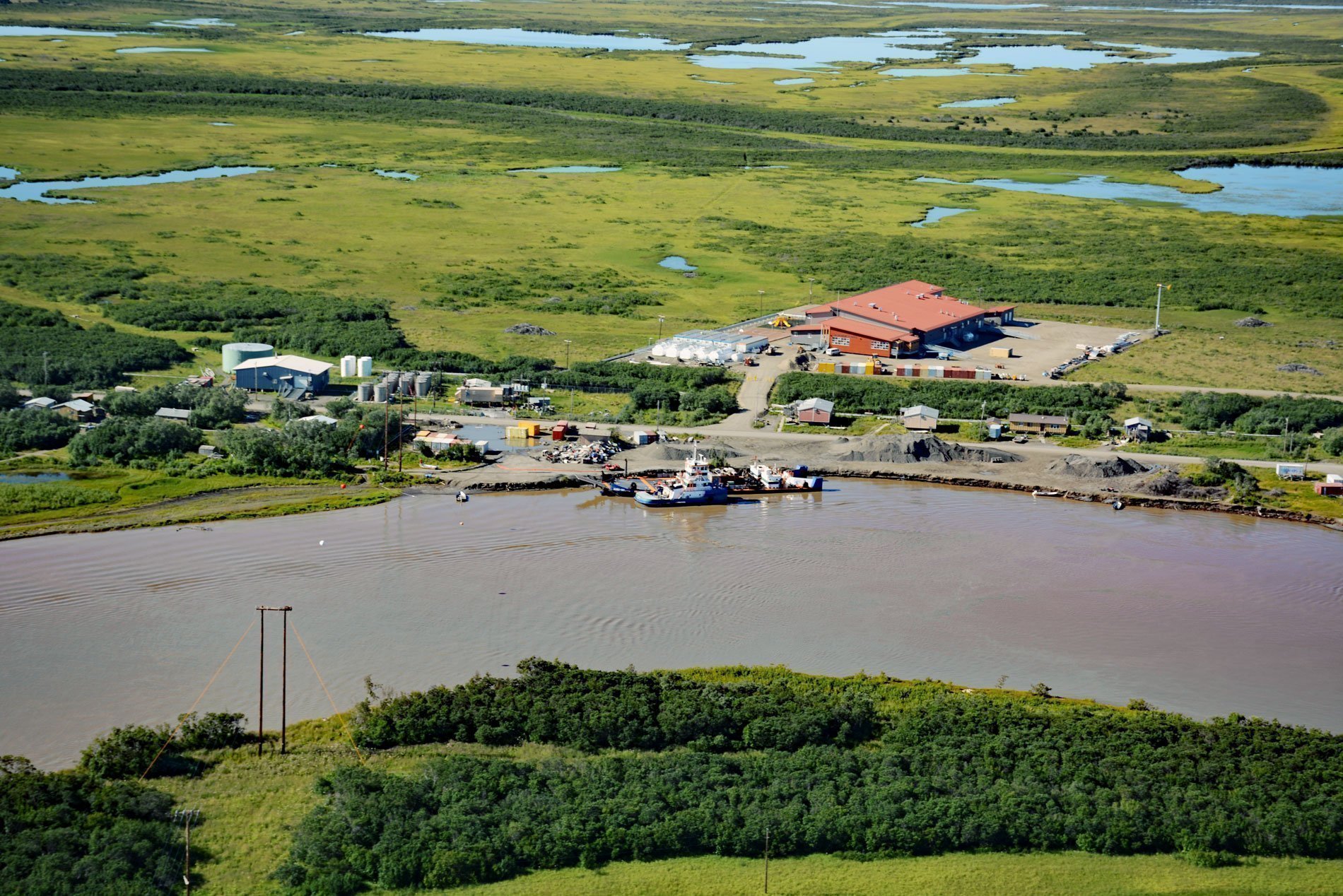
Alakanuk is a Yup’ik community surrounded by the Yukon Delta National Wildlife Refuge and located at the eastern entrance of Alakanuk Pass, a major distributary channel of the Yukon River that leads generally west for 11 miles (18 km) to the Bering Sea, about 162 miles (261 km) northwest of Bethel and 8 miles (13 km) southwest of Emmonak, Alaska. Alakanuk is a Yup’ik word meaning ‘wrong way’ presumably referring to the maze of interlaced waterways leading through the Yukon Delta. The village site was originally settled by a Yup’ik shaman named Anguksuar and was first reported by George R. Putnam while on a surveying expedition in 1898-1899 for the U.S. Coast & Geodetic Survey. A mission school was built near the village and a post office was established in 1946. The residents live mostly in wooden houses built on stilts to protect them from flooding. The village is situated on floodplain sediments consisting mostly of sand and silt deposited during the last 2,500 years. The delta has an area of about 32 million acres (13 million ha) and each year the Yukon deposits an additional 19.6 million tons of sediment on the floodplains and braided reaches of the river. The delta coastal plain consists of a complex assemblage of active and abandoned distributary channels and channel bars, natural levees, marshes, and lakes. Much of the older, more inland parts of the delta plain show clear evidence of permafrost, but it appears to be discontinuous and relatively thin with likely depths of 6 to 10 feet (2-3 m). Flooding is a major hazard on much of the delta plain, as are erosion and sedimentation associated with the meandering active distributary channels. River bank erosion at Alakanuk is causing the loss of about 1.42 acres (0.6 ha) per year. Erosion events mostly occur twice each year during ice break-up and fall storm surges from the Bering Sea. During breakup, the Yukon River experiences high flows due to thawing snow and ice as well as flooding surges caused by the failure of ice jams upriver. The distributary channels are used as a transportation corridor during the open water season by boats and by snow machines when they are frozen from late October to late May.
The Yukon Delta has been home to the Yup’ik people for at least 3,000 years and today there are 56 settlements in the region that mostly rely on a subsistence lifestyle. Alakanuk holds historical and cultural ties to the fish found in the river and depends on all five Pacific salmon for food security, especially Chinook, chum, and coho. Though subsistence food is largely based on fish, people also hunt seals, beluga whales, beavers, moose, geese, ptarmigan, and various waterfowl, and set traps for fox, hare, land otter, lynx, minx, and muskrat. Traditionally, subsistence salmon fishing occurs from late May through early October. The salmon runs correspond with the breaking-up timing of seasonal ice and daily incoming tides. Set gillnets are used from shore in the main rivers and coastal marine waters and drift gillnets are increasingly being used due to their efficiency in being able to produce more salmon per unit effort. The abundance of returning salmon declined between 1997 and 2021 leading to several declared economic fish disasters throughout the Yukon River watershed that closed commercial, recreational, and subsistence fishing due to low salmon escapement. Although determining a specific cause is difficult because of the ecological and socio-economic complexities, the Bering Sea walleye pollock fishery has been identified as one potential cause for the population decline because of the documented incidental bycatch of Chinook and chum salmon. This bycatch steadily increased through the late 1990s and to 2005 when chum salmon bycatch reached a record high of 704,586 fish. Chinook salmon bycatch reached a record high in 2007 of 130,139 fish before decreasing. In 2009, an amendment to the Bering Sea and Aleutian Islands Fishery Management Plan was passed requiring observers to monitor bycatch and implementing a limit on the number of incidental fish caught. Despite these regulations, Chinook salmon have continued to decline and fishery closures occurred most recently in 2020 and in 2021.
The Yukon Delta National Wildlife Refuge includes over 26 million acres (10.5 million ha) of land and water on the Yukon-Kuskokwim Delta with about 19.6 million acres (8 million ha) on federal land. The Yukon and Kuskokwim Rivers have created one of the largest river deltas in the world. The delta, a generally flat marshland containing innumerable lakes and ponds, is the dominant landform on the refuge. Water was the primary element in the creation of this landscape, and remains a major feature today. The abundance of water in lakes, ponds, streams, inlets, bays, and coastal areas provides habitat for waterfowl from all four North American flyways. The rivers support major salmon migrations and the refuge includes habitats for many populations of mammals, fish, and birds which are important in maintaining the traditional subsistence lifestyle of local residents. In 1909, President Theodore Roosevelt first set aside lands here as a preserve and breeding ground for native birds. In 1929, Nunivak Island became established as a refuge and breeding ground for wild birds, game, and fur-bearing animals. In 1930, the small islands and all lands under the waters surrounding Nunivak Island were added to the refuge. In 1937, additional lands were reserved by President Franklin D. Roosevelt when Hazen Bay Migratory Waterfowl Refuge was established. In 1960, the Kuskokwim National Wildlife Range was established and enlarged in 1961 as the Clarence Rhode National Wildlife Range. In 1980, President Jimmy Carter signed the Alaska National Interest Lands Conservation Act that included the establishment of the Yukon Delta National Wildlife Refuge by combining the existing ranges and refuges. Read more here and here. Explore more of Alakanuk here:

