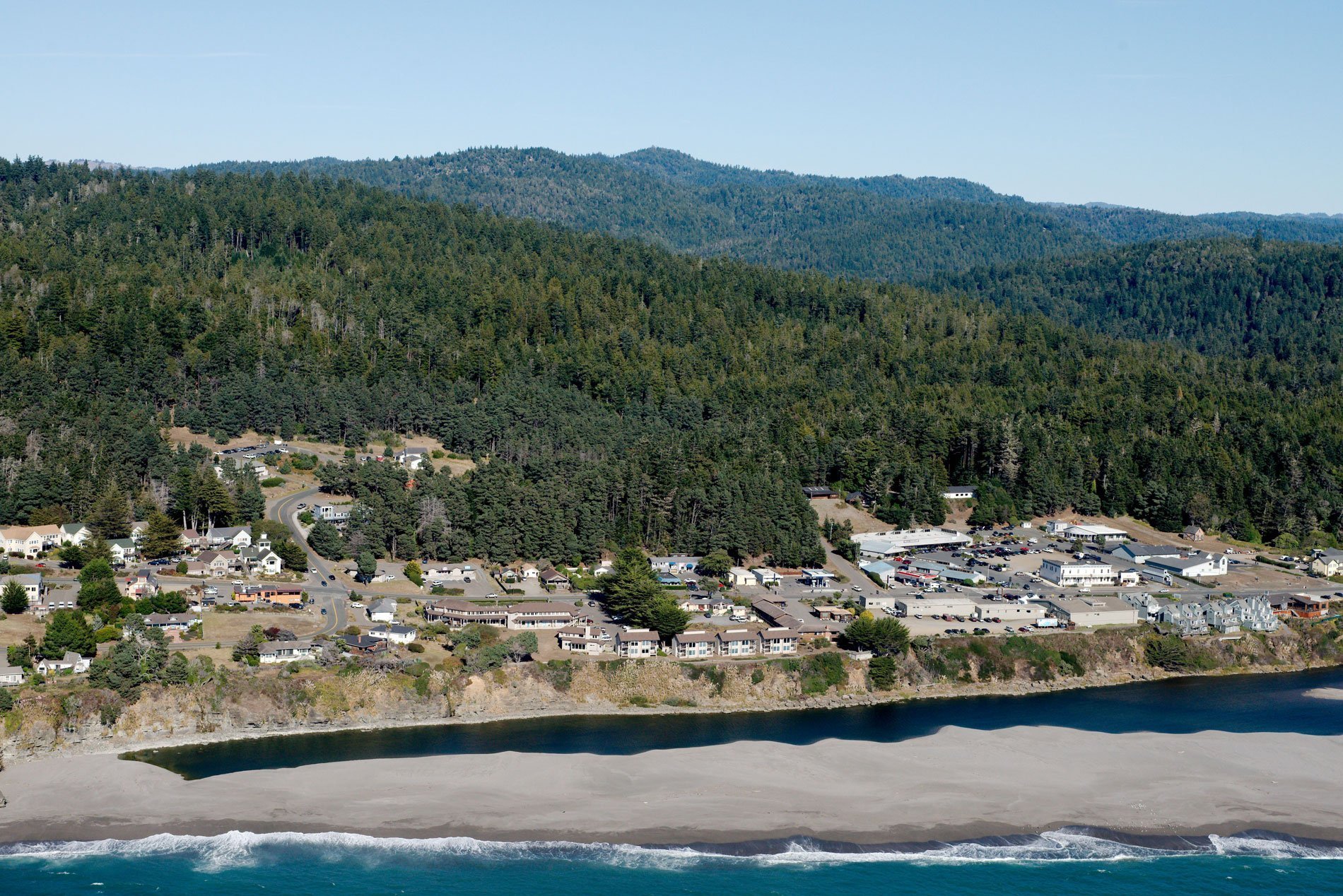
Gualala River flows into the Pacific Ocean at the community of Gualala where the river represents the combined flow of three tributaries that start from elevations near 1,800 feet (550 m) in the Coast Range and drain a watershed of 190,719 acres (77,181 ha), about 92 miles (148 km) northwest of San Francisco and 40 miles (64 km) south-southeast of Mendocino, California. Captain Ernest Rufus, of John Sutter‘s militia, is credited with naming the river in 1841, reputedly from the Kashia Pomo village name Walaali, meaning ‘where the water goes down’. Gualala is the Spanish spelling of the word published on early charts and it became the most common derivation. The San Andreas Fault rift zone forms a linear valley through which, in part, the Gualala River flows. The rocks of the Northern Coast Ranges are sandstones that formed during the Late Cretaceous to Late Eocene, or 100 million to 38 million years ago. The Northern Coast Ranges consist of two main parallel belts of mountains, the Outer Northern Coast Ranges lying along the coast, and the Inner Northern Coast Ranges to the east. They are separated by a long system of valleys representing the rift zone. A series of short rivers, including the Mattole, Gualala, and Navarro rivers, drain the western slopes of the ranges.
Russian fur traders established Fort Ross about 24 miles (38 km) southeast of Gualala as an agricultural outpost for Russian America from 1812 to 1841. In 1844, the Spanish governor for Alta California, Manuel Micheltorena, granted General Rafael Garcia permission to claim land in return for his military service. He was entitled to eleven leagues of land, two of which he held in Marin, and the other nine were located along 20 miles (32 km) of the coast between the Gualala River to the south and Mallo Pass Creek to the north. But the transition of power to Governor Pio Pico in 1845 and the outbreak of the Mexican-American War in 1846 stalled the application for title and the land grant was never made. In 1859, the U.S. Supreme Court ruled that Garcia’s claim was not valid and the 40,000 acres went into the public domain. Cyrus D. Robinson and his family were among the first American settlers to build on the lands of the Garcia land claim. In 1861, Robinson filed a claim under the Land Act of 1820 for much of the area which is now the town of Gualala. By 1862, he had sold part of the land for a lumber mill and the town of Gualala quickly grew to support company operations with a hotel, a saloon, and a ferry. By the end of the 1800s, Gualala had become a major commercial hub for the entire area, and today, the town supports the planned community of Sea Ranch.
The Gualala River watershed has been subject to three eras of active land use including old-growth redwood logging throughout the lower alluvial basin areas from 1868 to 1911, tractor logging of remaining old-growth conifer stands in the central reaches of the watershed from 1952 to 1968, and cable logging of second-growth coniferous stands from 1990 to the present. Extensive logging and road building have contributed to erosion and mass wasting, producing a legacy of increased sediment loads severely impacting aquatic habitats. The area also has considerable natural erosion caused by a continuous history of movement along the San Andreas rift zone. Logging has removed large streamside trees that provided shade and reduced the amount of large woody debris that creates natural pools contributing to higher water temperatures that significantly affect salmon spawning habitat. Read more here and here. Explore more of Gualala and the Gualala River here:

